Stangenried
|
Stangenried
Markt Markt Indersdorf
Coordinates: 48 ° 24 ′ 41 ″ N , 11 ° 20 ′ 55 ″ E
|
|
|---|---|
| Height : | 471 m above sea level NN |
| Residents : | 18 (May 25 1987) |
| Postal code : | 85229 |
| Area code : | 08136 |
|
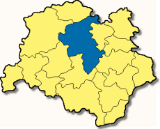
Markt Indersdorf in the district of Dachau
|
|
Stangenried is a district of Markt Indersdorf , which is about 47 kilometers northwest of Munich in the Upper Bavarian district of Dachau .
history
The hamlet of Stangenried was mentioned in a document in 1340 when Sighardt von Preitenen, Richter zu Dachau and his wife Cecilia donated the estate to the Indersdorf monastery . The other two goods also came to the monastery later. After the monastery was dissolved in 1783, Stangenried came to the municipality of Langenpettenbach and on January 1, 1972 to Markt Indersdorf.
literature
- Ludwig Bollenmiller: Chronicle of Langenpettenbach . Handwritten, Langenpettenbach 1924.
- Jakob Fischhaber, Josef Kröner: Langenpettenbach then and now in words and pictures . Geiger Verlag Horb 1987. ISBN 3-89264-135-8 .
- Wilhelm Liebhart , Günther Pölsterl: The communities of the district of Dachau . Dachau 1992. ISBN 3-89251-053-9 .
Individual evidence
- ↑ Bavarian State Office for Statistics and Data Processing (Ed.): Official local directory for Bavaria, territorial status: May 25, 1987 . Issue 450 of the articles on Bavaria's statistics. Munich November 1991, DNB 94240937X , p. 75 ( digitized version ).
- ^ Wilhelm Volkert (ed.): Handbook of Bavarian offices, communities and courts 1799–1980 . CH Beck, Munich 1983, ISBN 3-406-09669-7 , p. 443 f .
Web links
- Stangenried in the location database of the Bavarian State Library Online . Bavarian State Library
- Kiening Homeowners Success

