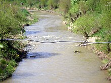
Svinka
|
Svinka Veľká Svinka |
||
|
Mouth of the Svinka (right) into the Hornád |
||
| Data | ||
| location | Slovakia | |
| River system | Danube | |
| Drain over | Hornád → Sajó → Tisza → Danube → Black Sea | |
| source |
Branisko Mountains northeast of Poľanovce 49 ° 2 ′ 29 ″ N , 20 ° 51 ′ 53 ″ E |
|
| Source height | 1000 m nm | |
| muzzle | between Kysak and Obišovce in the Hornád coordinates: 48 ° 51 '33 " N , 21 ° 13' 41" E 48 ° 51 '33 " N , 21 ° 13' 41" E
|
|
| length | 51 km | |
| Catchment area | 344.5 km² | |
The Svinka is a 51 km long river in the east of Slovakia , almost entirely in Prešov District area. It flows through the historical Šariš landscape to the west and south of Prešov . The name Svinka used to be used only for the lower section from the confluence of Veľká Svinka and Malá Svinka in Kojatice , according to some sources Veľká Svinka is equated with the course of the Svinka above Kojatice.
The river has its source in the Branisko Mountains below the Smrekovica massif (highest point 1200 m nm ), at an altitude of approx. 1000 m nm , northeast of Poľanovce . First the Svinka (also called Veľká Svinka in this section) flows south, at the Branisko Pass it turns its general course to the east and flows through the Šarišská vrchovina mountainous region through the municipalities of Široké , Fričovce , Hendrichovce , Bertotovce , Chmiňany , Chminianska Nová Ves and Kojatice, where it takes up the left tributary Malá Svinka. In this section, Svinka is accompanied by road 1st order 18 and the D1 motorway , which has been completed in this area .
The Malá Svinka has its source in the Bachureň Mountains west of Renčišov at an altitude of about 910 m nm and flows first to the east. After Uzovské Pekľany the river turns to the southeast and meets the Šarišská vrchovina mountains. Here the river begins to meander and flows through Jarovnice , Lažany and Svinia to the confluence with the (Veľká) Svinka near Kojatice.
After the confluence with the Malá Svinka, the river turns south to Rokycany , then briefly south-east through Bzenov , Janov and Radatice , before flowing south again through the Čierna hora mountain range . The river flows into the Hornád between Kysak and Obišovce in Okres Košice-okolie , just below the bridge of the Kysak – Muszyna railway line .

