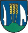
Kysak
| Kysak | ||
|---|---|---|
| coat of arms | map | |

|
|
|
| Basic data | ||
| State : | Slovakia | |
| Kraj : | Košický kraj | |
| Okres : | Košice-okolie | |
| Region : | Košice | |
| Area : | 10.865 km² | |
| Residents : | 1,484 (Dec 31, 2019) | |
| Population density : | 137 inhabitants per km² | |
| Height : | 298 m nm | |
| Postal code : | 044 81 | |
| Telephone code : | 055 | |
| Geographic location : | 48 ° 51 ' N , 21 ° 13' E | |
| License plate : | KS | |
| Kód obce : | 521639 | |
| structure | ||
| Community type : | local community | |
| Administration (as of November 2018) | ||
| Mayor : | Ľubomír Krajňák | |
| Address: | Obecný úrad Kysak 146 04481 Kysak |
|
| Website: | www.kysak.sk | |
| Statistics information on statistics.sk | ||
Kysak (until 1927 also "Kysag" in Slovak; Hungarian Sároskőszeg - until 1902 Kőszeg , hist. German Kesseck ) is a municipality in Eastern Slovakia with 1484 inhabitants (as of December 31, 2019). It is located on the Čierna hora mountains in the Hornád valley , about 16 kilometers from Košice and 18 kilometers from Prešov .
The place was first mentioned in 1269.
In September 1944 partisans fought against the German armed forces in the municipality. On December 20, 1944, the station was bombed and four days later razed to the ground. During the fighting, 70% of the village buildings were destroyed.
Today the place is again an important railway junction: The double-track main line Žilina – Košice meets the line to Prešov and Poland (see Kysak station ).

