Villars-le-Sec
| Villars-le-Sec | ||
|---|---|---|

|
|
|
| region | Bourgogne-Franche-Comté | |
| Department | Territoire de Belfort | |
| Arrondissement | Belfort | |
| Canton | Dent | |
| Community association | South Territoire | |
| Coordinates | 47 ° 27 ' N , 6 ° 59' E | |
| height | 519-621 m | |
| surface | 3.05 km 2 | |
| Residents | 181 (January 1, 2017) | |
| Population density | 59 inhabitants / km 2 | |
| Post Code | 90100 | |
| INSEE code | 90105 | |
| Website | http://www.villars-le-sec.net/ | |
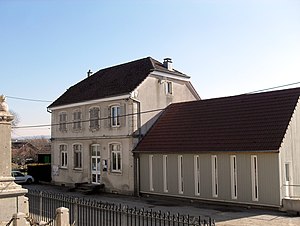
 Mairie Villars-le-Sec |
||
Villars-le-Sec is a French commune in the department Territoire de Belfort in the region Bourgogne Franche-Comté .
geography
Villars-le-Sec is located 552 m above sea level, about 16 kilometers east-southeast of the city of Montbéliard (as the crow flies). The village extends in the northern foothills of the Jura , in a hollow open to the east on the Tafeljura plateau west of the Allaine valley , in the immediate vicinity of the border with Switzerland .
The area of the municipality of 3.05 km² covers a section of the northern French Jura. The entire area is occupied by the limestone plateau of Villars, which averages 560 m. The plateau is mainly made up of arable and meadow land, but also shows some forest areas. There are no surface rivers here because the rainwater seeps into the karstified subsoil. To the north, the municipality extends to the edge of the Neu Bois . In the west, the terrain rises slowly to the height of Les Hauts , where the highest point in Villars-le-Sec is reached at 621 m.
Neighboring communities of Villars-le-Sec are Croix in the west, Saint-Dizier-l'Évêque in the northwest and the Swiss communities Boncourt in the north, Basse-Allaine in the east and Bure in the south.
history
Villars is first mentioned in a document in 1303 under the name Ueler . Since the beginning of the 14th century, the village was under the rule of Delle . In the first half of the 14th century, Villars came under the sovereignty of the Habsburgs. Together with the Sundgau , it came to the French crown with the Peace of Westphalia in 1648. Since 1793 Villars belonged to the Haut-Rhin department , but in 1871 it remained as part of the Territoire de Belfort, unlike the rest of Alsace, in France.
population
With 181 inhabitants (January 1, 2017) Villars-le-Sec is one of the smallest communities in the Territoire de Belfort. After the population had decreased significantly in the first half of the 20th century (222 people were still counted in 1886), the population has continued to grow steadily since the early 1980s.
| Population development | ||||||||
|---|---|---|---|---|---|---|---|---|
| year | 1962 | 1968 | 1975 | 1982 | 1990 | 1999 | 2009 | |
| Residents | 93 | 77 | 75 | 84 | 96 | 123 | 148 | |
Economy and Infrastructure
Until well into the 20th century, Villars-le-Sec was a village dominated by agriculture (arable farming, fruit growing and cattle breeding). Even today, the residents live mainly from their work in the first sector. Outside the primary sector there are few jobs in the village. Some workers are also commuters who work in the surrounding larger towns and in the Montbéliard agglomeration.
The village is far away from the larger thoroughfares. The main access is from Delle. Other road connections exist with Croix and Bure.
Attractions
The Notre-Dame de la Nativité church was built in 1829. In the center of the village there are some farmhouses in the characteristic style of Franche-Comté from the 17th to 19th centuries.
literature
- Le Patrimoine des Communes du Territoire de Belfort. Flohic Editions, Paris 1999, ISBN 2-84234-037-X , p. 39.

