
Sermamagny
| Sermamagny | ||
|---|---|---|
.svg)
|
|
|
| region | Bourgogne-Franche-Comté | |
| Department | Territoire de Belfort | |
| Arrondissement | Belfort | |
| Canton | Valdoie | |
| Community association | Grand Belfort | |
| Coordinates | 47 ° 42 ′ N , 6 ° 50 ′ E | |
| height | 384-423 m | |
| surface | 7.90 km 2 | |
| Residents | 860 (January 1, 2017) | |
| Population density | 109 inhabitants / km 2 | |
| Post Code | 90300 | |
| INSEE code | 90093 | |
| Website | http://www.sermamagny.fr/ | |

Sermamagny is a French commune in the department Territoire de Belfort in the region Bourgogne Franche-Comté .
geography
Sermamagny is located at 401 m , about six kilometers north of the city of Belfort (as the crow flies). The village extends in the foothills of the Vosges , in the Giromagny basin, which stretches between the Vosges, the hills of the Forêt de Roppe and the Montagne de Salbert, on the plain on either side of the Savoureuse river .
.jpg)
The area of the 7.90 km² municipal area includes a section in the area of the Vosges foothills. The whole area is occupied by the plain of the Giromagny basin, which is on average 400 m. It consists mainly of arable and meadow land, but also shows some larger forest areas. From north to south the plain is crossed by the Savoureuse, which receives the Rhôme from the right to the southwest of the village . To the east, the communal soil extends across the plain into the Forêt de Vaivre and to the Rosemontoise , another tributary of the Savoureuse. Along the rivers and in hollows there are numerous ponds that were once created for fish farming. The most important are the Étang de la Veronne and the Étang de Malsaucy , which are now designated as bathing lakes and local recreation areas of Belfort. On a hill north of the Étang de la Veronne, the highest elevation of Sermamagny is reached with 423 m .
Neighboring communities of Sermamagny are Lachapelle-sous-Chaux and Chaux in the north, Éloie in the east, Valdoie in the south and Évette-Salbert in the west.
history
Sermamagny is first mentioned in 1347 under the name Sermegin . Over time, the name changed via Surmaimaingny (1423), Samermenigny (1427), Sermemesgny (1458), Sermamegny (1563), Schirmamenga (1572) and Sermangny (1717) to the current name. The etymology of the name is interpreted as Sigimar (Germanic personal name) and mansio (Latin for apartment, hostel), which means Sermamagny, for example, house of Sigimar .
Initially under the influence of the Counts of Montbéliard , the village was always part of the Rosemont domain. In the middle of the 14th century it came under the sovereignty of the Habsburgs. Between 1360 and 1375 Sermamagny was devastated by mercenaries under Arnaud de Cervole and Enguerrand VII. De Coucy . It was also sacked by Swedish troops in 1633 during the Thirty Years' War . Together with the Sundgau , Sermamagny came to the French crown with the Peace of Westphalia in 1648. Since 1793 the village has belonged to the Haut-Rhin department , but in 1871 it remained as part of the Territoire de Belfort, unlike the rest of Alsace, in France. Since 1998, Sermamagny was initially a member of the Communauté d'Agglomération Belfortaine , which was merged into the Communauté d'agglomération Grand Belfort in 2017 .
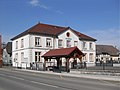
Mairie Sermamagny

Sermamagny school


Attractions
Maison Bardy, built in the 19th century by a wealthy family and with two towers, now serves as a chapel and cultural center. The region around the Étang de Malsaucy and the Étang de la Veronne is one of the natural sights and recreational areas.
population
| Population development | |
|---|---|
| year | Residents |
| 1962 | 648 |
| 1968 | 692 |
| 1975 | 827 |
| 1982 | 793 |
| 1990 | 832 |
| 1999 | 858 |
With 860 inhabitants (January 1, 2017), Sermamagny is one of the small communities in the Territoire de Belfort department. After the population in the first half of the 20th century had always been in the range between 480 and 550 people, a significant increase in population was recorded until 1975. Since then, the population has remained at a relatively constant level.
Economy and Infrastructure
Until well into the 20th century, Sermamagny was mainly a village characterized by agriculture (arable farming, fruit growing and cattle breeding), fish farming and forestry. Today there are some small and medium-sized businesses, including one in the chemical industry. In the meantime, the village has also turned into a residential community. Many workers are therefore commuters who go to work in the larger towns in the area and in the Belfort agglomeration.
The village is well developed in terms of traffic. It is located on the D465 departmental road from Belfort to Giromagny . The closest connection to the A36 motorway is around eight kilometers away. Other road connections exist with Lachapelle-sous-Chaux, Évette-Salbert and Éloie. Sermamagny is connected to the city of Belfort by a bus line.
Events
One of the largest rock music festivals in France, Les Eurockéennes de Belfort, takes place every July on a peninsula on Lac de Malsaucy .
literature
- Le Patrimoine des Communes du Territoire de Belfort. Flohic Editions, Paris 1999, ISBN 2-84234-037-X , p. 184.