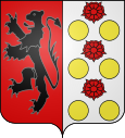
Romagny-sous-Rougemont
| Romagny-sous-Rougemont | ||
|---|---|---|

|
|
|
| region | Bourgogne-Franche-Comté | |
| Department | Territoire de Belfort | |
| Arrondissement | Belfort | |
| Canton | Giromagny | |
| Community association | Vosges du Sud | |
| Coordinates | 47 ° 43 ' N , 6 ° 58' E | |
| height | 390-538 m | |
| surface | 2.47 km 2 | |
| Residents | 218 (January 1, 2017) | |
| Population density | 88 inhabitants / km 2 | |
| Post Code | 90110 | |
| INSEE code | 90086 | |
 Town hall and school building |
||
Romagny-sous-Rougemont (German formerly Welsch Esch ) is a French commune in the department Territoire de Belfort in the region Bourgogne Franche-Comté .
geography
Romagny-sous-Rougemont is 405 m above sea level, about twelve kilometers northeast of the city of Belfort (as the crow flies). The former street row village extends on the northern edge of the Burgundian Gate , on the plateau in the foothills of the Vosges , at the eastern foot of the Châtelet and along the course of the Margrabant.
The area of the 2.47 km² large municipality covers a section in the area of the Vosges foothills. The eastern part of the area is occupied by the plateau at the foot of the Vosges, which averages 410 m. It is mostly covered with arable and meadow land, but also shows some forest areas. The plateau is drained by the Margrabant to the south to the Ruisseau de Saint-Nicolas . In the valley basins and on the outskirts there are several ponds that were once created for fish farming. To the north-west, the municipality extends into the hilly headwaters of the Margrabant and the Châtelet , a wooded foothill of the Vosges that extends to the south. Here, at 538 m, the highest point in Romagny-sous-Rougemont is reached.
Neighboring municipalities of Romagny-sous-Rougemont are Rougemont-le-Château in the north, Leval and Petitefontaine in the east, Felon in the south and Saint-Germain-le-Châtelet and Anjoutey in the west.
history
Romagny was first mentioned in a document in 1565. At that time the village had the German names Esche and Eschon . In the middle of the 14th century the area of Romagny came under the sovereignty of the Habsburgs. It belonged to the Rougemont dominion. Together with the Sundgau , the village came to the French crown with the Peace of Westphalia in 1648. Since 1793 it belonged to the Haut-Rhin department , but in 1871 it remained as part of the Territoire de Belfort, unlike the rest of Alsace, in France and then moved from the canton of Masevaux to the newly founded canton of Rougemont-le-Château. In 1913 Romagny was connected to the French railway network by a narrow-gauge railway line that ran from Belfort via Les Errues to Rougemont-le-Château. A few years before the Second World War, however, operations were stopped. In order to avoid confusion with other communities of the same name, Romagny was officially renamed Romagny-sous-Rougemont in 1933. Today Romagny-sous-Rougemont is united with 13 other municipalities to form the municipal association Pays Sous Vosgien .
population
| Population development | |
|---|---|
| year | Residents |
| 1962 | 136 |
| 1968 | 130 |
| 1975 | 155 |
| 1982 | 177 |
| 1990 | 183 |
| 1999 | 199 |
| 2007 | 215 |
With 218 inhabitants (January 1, 2017) Romagny-sous-Rougemont is one of the small municipalities of the Territoire de Belfort. After the population had decreased in the first half of the 20th century (in 1901 there were still 258 people), the population has continued to grow steadily since the early 1970s.
Economy and Infrastructure
Until well into the 20th century, Romagny-sous-Rougemont was mainly characterized by agriculture (arable farming, fruit growing and cattle breeding), fish farming and forestry. In addition, there are now some local small businesses. In the meantime the village has turned into a residential community. Many workers are also commuters who work in the agglomerations of Belfort and Mulhouse .
The village is located off the major thoroughfares on a departmental road that leads from Rougemont-le-Château towards Belfort. The next connection to the Autoroute A 36 is about seven kilometers away.
literature
- Le Patrimoine des Communes du Territoire de Belfort. Flohic Editions, Paris 1999, ISBN 2-84234-037-X , p. 234.
