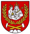
Vyšný Medzev
| Vyšný Medzev | ||
|---|---|---|
| coat of arms | map | |

|
|
|
| Basic data | ||
| State : | Slovakia | |
| Kraj : | Košický kraj | |
| Okres : | Košice-okolie | |
| Region : | Košice | |
| Area : | 32.435 km² | |
| Residents : | 513 (Dec. 31, 2019) | |
| Population density : | 16 inhabitants per km² | |
| Height : | 383 m nm | |
| Postal code : | 044 25 ( Medzev post office ) | |
| Telephone code : | 0 55 | |
| Geographic location : | 48 ° 43 ' N , 20 ° 54' E | |
| License plate : | KS | |
| Kód obce : | 582093 | |
| structure | ||
| Community type : | local community | |
| Administration (as of November 2018) | ||
| Mayor : | Róbert Nálepka | |
| Address: | Obecný úrad Vyšný Medzev Hrdinov SNP 152 044 25 Medzev |
|
| Website: | www.vysnymedzev.sk | |
| Statistics information on statistics.sk | ||
Vyšný Medzev (German upper Metzenseifen , Hungarian Felsőmecenzéf ) is a municipality and a town in the east of Slovakia with 513 inhabitants (December 31, 2019).
geography
Vyšný Medzev is located in the upper Bodva valley on the southeastern slope of the Slovak Ore Mountains , more precisely in the Volovské vrchy and is connected by two smaller roads with the small town of Medzev , two kilometers away . The area is characterized by a number of smaller ponds, these are remnants of the old hammer mills that existed in the area. The regional capital Košice is about 35 kilometers to the east.
Although not part of the municipality, the Baňa Lucia district east of the main town belongs to the municipality.
history
The first written mention comes from the year 1427, after the Metzenseifen, which was still united in the 14th century, was mentioned. Since 1628 the place developed into a small town and received market rights during the reign of Maria Theresa. During this time the place had its best times and besides mining and hammer smiths there were still some guilds such as B. a brewery and other industries such as coal distillery and forestry. In 1828 there were 220 houses and 1938 inhabitants. In the late 19th century, however, there was economic decline and the population emigrated overseas, particularly to the Cleveland, Ohio area.
After the Second World War, most of the residents of German descent were expelled. In 1960 Vyšný Medzev merged with Nižný Medzev to form the town of Medzev, but has been independent again since 1999. According to the 2001 Slovak census, the Carpathian Germans made up a 12.7 percent minority of the 529 inhabitants.
population
| Ethnic structure of Obermetzenseifen 1880–1930 | ||||||||
|---|---|---|---|---|---|---|---|---|
| year | Residents | Slovaks | German | Hungary | Others | |||
| 1880 | 1,359 | 68 | 1,200 | 10 | 81 | |||
| 1890 | 1,066 | 137 | 831 | 47 | 51 | |||
| 1900 | 1,411 | 314 | 745 | 248 | 104 | |||
| 1910 | 1,572 | 235 | 522 | 592 | 226 | |||
| 1921 | 1,521 | 392 | 672 | 297 | 160 | |||
| 1930 | 1,282 | 592 | 261 | 168 | 261 | |||
| 2001 | 529 | 394 | 67 | 7th | 61 | |||
| 2011 | 535 | 444 | 57 | 2 | 32 | |||
Attractions
- Baroque Roman Catholic Maria Magdalena Church from 1773, with an altar that comes from the Jasov Monastery

