Nižná Myšľa
| Nižná Myšľa | ||
|---|---|---|
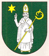
| coat of arms | map | |

|
|
|
| Basic data | ||
| State : | Slovakia | |
| Kraj : | Košický kraj | |
| Okres : | Košice-okolie | |
| Region : | Košice | |
| Area : | 12.614 km² | |
| Residents : | 1,675 (Dec. 31, 2019) | |
| Population density : | 133 inhabitants per km² | |
| Height : | 207 m nm | |
| Postal code : | 044 15 | |
| Telephone code : | 055 | |
| Geographic location : | 48 ° 37 ' N , 21 ° 22' E | |
| License plate : | KS | |
| Kód obce : | 521736 | |
| structure | ||
| Community type : | local community | |
| Administration (as of November 2018) | ||
| Mayor : | Miroslav Sisák | |
| Address: | Obecný úrad Nižná Myšľa Obchodná 104 04415 Nižná Myšľa |
|
| Website: | www.niznamysla.sk | |
| Statistics information on statistics.sk | ||
Nižná Myšľa (Hungarian Alsómislye ) is a municipality in Okres Košice-okolie , Slovakia . It is located in southern Slovakia between Košice and the Hungarian border, at the mouth of the Olšava and Torysa rivers in the Hornád .
geography
There is a Bronze Age burial ground (Várhegy) near the village. Some finds can be viewed in a local museum. Larger finds such as For example, a cult mine that was found by chance is exhibited in the Košice Museum. The excavations are being carried out by the University of Nitra by Ladislav Olexa; In the meantime she was supported by students from the University of Wuppertal.
history
The place was first mentioned in 1270. Until 1918 it belonged to the Kingdom of Hungary in Abaúj-Torna County , then it came to the newly formed Czechoslovakia , but became part of Hungary again from 1938 to 1945 due to the First Vienna Arbitration . Since then, the municipality has been part of Czechoslovakia and, since 1993, Slovakia . The community is repeatedly affected by floods. In the flood of spring 2010 , 22 houses had to be evacuated and demolished due to landslides.
