Siroké
| Siroké | ||
|---|---|---|
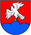
| coat of arms | map | |

|
|
|
| Basic data | ||
| State : | Slovakia | |
| Kraj : | Prešovský kraj | |
| Okres : | Prešov | |
| Region : | Šariš | |
| Area : | 25.788 km² | |
| Residents : | 2,512 (Dec 31, 2019) | |
| Population density : | 97 inhabitants per km² | |
| Height : | 562 m nm | |
| Postal code : | 082 37 | |
| Telephone code : | 0 51 | |
| Geographic location : | 49 ° 0 ′ N , 20 ° 56 ′ E | |
| License plate : | PO | |
| Kód obce : | 525260 | |
| structure | ||
| Community type : | local community | |
| Structure of the municipality: | 2 parts of the community | |
| Administration (as of November 2018) | ||
| Mayor : | Stanislav Bartoš | |
| Address: | Obecný úrad Široké Široké 118 08237 Široké |
|
| Website: | www.siroke.sk | |
| Statistics information on statistics.sk | ||
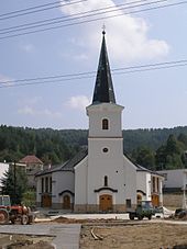
Široké (Hungarian Siroka ) is a municipality in the northeastern Slovakia , has about 2,330 inhabitants and is located on the motorway D1 ( European route E50 ) east of the Central Mountains Branisko . In terms of administration, it is divided into the Pod Braniskom district in addition to the actual location .
history
The place was founded in 1320.
There has been a large beverage manufacturer in the village since 1990.
traffic
The community does not have its own railway connection. The nearest train stations are in Krompachy , Poprad and Prešov .
It is located on the not yet completed D1 ( E 50 ) motorway , which is to connect Bratislava with Košice, and on national road 18 east of the Branisko Tunnel .
Web links
Commons : Široké - collection of images, videos and audio files

