
Ubraye
| Ubraye | ||
|---|---|---|

|
|
|
| region | Provence-Alpes-Cote d'Azur | |
| Department | Alpes-de-Haute-Provence | |
| Arrondissement | Castellane | |
| Canton | Castellane | |
| Community association | Alpes Provence Verdon | |
| Coordinates | 43 ° 55 ' N , 6 ° 42' E | |
| height | 720-1,941 m | |
| surface | 35.65 km 2 | |
| Residents | 92 (January 1, 2017) | |
| Population density | 3 inhabitants / km 2 | |
| Post Code | 04240 | |
| INSEE code | 04224 | |
 Mairie Ubraye |
||

Ubraye is a French municipality with 92 inhabitants (at January 1, 2017) in the department of Alpes-de-Haute-Provence in the region Provence-Alpes-Cote d'Azur . It belongs to the Arrondissement of Castellane and the Canton of Castellane . Since 2004 she has been a member of the Alpes Provence Verdon municipal association .
geography
The municipality includes five small villages: Ubraye at 949 m , Rouainette at 1230 m , Laval, Jaussier and Touyet. 960 hectares of the municipality mark are forested. The highest point in Ubraye is the mountain peak “La Bernarde” at 1941 m. A stream that flows through Ubraye is also called “La Bernarde”. The neighboring municipalities are Annot and Saint-Benoît in the north, Entrevaux in the northeast, Val-de-Chalvagne in the east, Briançonnet and Soleilhas in the south and Vergons in the west.
Population development
| year | 1962 | 1968 | 1975 | 1982 | 1990 | 1999 | 2009 | 2016 |
|---|---|---|---|---|---|---|---|---|
| Residents | 89 | 77 | 59 | 43 | 104 | 85 | 104 | 88 |

Rouainette

Saint-Sébastien church in Rouainette
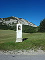
Wayside shrine in Laval


