
Saint-André-les-Alpes
| Saint-André-les-Alpes | ||
|---|---|---|

|
|
|
| region | Provence-Alpes-Cote d'Azur | |
| Department | Alpes-de-Haute-Provence | |
| Arrondissement | Castellane | |
| Canton | Castellane | |
| Community association | Alpes Provence Verdon | |
| Coordinates | 43 ° 58 ′ N , 6 ° 30 ′ E | |
| height | 880-1,784 m | |
| surface | 47.46 km 2 | |
| Residents | 1,008 (January 1, 2017) | |
| Population density | 21 inhabitants / km 2 | |
| Post Code | 04170 | |
| INSEE code | 04173 | |
 Place view |
||

Saint-André-les-Alpes is a French commune with 1,008 inhabitants (at January 1, 2017) in the department of Alpes-de-Haute-Provence in the region Provence-Alpes-Cote d'Azur . It belongs to the canton of Castellane and the Arrondissement of Castellane .
geography
The neighboring communities are
- Thorame-Basse in the north,
- La Mure-Argens , Allons , Angles and Saint-Julien-du-Verdon in the east,
- Castellane in the southeast,
- Senez in the southwest,
- Moriez in the west,
- Lambruisse in the northwest.
The Verdon flows from La Mure-Argens to Saint-André and there it reaches the Lac de Castillon reservoir. 3,187 hectares of the municipality mark are forested.
Surveys
- Col des Robines, 988 m ,
- Sommet de la Reynière, 1726 m ,
- Montagne de l'Allier, 1789 m ,
- Mont Chalvet, 1616 m ,
- Sommet du Castellard, 1725 m ,
- Montagne de Maurel, 1771 m ,
- Pic de Chamatte, 1878 m ,
- Sommet de Crémon, 1760 m
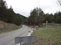
Transport links
The national route 202 connects Saint-André with Moriez and Saint-Julien-du-Verdon. The village is also on the meter-gauge railway line Nice - Digne-les-Bains .
Population development
| year | 1962 | 1968 | 1975 | 1982 | 1990 | 1999 | 2008 | 2012 |
|---|---|---|---|---|---|---|---|---|
| Residents | 751 | 952 | 901 | 852 | 794 | 818 | 937 | 925 |
Attractions
- Saint-André church
- Church ruin

Saint-André station on the Nice – Digne-les-Bains line and a rail tractor

Saint-André church
Col des Robines


Web links
Commons : Saint-André-les-Alpes - Collection of images, videos and audio files