Vialas
| Vialas | ||
|---|---|---|

|
|
|
| region | Occitania | |
| Department | Lozère | |
| Arrondissement | Florac | |
| Canton | Saint-Etienne-du-Valdonnez | |
| Community association | Cevennes au Mont Lozère | |
| Coordinates | 44 ° 20 ′ N , 3 ° 54 ′ E | |
| height | 335-1,509 m | |
| surface | 49.77 km 2 | |
| Residents | 432 (January 1, 2017) | |
| Population density | 9 inhabitants / km 2 | |
| Post Code | 48220 | |
| INSEE code | 48194 | |
| Website | http://vialas.free.fr/ | |
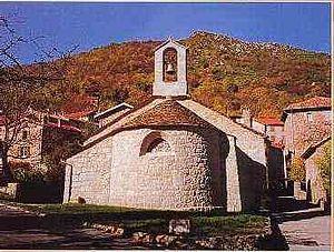
 Protestant Church |
||
Vialas is a French commune with 432 inhabitants (January 1, 2017) in the Lozère department of the Occitanie region . It belongs to the arrondissement of Florac and the canton of Le Pont-de-Montvert .
geography
Vialas is located on the upper reaches of the Luech River at an altitude of around 600 meters and offers numerous outdoor sports such as skiing, hiking and white water kayaking. The Mont Lozère is located nearby . The north and parts of the south of the municipality belong to the Cevennes National Park , part of the Massif Central . Major route is the secondary road D998 from Florac about Vialas after Génolhac .
Web links
Commons : Vialas - collection of images, videos and audio files
- Community presentation (French)
