
Vorster mill
| Vorster mill
|
||
|---|---|---|
 Tranchot card No. 34 1802/04 |
||
| Location and history | ||
|
||
| Coordinates | 51 ° 22 '36 " N , 6 ° 19' 57" E | |
| Location |
Germany
|
|
| Waters | Nice | |
| Built | 1456 mentioned when the estate is divided | |
| Shut down | 1919 End of milling activity | |
| technology | ||
| use | Flour mill | |
| Grinder | 1 grind | |
| drive | Watermill | |
| water wheel | undershot | |

The Vorster Mühle was a former watermill located on the Nette in the municipality of Wachtendonk with an undershot water wheel .
geography
The Vorster Mühle was located on the Nette, Harzbecker Straße / Gortschesweg, in the Vorst district, in the Wachtendonk district of Kleve in North Rhine-Westphalia . The Nette has a height of about 34 m above sea level here . The care and maintenance of the water is the responsibility of the Netteverband , which is based in Nettetal .
history
When the Bocholtz family was divided up in 1456, Katharina von Bocholtz and her husband received not only some goods in Wankum but also the nearby mill "op den Vorst". This is the first and only message from the old days. The flour mill with an undershot water wheel was closed after the First World War , around 1919. The dilapidated mill was removed during the regulation of the Nette in 1937/38.
gallery

Former mill pond
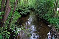
The nice one at the former Vorster Mühle


literature
- Hans Vogt: Lower Rhine water mill guide. 2nd Edition. Verein Niederrhein, Krefeld 1998, ISBN 3-00-002906-0 , p. 473.
Web links
Individual evidence
On the Niers :
old oil mill Geldern |
Old Wylick Mill |
Aspermühle |
Bimmen mill |
Castle mill Geldern |
Höster mill |
Holtheyder Oil Mill |
Goch grain mill |
Corn mill house Caen |
Corn mill Wachtendonk |
Lohmühle Goch |
Lohmühle Wachtendonk |
Mill on the Fleuth |
Mills from Haus Gesselen |
Neumühle |
Niersmühle Weeze |
Oil mill Goch |
Oil mill house Caen |
Wachtendonk oil mill |
Oil mill knowledge |
Ponter Mill |
Sawmill knowledge |
Castle mill knowledge |
Schravelsche Mühle |
Susmühle |
Vlassrather grain and oil mill |
Viller Mill |
Fulling Mill Goch |
Fulling Mill House Caen |
Fulling Mill Knowledge |
Fulling mill and oil mill Geldern |
Willick's Mill |
Windvonderer Mühle
An der Nette :
Kovermühle |
Nettmühle |
Vorster Mühle
Am Leitgraben / Mühlengraben :
Vennmühle Straelen |
Paesmühle |
Maesemühle
An der Gelderner Fleuth :
Pletzmühle |
Wyemühle
An der Issumer Fleuth :
Langendonker Mühle |
Kapellener Mill |
Honselaerer Mühle
At the Kervenheimer Mühlenfleuth :
Fallmühle |
Kervenheimer Mühle
An der Kendel :
Yshövelsche Mühle |
Mill to garbage