
Weitlingkiez

The Weitlingkiez is a district in the two Berlin districts of Rummelsburg and Friedrichsfelde in the Lichtenberg district with an area of around 50 hectares , which developed mainly in the 19th and 20th centuries. At the end of 2011, around 13,000 people lived in this area around Weitlingstrasse.
location
Weitlingstrasse, which runs roughly in a north-south direction, is the center of this residential area. To the west it is bounded by the railway tracks of the Ostbahn , behind it lies the Frankfurter Allee Süd district and, to the south of it, the Victoria City . In the south, allotment gardens and the railway area connect to the railway line to Frankfurt (Oder) . In the east the area borders on the center of Friedrichsfelde. There are quiet residential streets, numerous listed apartment blocks, three schools, the Münsterlandplatz and a sports stadium.
The area can be reached via the S-Bahn lines S5, S7 and S75 with the train stations Berlin-Lichtenberg and Nöldnerplatz as well as via the underground line U5 and various bus lines by public transport.
history

With the construction of the eastern railway line in 1867 and the Lichtenberg marshalling yard , the southeastern part of the Lichtenberg community was separated from the rest of the village. The area that bordered the municipality of Friedrichsfelde in the east was largely undeveloped in the early 1890s. Only in the south, on the road leading from Rummelsburg to Friedrichsfelde (today's Lückstraße), was the Lichtenberger Kiez horticultural colony built as early as 1783 by royal order . Colonists settled here and built small one- and two-story houses on narrow, deeply cut plots.
In the following years the area on the Chaussee from Lichtenberg to Friedrichsfelde was built on. The development was mainly in the area of today's Frankfurter Allee and Einbecker Straße in the vicinity of the Lichtenberg train station (then Lichtenberg-Friedrichsfelde ), which has also been used for passenger traffic since 1881. In the areas adjoining to the south, the structure of the planned residential areas could already be seen at the end of the 19th century.
Soon after 1900, the area on both sides of Wilhelmstrasse was built with tenement houses. After the First World War , numerous construction companies built completely new housing estates in open spaces. Housing estates emerged in the area around Metastraße, Archibaldweg and in the west of Friedrichsfelde on today's Marie-Curie-Allee. Renowned architects at the time realized their ideas of new building here . Almost all of these residential complexes have been under monument protection since the 1970s (see section Other monuments in the Kiez ).
The vacant lots caused by the Second World War were closed in the 1950s using conventional construction methods. Only a few buildings date from the 1970s and 1980s, such as the department store in Weitlingstrasse on Münsterlandplatz.
In 1994 the city administration declared the neighborhood a redevelopment area . As part of this project, numerous houses were renovated by 2008 and, among other things, Münsterlandplatz was redesigned.
Streets, squares and buildings in the Weitlingkiez
Weitlingstrasse
The area takes its name from this main road, which was an important north-south connection when the residential buildings were built. When it was built in the 1870s, the street was initially called Wilhelmstraße , either after Kaiser Wilhelm I or after Crown Prince Wilhelm of Prussia . On May 11, 1938, it was named Weitlingstrasse after the pedagogue Johann Ludwig Weitling .
Weitlingstraße begins on Einbecker Straße, then crosses Irenenstraße, touches the Lichtenberg train station , crosses Margaretenstraße, the Bietzkestraße – Sophienstraße street, touches Münsterlandplatz. After crossing Münsterlandstrasse and the confluence with Delbrückstrasse, it ends at Lückstrasse, opposite with a small footpath opening up the former Kietz colony. In total, it is around 1250 meters long. The current northern section was not built until the Lichtenberger Bridge was renewed in the 1970s, before it began at the Irenenstrasse confluence.
In the 21st century, the entire area around the station was renewed and in this context a longer mural was created on the wall facing the track system with the motto “I am the city too”. Creative people from the Urban II group with César Olhagaray, Dominique, Georg Manthey, Lenni and a few others took part in the design of various sections and immortalized their names there. Some typical characteristics of Lichtenberg are shown here.
Nöldnerplatz to Fischerstraße


The Nöldnerplatz is a large, irregularly shaped square, open to the numerous roads. In between there are green spaces. A memorial stone was unveiled directly on the square in May 2010, commemorating the Rummelsburg workers who bravely resisted during the Nazi era . It is a granite obelisk with a stainless steel nameplate. The listed school complex on the south side of the square was built from 1927 to 1932 according to designs by the architect Max Taut . It consists of several structures that extend from Fischerstrasse to Schlichtallee. They were originally used as a lyceum , middle school and vocational school. The individual buildings are structurally connected to each other and functionally divided into school buildings, gyms and auditorium . The predominantly two or three-story reinforced concrete construction is faced in its various areas with yellow or red clinker bricks. Except for one entrance, which is decorated with a terracotta depiction of a woman surrounded by nine children, all components are unadorned.
During the GDR era, the school buildings housed the extended high school "Immanuel Kant" (after 1990 Immanuel Kant high school ). Since the grammar school moved to Lückstrasse, the complex has been called Max-Taut-Schule and is used by the Upper School Center for Supply and Cleaning Technology.
The historic auditorium, which lies in front of the entire school complex, is a monument to classical modernism and was destroyed in the Second World War. The building fabric was only poorly secured for 60 years. Originally designed by Max Taut as a "public auditorium", it was rebuilt in 2003 after a Europe-wide competition under the direction of the architect Max Dudler and equipped with the latest event technology. The trapezoidal hall can hold up to 800 spectators. Named after its architect Max-Taut-Aula , the auditorium was inaugurated again in December 2007. From 2008 to 2010, the pioneering event series Medium Taut took place here with numerous cultural offers and well-known artists and guests. In addition to school tasks, it also serves theatrical performances, concerts and other public events as well as meetings of the district assembly of Lichtenberg.
There are plans to set up a weekly market right in front of the exit of the Nöldnerplatz S-Bahn station . The playgrounds on the square have been redesigned. Some of the areas in Fischerstraße 15/16 originally used by the Berlin city cleaning service were acquired by the city of Berlin and sports fields were set up there in 2008. At the end of Fischerstrasse there is still the recycling center.
The painter Heinrich Zille grew up in what is now Fischerstrasse.
Lückstrasse

The first community school for Rummelsburg, built in 1906 under Adolph Schlicht , is on Lückstrasse . The building is a three to four storey plastered brick building with a striking stair tower crowned by a clock lantern. The street front is rustified (clad with artificial stone), a humorous sculptural work can be seen on the bay window on the first floor of the attached former Rector's residence: a student is sitting on a snail and reading a book. During the GDR era, this school was called the 22nd Lichtenberg Oberschule . The Immanuel-Kant-Gymnasium has been located in this building since 1990.
In Lückstraße there are also several listed colonial houses from the end of the 18th century that were set up for foreign immigrants to Prussia. House number 18/19 was still in great danger of collapsing in 2007, but was renovated by the Lichtenberg District Office for around 500,000 euros by the end of 2009 and is now operated as a sports youth club.
Heinrich Zille lived briefly in a basement apartment in house number 31 .
Münsterlandplatz

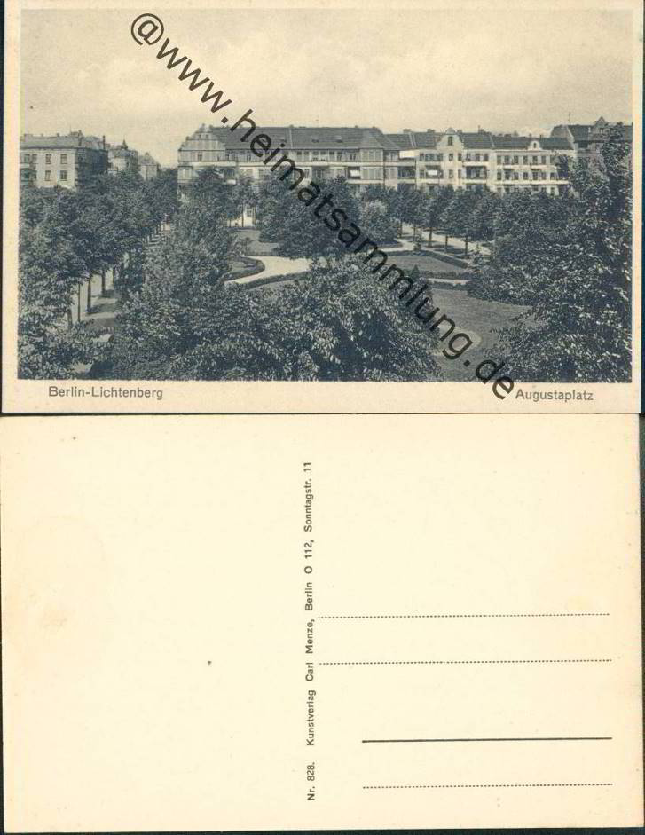
The Münsterlandplatz is a small green area of around 1400 m², bounded by the Münsterlandstrasse and Weitlingstrasse, the Münsterlandplatz street and the Wönnichstrasse. The square was laid out with the start of development around 1905. It was first called Augustaplatz . On May 10, 1951, it was renamed after the landscape in North Rhine-Westphalia .
Once a week there is a weekly market on Fridays between 7 a.m. and 6 p.m. on Münsterlandplatz . The New Apostolic Church is located directly on the corner of Münsterlandplatz and Wönnichstrasse .
Robinson Elementary School

The Robinson elementary school is located at Wönnichstraße 7, planned and built in 1907/1908 based on plans by Franz Knipping, and is now a listed building. In 1973 the school was named after the resistance fighter Horst Viedt and a commemorative plaque was placed on the school building. However, since the school was renamed Robinson Elementary School , the board no longer exists.
Erlenhof, Pappelhof, Ulmenhof

In the 1920s, architects such as Jacobus Goettel , Paul Mebes , Paul Emmerich , Erwin Anton Gutkind , to name just a few important ones, carried out further residential buildings in the New Building style in this neighborhood, which are characterized by a clear design language and functionality: whole Residential complexes were built with the simplest design elements so that many families could get inexpensive but relatively comfortable living space, the inner courtyards were designed as green oases of play and relaxation.
Since 1977 the courtyards mentioned above and planned by Jacobus Goettel between 1928 and 1931 and built by the Lenz company in the square Kraetke-, Ribbecker, Rummelsburger and Zachertstraße have been listed as historical monuments.
Sonnenhof

From 1925 to 1927, the urban and rural settlement company built a monumental-looking block development according to plans by Erwin Anton Gutkind in the Marie-Curie-Allee, Delbrückstrasse, Archenholdstrasse and Bietzkestrasse, which was named Sonnenhof . In the south-facing facade, the wide windows with white pillars in between are arranged completely evenly; in the horizontal direction there is a color contrast through the dark gray reinforced concrete beams and continuous red clinker strips. In the 1970s there was a partial increase in the original four floors. The inner courtyard is laid out as a spacious green area. The courtyard sides of the block are loosened up with accentuated stair parts; a separate building in the courtyard offered a protected space for the kindergarten. The Sonnenhof is a listed building, as indicated by a plaque unveiled in 2003 at the eastern double entrance.
Sports stadium
Between Zachert- and Kraetkestraße a sports field was set early on by several of the Second World War enttrümmerte was extended properties. The open-air sports facility, which is now called the Friedrichsfelde Stadium , offers space for local sports clubs and school sports.
Further architectural monuments in the neighborhood
- Residential complex Archibaldweg 28–40; 1925–1930 by Bruno Ahrends
- Residential complex Friedastraße, Irenenstraße, Metastraße; 1930–1933 by Adolf Rading
- Apartment building Irenenstrasse 2/3
- Housing complex Lincolnstrasse, Bietzkestrasse, Eggersdorfer Strasse, Zachertstrasse; 1926/1927 by Paul Mebes & Paul Emmerich
- Tenement houses Margaretenstrasse 5–6; around 1890
- Residential complex Metastraße 2–30; 1931 by Rudolf Henning
- Housing complexes Weitlingstrasse 19/21 and 25/27 with the back Wönnichstrasse 16–26, called "Alte Fabrik"; around 1930 by Volker Raatz
Right-wing extremism

Even before the fall of the Wall , a small East Berlin neo-Nazi scene had some of its meeting places in the Weitlingkiez. After the establishment of the Nazi organization Nationale Alternative , mainly by well-known Berlin neo-Nazis, a series of squats followed on February 18, 1990 in Berlin-Lichtenberg . Weapons and propaganda material were confiscated, and at times the entire NA executive committee was arrested. On March 5, 1990, the Lichtenberg municipal housing administration offered the group a legal lease for the large corner house at Weitlingstrasse 122 (corner of Lückstrasse). A party headquarters was set up there. Numerous German neo-Nazi cadre used this place to hold training courses. Some time later, the neo-Nazis also occupied Weitlingstrasse 120. Later - after Weitlingstrasse was cleared - the house became uninhabitable due to arson. On April 27, 1990, one of the squatted houses was stormed by the police. Externally, the buildings have now been renovated, but are only partially inhabited.
The Weitlingkiez has since become known throughout Germany again and again through racist and politically motivated attacks by right-wing extremists . The two attacks on the then PDS politicians Giyasettin Sayan on May 19, 2006 and Kirill Jermak on November 26, 2006 attracted particular attention . The number of right-wing extremists willing to use violence was estimated at around 65.
The local situation is subject to special observation by the security authorities, as there is an above-average number of political acts of violence. According to the State Criminal Police Office for 2006: 7 acts of violence in the category "Politically motivated crime - right" and 13 acts of violence in the category "Politically motivated crime - left" .
In 2007 the Federal Ministry for Family, Senior Citizens, Women and Youth launched a federal program entitled “VIELFALT TUT GUT - Youth for Diversity, Tolerance and Democracy” to promote projects against right-wing extremism, xenophobia and anti-Semitism . From 2007 to 2010, 100,000 euros were made available annually for the Lichtenberg - Mitte development area with a focus on Weitlingkiez and the associated Local Action Plan, which is used to finance a large part of campaigns against violence and right-wing extremism in the Weitlingkiez. The money has been used to support over 120 projects in these years. Examples for this are:
- The Vietnamese Moon Festival as a street festival (under the patronage of the district office and together with the Association of Vietnamese in Berlin & Brandenburg eV) under the motto "We in the Kiez" (September 2007),
- Intercultural education center and civic café (2007),
- Intercultural media library in the Bodo Uhse library (2007).
Since 2011, the local action plan in Lichtenberg-Mitte has been promoted by the new federal program Promoting Tolerance - Strengthening Competence . The funding is intended to ensure the sustainability of the measures.
literature
- Jan Feustel : Walks in Lichtenberg . In: Berlin reminiscences . tape 75 . Haude and Spener, Berlin 1996, ISBN 3-7759-0409-3 .
Web links
- Abolished redevelopment area Lichtenberg - Weitlingstraße ( Memento from April 29, 2011 in the Internet Archive )
- Visit to the danger zone , TAZ on May 23, 2006
- Coordination office for diversity projects in Lichtenberg
- Website of the event series Medium Taut with information about Max Taut, the auditorium and a description of the location
Individual evidence
- ↑ TOPOS Stadtforschung: Social investigation in the Weitlingkiez 2011 at berlin.de / balichtenberghohenschönhausen ( Memento from August 8, 2014 in the Internet Archive ) (PDF; 2.5 MB), accessed on May 31, 2013
- ↑ ENVIRONMENT OF BERLIN 1894 ( Memento from July 22, 2012 in the web archive archive.today ). In: Meyers Konversations-Lexikon , 5th edition
- ↑ BERLIN and its environs in 1899 ( Memento of 18 July 2012 in the Web archive archive.today ). In: Brockhaus Konversations-Lexikon , 14th edition
- ^ Abolished redevelopment area Lichtenberg - Weitlingstraße ( Memento from April 29, 2011 in the Internet Archive )
- ↑ Weitlingstrasse. In: Street name lexicon of the Luisenstädtischer Bildungsverein
- ↑ Nöldnerplatz. In: Street name lexicon of the Luisenstädtischer Bildungsverein
- ↑ Press release from the Lichtenberg district office on the memorial stone on Nöldnerplatz; Retrieved January 1, 2011
- ↑ Architectural monument school complex Nöldnerplatz
- ↑ The architectural and art monuments of the GDR , Berlin, Volume II, pages 206/207
- ↑ Communication from the district office on the inauguration of the memorial stone for Zille
- ↑ Berlin State Monument List: Colonist houses in Lückstrasse
- ^ Homepage Clearingstelle Jugendhilfe; Retrieved May 30, 2010
- ↑ Information on Zille from a drawing posted in the conference room of the Lichtenberg town hall ; seen on January 8, 2011 on the occasion of a public tour of the town hall
- ↑ Augustaplatz . In: Street name lexicon of the Luisenstädtischer Bildungsverein
- ^ Historical postcard of Augustaplatz
- ↑ Münsterlandplatz. In: Street name lexicon of the Luisenstädtischer Bildungsverein
- ↑ Berlin State Monument List: Robinson Elementary School
- ^ Description of the memorial plaque for Horst Viedt at luise-berlin.de
- ↑ Berlin State Monument List: Erlenhof, Pappelhof, Ulmenhof
- ↑ Berlin State Monument List: Open spaces as garden monuments
- ↑ Berlin State Monument List: Sonnenhof residential complex
- ↑ Berlin State Monument List: Archibaldweg 28–40 residential complex
- ↑ Berlin State Monument List: Residential Complex Friedastrasse, Irenenstrasse, Metastrasse
- ↑ Berlin State Monument List: Apartment building Irenenstrasse 2–3
- ↑ Berlin State Monument List: Residential Complex Lincolnstrasse, Bietzkestrasse, Eggersdorfer Strasse, Zachertstrasse
- ↑ Berlin State Monument List: tenement houses Margaretenstrasse 5–6
- ↑ Berlin State Monument List: Housing complex Metastraße 2–30
- ↑ Berlin State Monument List: Housing complexes Weitlingstrasse 19/21 and 25/27 with the back Wönnichstrasse 16–26
- ↑ Britta Bugiel: Right-wing extremism of young people in the GDR and in the new federal states from 1982-1998 (= media & politics. Volume 21). Lit-Verlag, Münster 2002, p. 129 f.
- ^ PDS politician Sayan attacked in Lichtenberg . In: Der Tagesspiegel , May 21, 2006
- ↑ Young PDS politicians dejected . In: Der Tagesspiegel from November 27, 2006
- ^ Signs against neo-Nazis in Weitlingkiez ( Memento from April 11, 2008 in the Internet Archive )
- ↑ Weitlingkiez in the focus of the Berlin security authorities ( memento of September 29, 2007 in the Internet Archive ), berlin.de, December 7, 2006
Coordinates: 52 ° 30 ′ 22 ″ N , 13 ° 29 ′ 45 ″ E