Wolfsberg (Obertrubach)
|
Wolfsberg
Community Obertrubach
Coordinates: 49 ° 41 ′ 17 ″ N , 11 ° 18 ′ 41 ″ E
|
|
|---|---|
| Height : | 390 (386-432) m above sea level NHN |
| Residents : | 191 (1987) |
| Incorporation : | January 1, 1972 |
| Postal code : | 91286 |
| Area code : | 09245 |
|
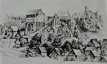
The Obertrubach district of Wolfsberg
|
|
Wolfsberg is a district of the municipality of Obertrubach in the Upper Franconian district of Forchheim , Bavaria .
geography
The village is naturally located in southern Franconian Switzerland in the Trubach valley at an altitude of 390 m above sea level. NHN . North of the village, the terrain rises steeply to 513 m above sea level. NHN high Hundsberg . To the south extends about 450 m above sea level. NHN high dolomite ridge Hochleithen, where the Dohlenstein natural monument is located 200 m from the village .
The closest cities are Bayreuth , 33 km north, Pegnitz , 17 km east, Nuremberg , 33 km south and Forchheim , 17 km west.
history
The area around Wolfsberg was settled as early as the Urnfield Period , the Hallstatt Period and the Early Latène Period, as is shown by finds in nearby caves and body graves. The Wolfsberg castle ruin was first mentioned in a document around 1150. It is in an exposed position on a prominent rock spur immediately north of the town. The elaborate building suggests some prosperity, so that the place should have developed several generations earlier.
In the Peasant Wars and in the Thirty Years' War there was repeated destruction and looting.
Apart from the castle ruins, nothing has been preserved from the medieval structure of the place. In the 1810s, the Bavarian original cadastre shows 19 farmsteads densely packed in the valley, some of which have impressive farm areas. Properties 15 and 18 were probably a mill and a forge that used the water power of the Trubach, as can be seen from the respective mill ditches and ensembles of buildings. Both have gone, so that apart from the castle ruins and the stately wall remnants of their high-medieval predecessor buildings with a rock cellar, only a few architectural monuments have survived:
- Catholic path chapel St. Maria from the 18th century at the eastern exit of the village
- Vogtshaus, later forester's house, now used as a school
In 1972 Wolfsberg joined the municipality of Obertrubach together with its districts Dörfles , Hundsdorf , Sorg and Untertrubach as part of the regional reform in Bavaria .
Wolfsberg is still predominantly characterized by agriculture and forestry. Since the 1980s, tourism and local recreation have become increasingly important for the Nuremberg Metropolitan Region .
traffic
The State Road 2260 connects the village with Obertrubach and Egloffstein . In the west the state road at Pretzfeld connects to the federal road 470 , in the east to the federal road 2 .
The public transport operated Wolfsberg weekdays with a bus route from Forchheim to Gößweinstein . A shared taxi can be requested at the weekend . From May to October additionally daytime leisure line 229, the "Trubachtal Express" runs Sundays Graefenberg -Gößweinstein every two hours.


