Wolinia
Wolinia (German Wollin ) is a village in the powiat Słupski ( Stolp district ) in the Polish Pomeranian Voivodeship .
Geographical location
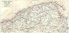
Wolinia is located in Hinterpommern , on the west side of the Leba Valley , about 16 kilometers northwest of the city of Lębork ( Lauenburg in Pomerania ), 16 kilometers south of the city of Łeba (Leba) and three kilometers south of the village of Cecenowo ( Zezenow ).
history


The former manor Wollin was in older times a fief of the Puttkamer family , who had had an ancestral home there since at least 1457. The estate was always passed on in the same male line, with inheritance divisions occurring since the second half of the 16th century. In 1523 Baltzar is called to puttkummer to Wollineke . In 1590 Wollin still had thirteen farms, some of which were uncultivated, and six cottages . At the beginning of the 17th century, Albrecht Puttkamer was the landowner. In a letter of grace drawn up in 1621 at Groß Stepenitz by the Pomeranian Duke Bogislaw X. , the Puttkamer family was granted the right to fish freely in the Leba on the two field marks Wollin and Zezenow from Podel to Poblotz, but excluding salmon fishing, which the Duke had for himself self claimed.
At the beginning of the 18th century, Wollin was reunited in one hand by Georg-Dietrich von Puttkamer , who had made his fortune in Polish and Russian services . By 1715 he acquired all shares in Wollin together. He had a representative mansion built, which was extended by his son of the same name. Around 1784 there was a Vorwerk in Wollin, a water-powered grinding and chopping mill, eight full farmers , six half-farmers , six kossäts , an inn, a blacksmith's shop, a schoolmaster, on the Feldmark the Morhof Vorwerk with a number of colonist houses, a brick factory , one Lime kiln and a total of 82 households. By 1800 there were only a few Kashubian- speaking villagers left.
In 1878 Baron Georg von Puttkamer lost the Wollin estate due to extraordinary circumstances; he had written a blank check to a business partner . The property then came to Philipp Georg von Braunschweig , who was then master of Sorchow , Groß Podel and Wollin.
Before 1945 the rural community Wollin belonged to the district of Stolp in the administrative district of Köslin in the province of Pomerania . In addition to the village of Wollin, there was the Friedrichswerder residential area in the municipality . On the total of 1823 hectares of community space there were 57 residential buildings. In 1938 a total of 91 households and 402 inhabitants were counted.
Towards the end of the Second World War , Wollin was occupied by the Red Army without a fight on March 9, 1945 , accompanied by looting, mistreatment and rape. On 25/26 In July 1945 a Polish administrative office was set up. In the following years the inhabitants were expelled and replaced by immigrating Poles. The German village of Wollin was renamed Wolinia .
In 1953 there were still 23 German families in Wollin, of which only six were originally from Wollin.
After the end of the war, 154 villagers displaced from Wollin were identified in the FRG and 160 in the GDR .
Population numbers
- 1852: 511
- 1925: 489, all Protestants
- 1933: 492
- 1939: 455
- 2008: 322
Sons and daughters of the place
- Georg-Dietrich von Puttkamer (1681–1754), military in Polish and Russian services, district administrator and landlord
literature
- Karl-Heinz Pagel : The district of Stolp in Pomerania . Lübeck 1989, p. 1030–1034 ( Download location description Wollin ) (PDF; 1.1 MB)
- Ludwig Wilhelm Brüggemann : Detailed description of the current state of the Königl. Prussian Duchy of Western and Western Pomerania . Part II, Volume 2, Stettin 1784, pp. 1017-1018, No. 159 .
Web links
- Gunthard Stübs and Pomeranian Research Association: The municipality of Wollin in the former Stolp district in Pomerania (2011).
- William Remus: Pictures by Wollin (Wolinia), Stolp District, Pomerania (2012) (English)
Footnotes
- ^ Karl-Heinz Pagel : The district of Stolp in Pomerania . Lübeck 1989, p. 1034 ( Download location description Wollin ) (PDF; 1.1 MB)
- ^ Kraatz: Topographical-statistical manual of the Prussian state . Berlin 1856, p. 960.
- ↑ http://gemeinde.wollin.kreis-stolp.de/
- ^ A b Michael Rademacher: German administrative history from the unification of the empire in 1871 to the reunification in 1990. stolp.html # ew39stlpwollin. (Online material for the dissertation, Osnabrück 2006).
Coordinates: 54 ° 37 ' N , 17 ° 33' E

