
Łeba
| Łeba | |||
|---|---|---|---|

|
|
||
| Basic data | |||
| State : | Poland | ||
| Voivodeship : | Pomerania | ||
| Powiat : | Lębork | ||
| Area : | 14.80 km² | ||
| Geographic location : | 54 ° 46 ' N , 17 ° 33' E | ||
| Height : | 0 m npm | ||
| Residents : | 3644 (June 30, 2019) |
||
| Postal code : | 84-360 | ||
| Telephone code : | (+48) 59 | ||
| License plate : | GLE | ||
| Economy and Transport | |||
| Street : | Ext. 214 : Warlubie - Kościerzyna - Lębork –Łeba | ||
| Rail route : | PKP line 229: (Pruszcz Gdański – Kartuzy–) Lębork – Łeba | ||
| Next international airport : | Danzig | ||
| Gmina | |||
| Gminatype: | Borough | ||
| Residents: | 3644 (June 30, 2019) |
||
| Community number ( GUS ): | 2208021 | ||
| Administration (as of 2011) | |||
| Mayor : | Andrzej Strzechmiński | ||
| Address: | ul.Kosciuszki 90 84-360 Łeba |
||
| Website : | www.leba.eu | ||

Łeba [ ˈwɛba ] (German Leba ) is a small town and a seaside resort in the powiat Lęborski of the Polish Pomeranian Voivodeship .
Geographical location
The city is located in eastern Pomerania at the mouth of the Leba River in the Baltic Sea , on the edge of the Slowinzischen National Park , about fifty kilometers northeast of the city of Stolp .

Aerial view of the city of Leba on the Baltic Sea coast
|
history


In the 11th century there was a fishing settlement of the Slavic Pomorans at the mouth of the river Leba, called Lebsko , Lepzky or Lebemünde . Lebe or Leve has the meaning of forest in Wendish . At that time the village was still about two kilometers west of the current estuary. The first records about the Lebamünde settlement date back to 1282. Over time, the place name has changed several times. Older forms of the name are Levemunde and Lebamünde . The place name is Lebemunde on the imprint of the city seal with which the city fathers provided the letter of alliance of the Prussian Confederation in 1440 . In the 16th century the place name Leba finally caught on.
As part of the Lauenburger Land, the place originally belonged to Pomeranian . After the Pomeranian dynasty of the Samborids died out in 1294 and the ensuing disputes, Pomerania, and with it Leba, became part of the Teutonic Order in 1308. Under the name Lebamünde, the town was granted city charter according to Kulmer law in 1357 by the Danzig Teutonic Order - Commander Wilhelm von Baldersheim with the approval of Grand Master Winrich von Kniprode , which was later changed to Luebian law . Leba was an open city that had no city walls and no gates. The city's coat of arms, which shows a fish griffin at the foot of the black cross of the Teutonic Order, was also awarded by the order in 1360.
The further development of the city led to the expansion of a fishing port and the establishment as a timber trading center.
In 1455, Duke Erich II of Pomerania took possession of the Lauenburger Land, which was confirmed after the Second Peace of Thorn in 1466. After the Pomeranian rulers of the Griffin family died out in 1637, the Lauenburger Land came to Poland for a few years, but in 1657 Brandenburg was enfeoffed with Lauenburg in the Treaty of Bromberg . Leba stayed with Brandenburg-Prussia until 1945.
For centuries Leba suffered severe damage from storm surges, such as in 1497 and 1558, which shifted the estuary further east. At the same time, the city was threatened by advancing shifting dunes. Therefore, in 1570, the city was moved further inland. The old Nikolaikirche, of which only a fragment of the wall still exists today, was initially used until a new church was completed in the center of the relocated town in 1592. On September 18 and 19, 1612, the well-known cartographer Eilhard Lubinus stopped in Leba while on a tour of Western Pomerania and was greeted by the mayor and some councilors.
In 1682, 1688, 1717 and 1774 Leba was ravaged by devastating fires. On March 4, 1779, Leba was threatened by floods, and the previously created connecting canal between Lebasee and the Baltic Sea was opened dangerously wide, so that it seemed advisable to block it completely as a precaution.
In the 19th century, the construction of a large port began on the orders of the Prussian king. In the course of the port construction, a 34 meter wide canal was dug between the Lebasee and the Baltic Sea . This made Leba an important trading center for salt and wood, and later for agricultural products. In 1862 the city became a seaside resort , whose remedies also included mud baths . When the city was connected to the Lauenburg - Leba railway line in 1899, industry took off. At the turn of the century there were twelve smokehouses, two canning factories and a sawmill, a box factory and a dairy. In addition to fishing, there was trade in beef cattle. Leba had a Protestant church, a beach office and a rescue station for shipwrecked people. On May 18, 1866, the crew of the Prussian schooner Stolper Packet was rescued from Leba . Around 1900 the Hotel Kurhaus Leba with 40 guest rooms was built on the dunes in front of the city . In 1921 the expressionist painter Max Pechstein chose Leba as his domicile. In 1930 a gliding school started operations. Until 1945 the city was in the Lauenburg district .
To the west of Leba was the Rumbke rocket test site for testing long-range weapon systems. The German Rheinbote and Rhine Daughter rockets were launched on this area between 1941 and 1945 for test purposes. The counter-measuring point for the V2 / A4 missiles launched from test stand VII of the Peenemünde Army Research Center was also located here . From there to here it was 250 km, the maximum range of the A4 at that time.
Towards the end of World War II , Leba was captured by the Red Army on March 10, 1945 . The city was soon placed under Polish administration. The immigration of Polish and Ukrainian civilians began, mainly from areas east of the Curzon Line , which had belonged to Poland since the First World War. The Polish spelling Łeba was introduced for the place name . In the following period, the residents were evicted by the local Polish administration .
Between 1963 and 1973, 33 Polish Meteor sounding rockets were launched from the Rumbke / Leba test site . The test site will be preserved as a museum.
Shifting dunes
In the vicinity of Łeba there are extensive shifting dunes (Góry Białe), which in the Lontzkedüne , 9 kilometers west of Leba on a narrow spit between Lake Leba and the Baltic Sea, reach a height of 42 m. To the west of the Lebasee rise the so-called small wool sacks , with a height of up to 56 meters, the highest dunes in Western Pomerania. To the east of Lake Lebasee are the large wool sacks , up to 45 meters high dunes with a 23 meter high beacon . The behavior of the Pomeranian shifting dunes had been examined between the two world wars by the Greifswald geologist Wilhelm Hartnack .
Population development
| year | Residents | Remarks |
|---|---|---|
| 1782 | 503 | no jews |
| 1794 | 526 | no jews |
| 1812 | 707 | including four Catholics and 16 Jews |
| 1816 | 699 | including two Catholics and twelve Jews |
| 1831 | 806 | including seven Catholics and two Jews |
| 1843 | 948 | including four Catholics and two Jews |
| 1852 | 1,093 | including seven Catholics and eight Jews |
| 1861 | 1,236 | including seven Catholics and eight Jews |
| 1867 | 1,860 | |
| 1871 | 2,025 | 1,975 of them Evangelicals, eight Catholics, twelve other Christians and 17 Jews |
| 1900 | 1,966 | |
| 1925 | 2,332 | including 2,244 Evangelicals, 15 Catholics and five Jews |
| 1933 | 3,512 | |
| 1939 | 2,846 | |
| 1978 | 3,649 |
Spa guests numbers
- 1908: 677
- 1923: 300
- 1929: 1,270
Personalities
sons and daughters of the town
- Martin Weiher (1512–1556), bishop of the diocese of Cammin
Other personalities associated with the city
- Max Pechstein (1881–1955), expressionist painter
Attractions
- Moving dunes (Góry Białe) with the Lontzkedüne (Łącka Góra) and the small wool sacks and the large wool sacks
- Fragment of the wall of the Nikolaikirche west of the city on the way to the beach
- Fischerkirche from 1683, here is a painting by Max Pechstein
- 19th century fishing cottages on Kościuszki Street
- Castle on ulica Sosnowa, former spa house from the 19th century, today Hotel Neptun
- Former missile test site (Wyrzutnia Rakiet) east of Rumbke, today an extensive museum area
- The fishing port
To the west of the city is the Slowinski National Park .

Harbor basin at night

The eastern beach during high season

Rumbke / Leba missile test center in front of ramp with "Rhine daughter" in back right "Rheinbote"
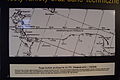
Rumbke / Leba rocket measuring station for V2 / A4 from Peenemünde

Rumbke / Leba rocket test center reconstruction
Rumbke / Leba control bunker missile testing facility

At the dunes of Leba


traffic
Łeba is connected to the next larger city of Lębork both via the road 214 and the Pruszcz Gdański – Łeba railway. In the summer (as of 2017) direct night trains run to and from the south of Poland.
See also
literature
- Ludwig Wilhelm Brüggemann : Detailed description of the current state of the Königl. Prussian Duchy of Vor and Hinter Pomerania . Part II, Volume 2, Stettin 1784, pp. 1044-1048 .
- Friedrich von Restorff : Topographical description of the province of Pomerania with a statistical overview . Berlin / Stettin 1827, pp. 284–285 .
- Gustav Kratz : The cities of the province of Pomerania - an outline of their history, mostly according to documents . Berlin 1865 (reprinted in 1996 by Sendet Reprint Verlag, Vaduz, ISBN 3-253-02734-1 ), pp. 252-254 ( full text) .
Web links
- The city of Leba in the former Lauenburg district in Pomerania (Gunthard Stübs and Pommersche Forschungsgemeinschaft, 2011).
- Historical city map, drawn in 1922 (PDF; 1.7 MB)
- Rocket launches near Leba in the Encyclopedia Astronautica (English)
- Website of the city of Łeba (Polish)
- League of Lebaers
See also
Footnotes
- ↑ a b population. Size and Structure by Territorial Division. As of June 30, 2019. Główny Urząd Statystyczny (GUS) (PDF files; 0.99 MiB), accessed December 24, 2019 .
- ↑ a b Friedrich August Vossberg : History of the Prussian coins and seals from the earliest times to the end of the rule of the Teutonic Order . Berlin 1843, p. 44.
- ↑ See for example Wilhelm Hartnack : The coast of Hinterpommern with special consideration of the morphology . Geographical Society, Greifswald 1926, Figure 74.
- ↑ Christian Friedrich Wutstrack : Addendum to the brief historical-geographical-statistical description of the Royal Prussian Duchy of Western and Western Pomerania . Stettin 1795, pp 266 et seq. .
- ↑ Christian Friedrich Wutstrack (Ed.): Brief historical-geographical-statistical description of the Royal Prussian Duchy of Western and Western Pomerania. Stettin 1793, p. 729, note 950.
- ^ Gustav Kratz : The cities of the province of Pomerania - Outline of their history, mostly according to documents . Berlin 1865 (reprinted in 1996 by Sendet Reprint Verlag, Vaduz, ISBN 3-253-02734-1 ), p. 254 ( full text)
- ↑ Ludwig Wilhelm Brüggemann : Detailed description of the current state of the Royal Prussian Duchy of Vor und Hinterpommern : Part II, Volume 2, Stettin 1784, pp. 1044-1048 .
- ↑ Lubin's journey through East Pomerania in 1612 . In: Baltic Studies , AF, Volume 14, No. 1, Stettin 1850, pp. 1–25 .
- ↑ Johann Georg Krünitz (Ed.): Economic encyclopedia, or general system of state, city, house and agriculture in alphabetical order . Volume 66, Brünn 1797, pp. 669-677 .
- ↑ Globus - Illustrated magazine for country and ethnology (Karl Andree, ed.). Volume 7, Bibliographisches Institut, Hildburghausen 1865, p. 285, top right column .
- ↑ See for example v. Strantz and Sassenhagen (Mayor): The port construction of Leba . In: Globus. Illustrated magazine for regional and folklore . 8th volume, Hildburghausen 1865, pp. 155-156 .
- ↑ Hansa. Journal of marine life. Organ of the German Society for the Rescue of Shipwrecked People . Hamburg, March 31, 1867, Volume 4, No. 85, p. 680, top left column .
- ^ Meyer's travel books: Baltic resorts and cities on the Baltic coast . 4th edition, Bibliographisches Institut, Leipzig and Vienna 1910, p. 153.
- ^ Wilhelm Hartnack : Wandering dunes in Pomerania - their shape and emergence , Greifswald 1925 (112 pages). Shifting dunes in Pomerania - their shape and origin , Greifswald 1925 (112 pages).
- ↑ Wilhelm Hartnack : On the origin and development of the shifting dunes on the German Baltic Sea coast - a comparative study of shifting dunes . Leipzig 1931 (43 pages).
- ↑ a b c d e f g h Gustav Kratz : The cities of the province of Pomerania - outline of their history, mostly according to documents . Berlin 1865, p. 254 .
- ↑ a b Royal Prussian Statistical Bureau: The municipalities and manor districts of the province of Pomerania and their population . Berlin 1874, pp. 164-165, No. 2.
- ^ Meyer's Large Conversational Lexicon . 6th edition, 12th volume, Bibliographisches Institut, Leipzig and Vienna 1908, p. 277.
- ↑ http://stadt.leba.kreis-lauenburg.de/
- ^ Michael Rademacher: German administrative history from the unification of the empire in 1871 to the reunification in 1990. lauenburg_p.html # ew39laupleba. (Online material for the dissertation, Osnabrück 2006).
- ↑ a b Johannes Hinz: Pomerania. Signpost through an unforgettable country. Flechsig-Buchvertrieb, Würzburg 2002, ISBN 3-88189-439-X , p. 211.
- ^ Meyer's travel books: Baltic resorts and cities on the Baltic coast . 4th edition, Bibliographische Institut, Leipzig and Vienna 1910, p. 153.
- ^ Meyer's travel books: German Baltic Sea Coast . Part II: Rügen and the Pomeranian coast with its hinterland . 2nd edition, Bibliographisches Institut, Leipzig and Vienna 1924, p. 199.
- ↑ The Big Brockhaus . 15th edition, 11th volume, Leipzig 1932, p. 203
