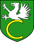
Gmina Cewice
| Gmina Cewice | ||
|---|---|---|

|
|
|
| Basic data | ||
| State : | Poland | |
| Voivodeship : | Pomerania | |
| Powiat : | Lęborski | |
| Geographic location : | 54 ° 26 ' N , 17 ° 44' E | |
| Residents : | see Gmina | |
| Postal code : | 84-312 | |
| Telephone code : | (+48) 59 | |
| License plate : | GLE | |
| Economy and Transport | ||
| Street : | Ext. 212 : Kamionka - Unichowo - Osowo Lęborskie | |
| Ext. 214 : Łeba ↔ Warlubie | ||
| Rail route : | no rail connection | |
| Next international airport : | Danzig | |
| Gmina | ||
| Gminatype: | Rural community | |
| Gmina structure: | 25 localities | |
| 11 school offices | ||
| Surface: | 187.86 km² | |
| Residents: | 7570 (Jun. 30, 2019) |
|
| Population density : | 40 inhabitants / km² | |
| Community number ( GUS ): | 2208032 | |
| Administration (as of 2012) | ||
| Community leader : | Jerzy Pernal | |
| Address: | ul. Witosa 16 84-312 Cewice |
|
| Website : | www.cewice.pl | |
The Gmina Cewice is a rural municipality in the powiat Lęborski of the Pomeranian Voivodeship in Poland . Its seat is the village of the same name ( German Zewitz , Kashubian Céwice ) with almost 1700 inhabitants. The rural community covers an area of 187.9 km² and has more than 7500 inhabitants.
geography
The rural community is located in Western Pomerania , about ten kilometers south of the district town of Lębork (Lauenburg in Pomerania) . The Bukowina (Buckowin) flows through the southern municipal area and flows into the Łupawa (Lupow) four kilometers behind the municipal boundary .
Neighboring municipalities to Cewice are: Czarna Dąbrówka (Schwarz Damerow) , Lębork (Lauenburg) , Linia (Linde) , Łęczyce (Lanz) , Nowa Wieś Lęborska (Neuendorf) , Potęgowo (Pottangow) and Sierakowice (Sierakowitz) .
history
The southeastern municipal border separated the Prussian provinces of West Prussia and Pomerania . From 1919 to 1939 it was the state border between Germany and Poland ( Polish Corridor ).
structure
The rural municipality of Cewice includes 25 localities, which are assigned to 11 villages with " Schulzenämtern ":
- Schulzenämter
|
|
- Other localities
Dziechno ( Seehof ) Kamieniec , Krępkowice ( Krampkewitz ) Krępkowo ( picket ) Lesiaki ( Lessaken ) Leśnik , Malczyce ( Henriettenthal ) Okalice ( Occalitz ) Osowiec , Roztopczyn , Święte ( Swantee , 1938-1945 Schwansee ) Unieszyniec ( Neu Wunneschin ) and Unieszynko ( Klein Wunneschin ).
traffic
Two provincial roads run through the Gmina Cewice area:
- The DW 212 (formerly Reichsstraße 158 ) in east-west direction from Osowo Lęborskie (Wussow) to Unichowo (Wundichow) in Powiat Bytowski , and
- the DW 214 in north-south direction from Łeba (Leba) and Lębork (Lauenburg) according Sierakowice (Sierakowitz) and continue until Kościerzyna (Berent) - Zblewo (Hohenstüblau) - Skórcz (Skurz) and Warlubie (Warlubien) .
In 1902, the opened Prussian state railway , the railway Lauenburg-Bütow (- Rummelsburg ) built. It led with the train stations Wussow, Groß Massow, Zewitz and Wutzkow through the municipality. The line was only partially taken over by the Polish State Railways after 1945 , a siding was laid from Cewice (Zewitz) to the Siemirowce (Schimmerwitz) airfield , but the passenger traffic, which had long since been completely suspended, was only carried out to Maszewo Lęborskie (Groß Massow) .
Web links
- Web presence of Gmina Cewice (Polish)
- District Zewitz (Rolf Jehke, 2016)
Individual evidence
- ↑ population. Size and Structure by Territorial Division. As of June 30, 2019. Główny Urząd Statystyczny (GUS) (PDF files; 0.99 MiB), accessed December 24, 2019 .

