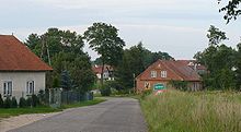
Zerbuń
| Zerbuń | ||
|---|---|---|

|
|
|
| Basic data | ||
| State : | Poland | |
| Voivodeship : | Warmia-Masuria | |
| Powiat : | Olsztyński | |
| Gmina : | Jeziorany | |
| Area : | 0.50 km² | |
| Geographic location : | 53 ° 56 ' N , 20 ° 51' E | |
| Height : | 156 m npm | |
| Residents : | 259 (March 31, 2011) | |
| Postal code : | 11-320 | |
| Telephone code : | (+48) 89 | |
| License plate : | NOL | |
| Economy and Transport | ||
| Street : |
Jeziorany –Biesowo Droga krajowa 57 |
|
| Next international airport : | Olsztyn-Mazury | |
| Danzig | ||
Zerbuń [ zerbuɲ ] (German: Sour Tree , formerly Sorbon , Serbs ) is a village in the region of Warmia in Poland . It belongs to the urban-and-rural municipality Jeziorany des Powiat Olsztyński in the Warmian-Masurian Voivodeship .
geography
Geographical location
The village is located in the west of the Masurian Lake District , which belongs to the Baltic ridge . Numerous lakes, rivers, as well as coniferous and mixed forests are characteristic of the area. It is at an altitude of 156 meters above sea level. Zerbuń is located about eight kilometers southeast of the administrative center of the rural community in Jeziorany . The closest places are Biesowo, about 2.5 kilometers to the east and Biesówko, about 1.8 kilometers to the northeast. The southern shore of Lake Tejstymy runs about two kilometers northeast of Zerbuń. The main sources of income for the inhabitants are forestry and agriculture.
Droga krajowa 57 (DK57) Bartoszyce - Kleszewo runs east of the village .
geology
The landscape was shaped by the Fennoscan ice sheet and is a postglacial , hilly, wooded ground moraine with many channels , inland lakes and rivers.
history
Originally the Gau Barten of the pagan Prussians was here . After Christianization by the Teutonic Order which was Diocese of Warmia a part of since 1243 German religious country . On February 10, 1369, the bishop of Warmia, Johann II. Stryprock, awarded the four brothers Clauko, Herman, Heinco and Dyngon 32 forest hooves according to the Kulmer law . They sold their property to the episcopal surveyor Tilo, who sold it to Johann Sorbom, after whom the estate was called Sorbon, later Sauerbaum. In the Thirteen Years War (1454–1466) Sauerbaum was completely devastated.
After the Second Peace of Thorn in 1466, Warmia was subordinated to the Crown of Poland as an autonomous duchy of Warmia . At the beginning of the 1480s, families of the Mazovian szlachta Opęchowski and Gratkowski settled on the deserted village . The Knobbelsdorf and Luzian families settled here around 1500. With the first partition of Poland in 1772, Warmia became part of the Kingdom of Prussia . In the years 1772/73 the property of 58 Hufen was distributed between the von Gratkowski, von Knobelsdorff, von Koszciesza and von Oppenkowski families.
In 1785 Sauerbaum was a noble village and belonged to the Seeburg domain office , which was in the Rößel district from 1815 . In July 1874, the district of Bößau was formed with the rural communities of Groß Bössau, Klein Bössau, Kleisack, Rothfließ, Sauerbaum and Willims and the manor district of Kunzkeim. A memorial to the fallen from the First World War with memorial stones and plaques was set up in the village .
On the basis of the provisions of the Versailles Treaty , the population in the Allenstein voting area , to which Sauerbaum belonged, voted on July 11, 1920 on whether it would continue to belong to East Prussia (and thus to Germany) or join Poland. In Sauerbaum, 460 people voted to remain with East Prussia, Poland had 20 votes.
The largest farms in the years 1930-1933 were:
- Matthias Bolz, 30 ha
- J. Gorlitzki, 31 ha
- Franziska Klomfaß, 31 ha
- Paul Lingnau, 29 ha
- Joseph Masuck, 38 ha
- Otto Neumann, 38 ha
- Ferdinand von Oppenkowski, 188 ha
- Andreas Witt, 32 ha
In the course of the East Prussian operation , Sauerbaum was captured by the Red Army on February 1, 1945 and placed under the Soviet command. After the war ended , the village became part of the People's Republic of Poland and has been called Zerbuń ever since .
Population development
- 1785: 39 fireplaces
- 1820: 31 fireplaces, 104 souls
- 1885: 639
- 1905: 682
- 1910: 770
- 1928: 650
- 1933: 696
- 1939: 649
- 2011: 259
Web links
- Sauerbaum at GenWiki
- Sauerbaum, Zerbuń at Genealogy.net
- Sauerbaum location information according to D. Lange
- Zerbuń - Sauerbaum in Ostpreussen.net
- Zerbuń in Encyklopedia Warmii i Mazur (Polish)
- Geography Zerbuń
Individual evidence
- ^ CIS 2011: Ludność w miejscowościach statystycznych według ekonomicznych grup wieku (Polish), March 31, 2011, accessed on May 28, 2017
- ↑ Artur Andreas Tiedmann: Grotkowski to sour tree . In: Magazine for the history and antiquity of Warmia (ZGAE) . 9, 1990.
- ^ Rolf Jehke: District Bößau. Rolf Jehke, Herdecke, October 18, 2004, accessed on January 20, 2017 .
- ^ Sauerbaum (Polish: Zerbuń), Rößel (Reszel) district, East Prussia, Poland. Denkmalprojekt.org, April 2011, accessed January 20, 2017 .
- ↑ Herbert Marzian , Csaba Kenez : self-determination for East Germany. Documentation on the 50th anniversary of the East and West Prussian referendum on July 11, 1920. Editor: Göttinger Arbeitskreis , 1970, p. 110
- ^ Niekammer: Landwirtschaftliches Adreßbuch (...) of the province of East Prussia, excerpt from Ermland - edition 1932 . In: Goods address book for the province of East Prussia . 1932.


