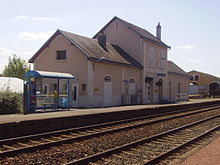
Vierzon – Saincaize railway line
| Vierzon – Saincaize | |||||||||||||||||||||||||||||||||||||||||||||||||||||||||||||||||||||||||||||||||||||||||||||||||||||||||||||||||||||||||||||||||||||||||||||||||||||||||||||||||||||||||||||||||||||||||||||||||||||||||||||||||||||||||||||||||||||||||||||||||||||||
|---|---|---|---|---|---|---|---|---|---|---|---|---|---|---|---|---|---|---|---|---|---|---|---|---|---|---|---|---|---|---|---|---|---|---|---|---|---|---|---|---|---|---|---|---|---|---|---|---|---|---|---|---|---|---|---|---|---|---|---|---|---|---|---|---|---|---|---|---|---|---|---|---|---|---|---|---|---|---|---|---|---|---|---|---|---|---|---|---|---|---|---|---|---|---|---|---|---|---|---|---|---|---|---|---|---|---|---|---|---|---|---|---|---|---|---|---|---|---|---|---|---|---|---|---|---|---|---|---|---|---|---|---|---|---|---|---|---|---|---|---|---|---|---|---|---|---|---|---|---|---|---|---|---|---|---|---|---|---|---|---|---|---|---|---|---|---|---|---|---|---|---|---|---|---|---|---|---|---|---|---|---|---|---|---|---|---|---|---|---|---|---|---|---|---|---|---|---|---|---|---|---|---|---|---|---|---|---|---|---|---|---|---|---|---|---|---|---|---|---|---|---|---|---|---|---|---|---|---|---|---|---|---|---|---|---|---|---|---|---|---|---|---|---|---|---|---|---|
|
Bengy on the road before electrification with TER X72500
| |||||||||||||||||||||||||||||||||||||||||||||||||||||||||||||||||||||||||||||||||||||||||||||||||||||||||||||||||||||||||||||||||||||||||||||||||||||||||||||||||||||||||||||||||||||||||||||||||||||||||||||||||||||||||||||||||||||||||||||||||||||||
| Route number (SNCF) : | 690,000 | ||||||||||||||||||||||||||||||||||||||||||||||||||||||||||||||||||||||||||||||||||||||||||||||||||||||||||||||||||||||||||||||||||||||||||||||||||||||||||||||||||||||||||||||||||||||||||||||||||||||||||||||||||||||||||||||||||||||||||||||||||||||
| Route length: | 87.194 km | ||||||||||||||||||||||||||||||||||||||||||||||||||||||||||||||||||||||||||||||||||||||||||||||||||||||||||||||||||||||||||||||||||||||||||||||||||||||||||||||||||||||||||||||||||||||||||||||||||||||||||||||||||||||||||||||||||||||||||||||||||||||
| Gauge : | 1435 mm ( standard gauge ) | ||||||||||||||||||||||||||||||||||||||||||||||||||||||||||||||||||||||||||||||||||||||||||||||||||||||||||||||||||||||||||||||||||||||||||||||||||||||||||||||||||||||||||||||||||||||||||||||||||||||||||||||||||||||||||||||||||||||||||||||||||||||
| Power system : | 1997: Vierzon – Bourges 1.5 kV = | ||||||||||||||||||||||||||||||||||||||||||||||||||||||||||||||||||||||||||||||||||||||||||||||||||||||||||||||||||||||||||||||||||||||||||||||||||||||||||||||||||||||||||||||||||||||||||||||||||||||||||||||||||||||||||||||||||||||||||||||||||||||
| Power system : | 2011: Bourges – Saincaize 25 kV 50 Hz ~ | ||||||||||||||||||||||||||||||||||||||||||||||||||||||||||||||||||||||||||||||||||||||||||||||||||||||||||||||||||||||||||||||||||||||||||||||||||||||||||||||||||||||||||||||||||||||||||||||||||||||||||||||||||||||||||||||||||||||||||||||||||||||
| Maximum slope : | 6 ‰ | ||||||||||||||||||||||||||||||||||||||||||||||||||||||||||||||||||||||||||||||||||||||||||||||||||||||||||||||||||||||||||||||||||||||||||||||||||||||||||||||||||||||||||||||||||||||||||||||||||||||||||||||||||||||||||||||||||||||||||||||||||||||
| Dual track : | Yes | ||||||||||||||||||||||||||||||||||||||||||||||||||||||||||||||||||||||||||||||||||||||||||||||||||||||||||||||||||||||||||||||||||||||||||||||||||||||||||||||||||||||||||||||||||||||||||||||||||||||||||||||||||||||||||||||||||||||||||||||||||||||
|
|||||||||||||||||||||||||||||||||||||||||||||||||||||||||||||||||||||||||||||||||||||||||||||||||||||||||||||||||||||||||||||||||||||||||||||||||||||||||||||||||||||||||||||||||||||||||||||||||||||||||||||||||||||||||||||||||||||||||||||||||||||||
The Vierzon – Saincaize line is a double-track line in France that is electrified with two different voltages . It went into operation between 1847 and 1850 and still forms an important west-east connection between the Loire Valley and Bourgogne .
history
opening

Efforts had been made since 1842 to build a railway line from Orléans to Bourges , and it was declared of public importance on June 11, 1842. A community of concessions was found around the Geneva banker François Bartholoni (1796–1881), which was to form the Compagnie du chemin de fer du Center from 1844 onwards . The company only existed until the end of March 1852 and was taken over by the Compagnie du chemin de fer de Paris à Orléans together with the 40-year concession . The public interest announcement for the Bourges – Le Guétin section was declared on July 26, 1844 and for the Le Guétin – Saincaize section on June 21, 1846.
The route was built in three sections. The first 28.2 km long section Vierzon – Bourges was opened to traffic on July 20, 1847, Bourges – Nérondes with a length of 36.1 km followed on May 20, 1849 and on October 5, 1850 the last 22, 9 km to Saincaize-Ouest. The northern connecting curve in the direction of Nevers followed on May 15, 1853, everything was immediately double-tracked.
Infrastructure
There is both freight and passenger traffic.
The electrification of the line is based on the two north-south facing routes Paris – Toulouse in Vierzon and Paris – Lyon in Saincaize, which are equipped with different voltages. First, from September 26, 1997, the western section Vierzon – Bourges was electrified with 1.5 kV, from November 15, 2011, Bourges – Saincaize was electrified with 25 kV 50 Hz.
Today, the highest type of train, Intercités of the SNCF Est-Center, with the destination Nantes –Lyon and Paris – Bourges, stops in Vierzon and Bourges. The route is thus part of the only Intercités east-west link between Paris and the Mediterranean. Regional trains of the TER Center-Val de Loire (line 34) also operate with nine other stops.
Transitions
At three stations there were crossings to other railroad companies guided by meter gauge. In Vierzon, the Tramways de l'Indre ran to Issoudun, 57 km away, and to Saint-Satur via Sancerre until 1937 ; in Bourges there was the Chemin de fer économique de Bourges via Dun-sur-Auron and Laugère ( Berry province ) to Saint- Amand-Montrond , which drove until 1951 and in La Guerche-sur-l'Aubois also to St.-Amand, but through the Société générale des chemins de fer économiques . The 97 km long route to Argent-sur-Sauldre also began in La Guerche . It was put into operation in 1906/1907 and closed again in 1948. The 17 km long section to Marseilles-lès-Aubigny and an approx. 1 km long connecting piece to the port on the Canal Latéral à la Loire, however, converted to 1432 mm standard gauge and reopened in 1956.
Web links
Individual evidence
- ↑ Voie ferrée: ligne Argent-sur-Sauldre - La Guerche-sur-l'Aubois (et Saint-Satur), chemin de fer économique à voie étroite dit le Tacot , Ministère de la culture, Région Center-Val de Loire, 2007
- ↑ a b c Ligne Vierzon - Saincaize . In: Infrastructure ferroviaire française, Bourgogne-Franche-Comté, Center-Val de Loire, et 2 autres
- ^ Thorsten Büker: Railways through Europe . Electrical Systems Map, December 2011
- ↑ Réseau Intercites 2016
- ^ List of chemins de fer secondaires. Indre (36) . FACS - Patrimoine Ferroviaire
- ↑ a b List of chemins de fer secondaires. Cher (18) . FACS - Patrimoine Ferroviaire

