
Dresden metropolitan area
| Dresden metropolitan area | |
|---|---|
| country |
|
| Surface: | 644.76 km² |
| Residents : | 783.977 |
| Population density : | 1,215.92 inhabitants / km² |
| Structure: | 1 district-free city , 11 district-related cities and municipalities |

The Dresden metropolitan area (also known as the Upper Elbe Valley conurbation ) is a highly dense area in Germany that has formed as an agglomeration around its only regional center, Dresden , and in which around 780,000 people live. It is the largest agglomeration in the Free State of Saxony and contains five of the 15 largest cities in Saxony .
The term Upper Elbe Valley agglomeration is a general human-geographical term and should not be confused with the terms Elbe Valley as a geological or Dresden Elbe Valley as a cultural-geographic technical term.
geography

The main component of the Dresden metropolitan area is the Elbe valley basin , which is around 45 kilometers long and up to 10 kilometers wide . It borders in the south and southwest on the Erzgebirge foothills , in the east on the Elbe Sandstone Mountains and in the north on the plateau of the Upper Lusatian granite massif.

In addition to the Elbe, important rivers in the area are the Müglitz , Wesenitz , Weißeritz and Triebisch , all of which flow into the Elbe in the greater area. Where the rivers cut into the Ore Mountains are heavily populated valleys that are part of the metropolitan area.
structure
According to the spatial structure in the state development plan, the area consists of the Saxon state capital Dresden, the intermediate centers Coswig , Freital , Meißen , Pirna , Radebeul and Radeberg as well as the basic center Heidenau . The conurbation also includes the communities of Bannewitz , Dohna , Ottendorf-Okrilla and Weinböhla on the outskirts of Dresden .
The metropolitan area is central to the regional center directed Dresden. Most of the cities are lined up close together in the Elbe valley. Parts of Dresden and other communities lie outside or above this valley widening.
The city of Heidenau has a relatively high population density for a small town of over 1400 inhabitants per km².
| local community | circle | population | Area (km²) | status |
|---|---|---|---|---|
| Dresden | circular | 551.072 | 328.31 | State capital |
| Freital | District of Saxon Switzerland-Eastern Ore Mountains | 39,300 | 40.53 | Great county seat |
| Pirna | District of Saxon Switzerland-Eastern Ore Mountains | 38.276 | 53.02 | Great county seat |
| Radebeul | Meißen district | 33,954 | 26.06 | Great county seat |
| Meissen | Meißen district | 28,061 | 30.90 | Great county seat |
| Coswig | Meißen district | 20,899 | 25.85 | Great county seat |
| Radeberg | Bautzen district | 18,451 | 29.74 | Great county seat |
| Heidenau | District of Saxon Switzerland-Eastern Ore Mountains | 16,598 | 11.07 | city |
| Bannewitz | District of Saxon Switzerland-Eastern Ore Mountains | 10,789 | 25.81 | local community |
| Weinböhla | Meißen district | 10,347 | 19.01 | local community |
| Ottendorf-Okrilla | Bautzen district | 9,966 | 25.88 | local community |
| Dohna | District of Saxon Switzerland-Eastern Ore Mountains | 6.264 | 28.58 | city |
| Total: 12 | 783.977 | 644.76 |
The other neighboring communities such as Wilsdruff , Klipphausen , Moritzburg , Radeburg , Wachau , Großröhrsdorf and others are not directly part of the urban agglomeration , but have a clear characteristic towards the Dresden regional center.
traffic

The metropolitan area has an international airport, Dresden Airport . The long-distance train stations in the metropolitan area are Dresden Central Station and Dresden-Neustadt Train Station . All larger cities are connected to the S-Bahn network or can be reached via regional express lines. The Pirna – Coswig S-Bahn line follows the metropolitan area in its southeast-northwest extension and forms a backbone in local rail passenger transport .
Important roads in the conurbation are the A 4 ( E 40 ), the A 13 and the A 17 (both E 55 ). The accessibility of the cities via the autobahns could be improved by the construction of the A 17, especially in the southeast area of the conurbation.
economy
The Dresden metropolitan area recorded a gross domestic product (GDP) of 26.9 billion euros in 2004 (excluding the small parts of the Bautzen district), which corresponds to a GDP per inhabitant of 21,547 euros or around 31 percent of Saxony's economic output. The independent city of Dresden contributes the largest share in the total bill with 15.2 billion euros.
The largest manufacturing companies include the Planeta plant owned by Koenig & Bauer (2000 employees, sales of EUR 700 million in 2004) in Radebeul , the Transparent Factory at Volkswagen (400 employees, sales of EUR 220 million in 2004) and others Companies such as Linde -KCA Dresden or GlaxoSmithKline Biologicals Dresden . Dresden is the headquarters of the VEM Group with around 1300 employees in Saxony and Saxony-Anhalt. The Elbe Flugzeugwerke (1000 employees, sales of 183 million euros in 2005) are located at Dresden Airport . The BGH Edelstahlwerk exists in Freital (600 employees in the factory, 1,500 employees and a turnover of 300 million euros in the entire holding company).
In microelectronics, the Infineon and Globalfoundries plants in Dresden are among the largest companies in the region. The Telekom subsidiary T-Systems Multimedia Solutions employs around 1000 people, mainly at the headquarters in Dresden. The software industry is still represented with several branches of international corporations ( SAP , Amazon ) and with small and medium-sized companies.
The metropolitan area is also known for some manufacturers of the luxury food industry. The well-known Radeberger export beer brewery (250 employees, sales of 150 million euros in 2004) is based in Radeberg . In Dresden, the f6 cigarette factory (400 employees, sales of 900 million euros) remained from the once further divided tobacco industry .
Attractions
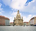
Dresden Neumarkt with the Frauenkirche

The Zwinger of Dresden

Bruehl Terrace

Pillnitz Castle

Moritzburg Castle


