Beru (island)
| Beru | ||
|---|---|---|
| NASA image of Beru | ||
| Waters | Pacific Ocean | |
| archipelago | Gilbert Islands | |
| Geographical location | 1 ° 19 ′ S , 175 ° 58 ′ E | |
|
|
||
| Number of islands | 1 | |
| Main island | Beru | |
| Land area | 17.7 km² | |
| Lagoon area | 38.9 km² | |
| Residents | 2099 (2010) | |
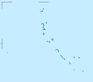
| Beru is one of the southern atolls of the Gilbert Islands, below the equator | ||
Beru (formerly also known as Eliza , Francis Island , Maria , Peroat , Peruinsel or Sunday ) is an island in the southern part of the Gilbert Islands archipelago in the Pacific Ocean . It belongs to the area of the island state of Kiribati . The island consists mostly of a reef about 14 km long , which extends from northwest to southeast and is about 4.75 km wide at its widest point. In the middle of the reef is the Nuka lagoon , which consists of shallow water .
geography
The island is located 96 km east of the Tabiteuea atoll and 426 km southeast of the Tarawa atoll near the equator . More than a third of the land mass consists of the shallow coral reef . At the northern end, the almost closed Tabiang lagoon, overgrown with mangroves , developed over time . Settlements are located along the inside of the lagoon.
Fish ponds were created in the smaller lagoons on the northern and southern tip. The Nuka lagoon has a wide access to the sea, but it cannot be used as a harbor. The closest island is Nikunau Island .
population
Demographic statistics
| census | 1978 | 2005 | 2010 |
|---|---|---|---|
| Autukia | 252 | 204 | 188 |
| Tabiang | 422 | 416 | 399 |
| Aoniman | 120 | 101 | 123 |
| Rongorongo | 49 | 315 | 190 |
| Nuka | 423 | 348 | 443 |
| Teteirio | 84 | 74 | 79 |
| Taubukinberu | 74 | 97 | 64 |
| Temara (Hospital) | 97 | - | - |
| Eriko | 250 | 265 | 259 |
| Taboiaki | 441 | 349 | 354 |
| total | 2212 | 2169 | 2099 |
Population development
| census | 1947 | 1963 | 1968 | 1973 | 1978 | 1985 | 1990 | 1995 | 2000 | 2005 | 2010 |
|---|---|---|---|---|---|---|---|---|---|---|---|
| total | 2231 | 2337 | 2412 | 2318 | 2212 | 2702 | 2909 | 2784 | 2732 | 2169 | 2099 |
The island sends two MPs to Maneaba ni Maungatabu , the Kiribati parliament.
traffic
The Beru airfield is located on the southern part of the island .
Web links
- Beru ( Memento of December 23, 2010 in the Internet Archive ) on Oceandots.com (English) (Retrieved April 21, 2010)
- Beru on janeresture.com. Illustrated history and culture information (accessed April 21, 2010)
Individual evidence
- ↑ a b c National Statistics Office: Report on the Kiribati 2010 Census of Population and Housing. Bairiki, August 2012, pp. 31, 46-47. ( Memento of November 7, 2016 in the Internet Archive ) (PDF; 6.6 MB). Retrieved November 12, 2016.
- ^ Report of the 1978 Census of Population and Housing. Republic of Kiribati 1980, Vol. 1, pp. 12-13 (date of independence)
- ↑ Kiribati 2005 Census of Population and Housing. Provisional tables. (Accessed March 29, 2010)
- ↑ Kiribati: 2005 Census. Vol. 2: Analytical Report. 2007 ( Memento of the original from January 13, 2014 in the Internet Archive ) Info: The archive link was inserted automatically and has not yet been checked. Please check the original and archive link according to the instructions and then remove this notice. Final Report, p. 126 (for the years 1947-2005) (Retrieved April 17, 2010)


