
Biezwil
| Biezwil | |
|---|---|
 |
|
| State : |
|
| Canton : |
|
| District : | Bucheggberg |
| BFS no. : | 2445 |
| Postal code : | 4585 |
| Coordinates : | 598 440 / 218 254 |
| Height : | 586 m above sea level M. |
| Height range : | 528–672 m above sea level M. |
| Area : | 4.15 km² |
| Residents: | 305 (December 31, 2018) |
| Population density : | 73 inhabitants per km² |
| Website: | www.biezwil.ch |
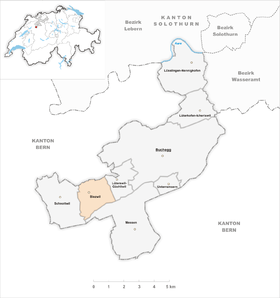
| Location of the municipality | |
  |
|
Biezwil is a municipality in the Bucheggberg district in the canton of Solothurn in Switzerland .
geography
Biezwil lies at 586 m above sea level. M. , 14 km southwest of the canton capital Solothurn (air line). The cluster village extends in a hollow in the catchment area of the Rütibach on the plateau of the Bucheggberg , in the Solothurn Mittelland .
The area of the 4.2 km² municipal area comprises a section of the Molasse heights of the Bucheggberg. The central part of the area is occupied by the Biezwil basin, which merges into a valley to the north and drains to the Oberwiler Mülibach (source stream of the Rütibach). This high trough is bounded in the west by the meadow height Aspi ( 605 m above sea level ), which gradually slopes down towards Schnottwil. The high plateau adjoining Biezwil to the east is flanked in the south by the forest hills Schoren ( 615 m above sea level ), Flüeli (at 673 m above sea level, the highest elevation in Biezwil) and Hubel ( 654 m above sea level ). The southern border runs on the edge above the steep drop to the Limpachtal . In 1997, 7% of the municipal area was accounted for by settlements, 41% for forests and trees and 52% for agriculture.
Various individual farms belong to Biezwil. Neighboring communities of Biezwil are Lüterswil-Gächliwil , Messen and Schnottwil in the canton of Solothurn and Oberwil bei Büren in the canton of Bern .
population
With 305 inhabitants (as of December 31, 2018), Biezwil is one of the small communities in the canton of Solothurn. 98.3% of the residents speak German, 1.4% speak French and 0.4% speak Italian (as of 2000). The population of Biezwil was 579 in 1850, compared with 376 in 1900. Due to strong emigration in the course of the 20th century, the population decreased by a further 40% to 226 people by 1980. Since then, the population has increased significantly again.
economy

Until the second half of the 20th century, Biezwil was a predominantly agricultural village. During the 19th century there was an important yarn boiling plant in Biezwil, which attracted numerous workers from the area who settled in the village.
Even today, arable farming , fruit growing , cattle breeding and forestry have an important place in the income structure of the population. Further jobs are available in local small businesses and in the service sector, including in a timber construction company. In the last few decades the village has also developed into a residential community. Many employed people are therefore commuters who mainly work in the Solothurn and Grenchen regions.
traffic
The community is located off the major thoroughfares on a connecting road from Lohn-Ammannsegg to Schnottwil . Biezwil is connected to the public transport network through a Postbus course , which serves the route from Lohn-Lüterkofen train station to Schnottwil, and the Bucheggberg on- call bus .
history
The municipality of Biezwil was already settled in the Neolithic and Roman times, which has been proven by various small finds. The place was first mentioned in a document in 1255 under the name Beizwile ; The name Bietzwile has been handed down from 1276 . The place name is derived from the Old High German personal name Piezo and means in the courts of the Piezo .
Since the 13th century, Biezwil has been under the rule of Buchegg, which was part of the Landgraviate of Kleinburgund, acquired by Solothurn in 1391 and converted into the Bucheggberg Bailiwick. Until 1798 the high jurisdiction lay with the Bernese district court in Zollikofen , while Solothurn with the court place Schnottwil exercised the lower jurisdiction. After the collapse of the Ancien Régime (1798), Biezwil belonged to the Biberist district during the Helvetic and from 1803 to the Bucheggberg district. In 1893 numerous houses fell victim to a village fire.
Attractions
The center of Biezwil is characterized by many characteristic half-timbered houses in the Bernese style.
coat of arms
- Three yellow ears of wheat in red on a yellow three-mountain
Web links
- Website of the municipality of Biezwil
- Peter Lätt: Biezwil. In: Historical Lexicon of Switzerland .
Individual evidence
- ↑ Permanent and non-permanent resident population by year, canton, district, municipality, population type and gender (permanent resident population). In: bfs. admin.ch . Federal Statistical Office (FSO), August 31, 2019, accessed on December 22, 2019 .
Biezwil |
Buchegg |
Lüsslingen-Nennigkofen |
Lüterkofen-Ichertswil |
Lüterswil-Gächliwil |
Measure |
Schnottwil |
Unterramsern
Former municipalities: Aetigkofen | Aetingen | Balm at trade fairs | Beavers | Brügglen | Brunnenthal | Gächliwil | Gossliwil | Hessigkofen | Ichertswil | Küttigkofen | Kyburg-Buchegg | Lüsslingen | Lueterkofen | Lüterswil | Mühledorf | Nennigkofen | Oberramsern | Tscheppach
Canton of Solothurn | Districts of the Canton of Solothurn | Municipalities of the Canton of Solothurn