
Küttigkofen
| Küttigkofen | ||
|---|---|---|
 |
||
| State : |
|
|
| Canton : |
|
|
| District : | Bucheggberg | |
| Residential municipality : | Buchegg | |
| Postal code : | 4581 | |
| former BFS no. : | 2452 | |
| Coordinates : | 605919 / 222 426 | |
| Height : | 481 m above sea level M. | |
| Area : | 2.17 km² | |
| Residents: | 263 (December 31, 2013) | |
| Population density : | 121 inhabitants per km² | |
| Website: | www.kuettigkofen.ch | |
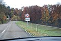
_336.JPG) Küttigkofen |
||
| map | ||
|
||


Until December 31, 2013, Küttigkofen was a municipality in the Bucheggberg district of the canton of Solothurn in Switzerland . On January 1, 2014, Küttigkofen merged with the former municipalities of Aetigkofen , Aetingen , Bibern , Brügglen , Gossliwil , Hessigkofen , Kyburg-Buchegg , Mühledorf and Tscheppach to form the new municipality of Buchegg .
geography
Küttigkofen is 481 m above sea level. M. , six and a half kilometers south-southwest of the canton capital Solothurn ( linear distance ). The street village extends on both sides of the Mühlebach in a wide valley basin in the eastern edge of the Bucheggberg , in the Solothurn Mittelland .
The area of the 2.2 km² large municipal area includes a section of the Molasse heights of the Bucheggberg. The area is crossed from west to east by the Mühlebach, which emerges west of the village from the narrow Mühletal into a valley that is up to 500 m wide. This valley level is divided in the south by the ridge of the Altisberg ( 494 m above sea level ) from the level of the Limpach valley , in the north by the ridge of Oberholz (at 563 m above sea level, the highest elevation in Küttigkofen) and Höchi ( 541 m) above sea level ) separated from the Bibern Valley. In 1997, 9% of the municipal area was accounted for by settlements, 31% for forests and woodlands and 60% for agriculture.
Some individual farms and outlying areas belong to Küttigkofen. Until December 31, 2013, neighboring communities of Küttigkofen were Kyburg-Buchegg , Brügglen and Lüterkofen-Ichertswil in the canton of Solothurn and Bätterkinden in the canton of Bern .
population
With 263 inhabitants (as of December 31, 2013), Küttigkofen was one of the small communities in the canton of Solothurn. 98.8% of the residents speak German, 0.4% French and 0.4% speak English (as of 2000). The population of Küttigkofen was 196 inhabitants in 1850 and 184 inhabitants in 1900. After that, the population fluctuated in the range between 170 and 240 inhabitants. Only since 1990 (211 inhabitants) has an increased population increase been recorded.
economy
Until the second half of the 20th century, Küttigkofen was predominantly an agricultural village. The water power of the Mühlebach was previously used to operate a mill and a sawmill. Even today, arable farming and fruit growing as well as cattle breeding have an important place in the income structure of the population. Further jobs are available in local small businesses and in the service sector, including in a horticultural company. In the last few decades the village has also developed into a residential community. Many employed people are therefore commuters who work mainly in the Solothurn and Bern regions.
traffic
The former community is located away from the larger thoroughfares, but is easily accessible from Biberist and Bätterkinden . Küttigkofen is connected to the public transport network through a PostBus course , which serves the route from Lohn-Lüterkofen train station to Messen , and the Bucheggberg on- call bus .
history
The place was first mentioned in a document in 1316 under the name Obrenchüttenkofen . The names Kuttenkon (1321), Kutenkoven (1327), Chütikon (1344) and Küttikon (1370) appeared later . The place name goes back to the Alemannic personal name Cuto . With the suffix -igkofen it means something like the farms of the people of the Cuto, whereby so-called Aussiedlerhöfe are meant.
Since the Middle Ages, Küttigkofen has been under the rule of Buchegg, which was part of the Landgraviate of Burgundy , acquired by Solothurn in 1391 and converted to the Bucheggberg Bailiwick. Until 1798 the high jurisdiction lay with the Bernese district court Zollikofen , while Solothurn exercised the lower jurisdiction with the place of jurisdiction Aetingen . After the collapse of the Ancien Régime (1798), Küttigkofen belonged to the Biberist district during the Helvetic and from 1803 to the Bucheggberg district.
Attractions
The former mill from 1794 was restored in 1977. Some characteristic farmhouses from the 18th and 19th centuries have been preserved in the town center. Küttigkofen does not have its own church; it belongs to the parish of Aetingen-Mühledorf.

school
Entrance

Old farmhouses in Küttigkofen
_328.JPG)
_323.JPG)
_324.JPG)
coat of arms
Blazon :
- Yellow-green uprooted beech; the blue head of the shield sprinkled with a flock of six white doves in flight to the right
Web links
- Official website of the municipality of Küttigkofen
- Othmar Noser: Küttigkofen. In: Historical Lexicon of Switzerland .
Biezwil |
Buchegg |
Lüsslingen-Nennigkofen |
Lüterkofen-Ichertswil |
Lüterswil-Gächliwil |
Measure |
Schnottwil |
Unterramsern
Former municipalities: Aetigkofen | Aetingen | Balm at trade fairs | Beavers | Brügglen | Brunnenthal | Gächliwil | Gossliwil | Hessigkofen | Ichertswil | Küttigkofen | Kyburg-Buchegg | Lüsslingen | Lueterkofen | Lüterswil | Mühledorf | Nennigkofen | Oberramsern | Tscheppach
Canton of Solothurn | Districts of the Canton of Solothurn | Municipalities of the Canton of Solothurn