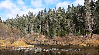
Bikini (river)
|
Bikin Бикин |
||
|
Location of the bikini ( Бикин ) in the Ussuri catchment area |
||
| Data | ||
| Water code | RU : 20030700412118100058636 | |
| location | Primorsky Krai , Khabarovsk Region ( Russia ) | |
| River system | Amur | |
| Drain over | Ussuri → Amur → Tatar Sound | |
| Headwaters |
Sichote-Alin 46 ° 59 ′ 56 " N , 137 ° 0 ′ 51" E |
|
| Source height | 1380 m | |
| muzzle |
Ussuri coordinates: 46 ° 51 '6 " N , 134 ° 2' 23" E 46 ° 51 '6 " N , 134 ° 2' 23" E |
|
| Mouth height | 46 m | |
| Height difference | 1334 m | |
| Bottom slope | 2.4 ‰ | |
| length | 560 km | |
| Catchment area | 22,300 km² | |
| Discharge at the gauge near the mouth |
MQ |
256 m³ / s |
| Left tributaries | Sewa | |
| Right tributaries | Klyuchevaya , Aljan | |
| Small towns | Bikini | |
| Navigable | Lower course | |
The 560 km long Bikin ( Russian Бики́н ) is a right tributary of the Ussuri in the Far East of Russia ( Asia ).
course
The bikini rises at an altitude of 1380 m not far from the main ridge of the Sichote-Alin Mountains, on the northern flank of the Sukhopadnaja mountain ( 1746 m ). In the upper reaches, the river first curves in a northerly, easterly, and then southerly direction before turning in a westerly direction, which it maintains to the mouth. It flows through the mountains, which in a westerly direction increasingly takes on the character of a low mountain range , in a mostly wide, wooded valley in the extreme north of the Primorye region, not far from the border with the Khabarovsk region . In the lower reaches, the river turns to the northwest, reaches the Khabarovsk region south of the town of Bikin, which is named after him, and flows into the Ussuri ( Wusuli Jiang in Chinese ) a little later at the village of Vasilyevka . This tributary of the Amur forms the border with the People's Republic of China here, 214 kilometers above its mouth .
The bikini is up to 200 m wide and over 2 m deep near the mouth. The largest tributaries are Seva (length 139 km) from the left and Klyuchevaya (97 km) and Altschan (170 km) from the right.
Hydrography
The catchment area covers 22,300 km². With an average monthly water flow near the mouth of 256 m³ / s, the Bikin is one of the largest tributaries of the Ussuri. In the summer months, after heavy rain, floods often occur.
The bikini freezes between late November / early December and mid-April.
Flora and fauna
In the extremely sparsely populated area of the upper and middle reaches, the river lowlands are marshy in many places, and the river forms a large number of arms. Peat bogs overgrown with larches are widespread . A number of rare bird species that are classified as endangered or critically endangered on the Red List of Threatened Species nest in this area : Black crane ( Grus monacha ), Red- crowned crane ( Grus japonica ), black- billed stork ( Ciconia boyciana ), scales saw ( Mergus squamatus ) and giant cranes. Fischuhu ( Bubo blakistoni ), as well as the black stork ( Ciconia nigra ) and mandarin duck ( Aix galericulata ) , which are rare in Russia . Siberian tigers live in the catchment area of the Bikin ; the Amur leopard , which used to be found here, is no longer to be found. It is one of the northernmost areas where plants such as ginseng , eleutherococcus and other araliaceae can be found.
In 2018, the UNESCO World Heritage Site of Sichote-Alin was expanded threefold by adding the Bikin Valley in the north.
Infrastructure and economy
The Bikin is navigable in the lower reaches of about 25 kilometers from the town of Bikin; Currently, however, only the three kilometers from the village of Vasilyevka to the mouth are considered an inland waterway.
The area on the upper and middle reaches is very sparsely populated. The only place here is the Krasny Jar settlement, which is inhabited by Udehe , an indigenous people of the area. In the lower reaches of the river between Luchegorsk (a few kilometers to the left of the river, on the small tributary Kontrowod) and the town of Bikin, it reaches a more densely populated area with a number of villages. Here the Trans-Siberian Railway follows the left bank of the river for a good 30 kilometers from Bikin to the Burlit-Wolotschajewski station. At Bikin, the railway line crosses the river with two bridges about five kilometers apart for one track each. The M60 "Ussuri" trunk road from Khabarovsk to Vladivostok also crosses the river here.
Web links
- Marina Makagonowa: Bikin on the website Primpogoda ( "Primorje-weather") product of the Senior Hydro login of the Meteorological Service of Primorye (Russian)
Individual evidence
- ↑ a b Article Bikin (river in the Primorye and Khabarovsk regions) in the Great Soviet Encyclopedia (BSE) , 3rd edition 1969–1978 (Russian)
- ↑ a b Bikin in the State Water Register of the Russian Federation (Russian)
- ↑ whc.unesco.org
- ↑ List of Inland Waterways of the Russian Federation (confirmed by Order No. 1800 of the Government of the Russian Federation of December 19, 2002)


