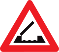
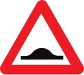
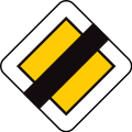
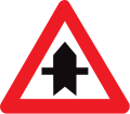
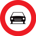
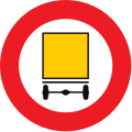
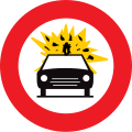
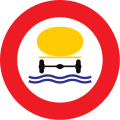
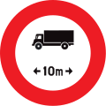
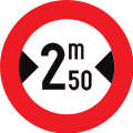
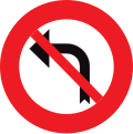
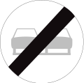
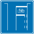
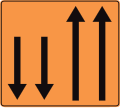
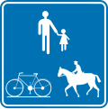
Illustration of the road signs in Belgium
This picture table of the road signs in Belgium contains the currently valid road signs in Belgium.
General danger signs
A1a: curve (left)
A3: slope
A5: slope
A9: Movable bridge
A11: shore
A13: uneven road surface
A14: speed bump
A15a: Additional sign for slippery snow or ice
A17: grit, gravel
A19: Rockfall
A21: pedestrian crossing
A23: children
A25: cyclists
A27: Deer crossing
A29: cattle drive
A31: construction site
A33: traffic lights
A35: flight operations
A37: cross wind
A39: two-way traffic
A41: level crossing with barriers or half barriers
A43: Unrestricted level crossing
A45: level crossing with one track
A47: level crossing with two or more tracks
A49: tram (crosses)
Precedence sign
B1: give way!
B3: Give way! (at 200 m)
B5: Stop! Give way!
B7: Stop! Give way! (at 150 m)
B9: priority road
B13: End of the priority road (250 m away)
B15: right of way
Speed limits, traffic and overtaking bans
C1: No entry
C6: Ban on quads
C7: ban on motorcycles
C13: Prohibition of animal teams
C15: Prohibition for riders
C17: Ban on handcart drivers
C22: Ban on buses and coaches
C45: End of the permitted maximum speed
C48: Tempopilot ban
Prescribed driving directions and special routes
D1a: prescribed direction of travel - here on the left
D5: roundabout
D7: cycle path
D11: sidewalk
D13: bridle path
Park
E1: Restricted no stopping
E9a: parking
E9c: Parking for trucks only
E9d: Parking for buses and coaches only
Notes of all kinds
F1: Entrance sign (expires in 2015)
F1a: entrance sign
F1a: entrance sign (upright)
F4a: Beginning of a Tempo 30 zone
F4b: End of a Tempo 30 zone
F5: motorway
F9: Motorway
F12a: Start of a restricted traffic area
F17: special bus lane
F19: one-way street
F23a: license plate for national roads
F23c: number plate for European roads
F29: Signposts on national roads
F33c: Tourist information (on leisure, culture and other sites)
F34c1: Tourist information (on leisure, cultural and other sites)
F45: dead end
F45b: Permeable cul-de-sac for pedestrians and cyclists
F47: End of the construction site
F49: pedestrian crossing
F50: cycle path (also for mopeds)
F55: first aid
F56: fire extinguisher
F57: River information board
F59: Announcement of a parking space
F60: parking garage
F63: gas station
F75: youth hostel
F87: Speed Bump
F89: Maximum permitted speed on different lanes (in 1500 m)
F91: Maximum permitted speed in different lanes
F95: emergency lane
F103: start of a pedestrian area
F111: Beginning of a bicycle street
Additional characters
Symbols
S1: airport
S3: port
S4: car ferry
S5: industrial area
S10: Police station
S11: fire department
S12: Civil Protection
S13: cemetery
S14: bus station
S15: train station
S16: freight yard
S17: City Hall
S18: Worship building (e.g. church )
S20: Motorail train
S21: Post Office
S30: sports facility (e.g. hall, sports field)
S31: lock
S32: ruin
S34: cultural park, recreation park or amusement park
S35: Important cultural or natural monument that is depicted in a specific way (here as an example: Atomium )
S36: Park
Web links
- List of Belgian road signs (French)
- List of Belgian road signs (Dutch)


