Caraybamba District
| Caraybamba District | |
|---|---|
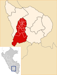
 The Caraybamba district is located in the east of the Aymaraes province (marked in red) |
|
| Basic data | |
| Country | Peru |
| region | Apurímac |
| province | Aymaraes |
| Seat | Caraybamba |
| surface | 230 km² |
| Residents | 989 (2017) |
| density | 4.3 inhabitants per km² |
| founding | December 14, 1956 |
| ISO 3166-2 | PE-APU |
| politics | |
| Alcalde District | Samuel Ysmael Morales Huamaní (2019-2022) |
Coordinates: 14 ° 23 ′ S , 73 ° 10 ′ W
The Caraybamba district is located in the Aymaraes province in the Apurímac region in central southern Peru . The district was established on December 14, 1956. It has an area of 230 km². The 2017 census counted 989 inhabitants. In 1993 the population was 1193, in 2007 it was 1295. The district administration is located in the 3310 m high village of Caraybamba with 512 inhabitants (as of 2017). Caraybamba is located 13 km southeast of the provincial capital Chalhuanca .
Geographical location
The Caraybamba district is located in the Andean highlands in the east of the Aymaraes province. The Río Caraybamba crosses the district in a north-westerly direction, the Río Colcachaca flows along the western district boundary to the north. Both rivers flow into the Río Chalhuanca in the northwest of the district .
The Caraybamba district is bordered to the south-east and to the west by the district Cotaruse , on the north by the district Chalhuanca and on the east by the districts Sabaino and Juan Espinoza Medrano (both in the province Antabamba ).
Web links
- Peru: Region Apurímac (provinces and districts) at www.citypopulation.de
- INEI Perú