Cerovo
| Cerovo | ||
|---|---|---|
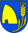
| coat of arms | map | |

|
|
|
| Basic data | ||
| State : | Slovakia | |
| Kraj : | Banskobystrický kraj | |
| Okres : | Krupina | |
| Region : | Poiplie | |
| Area : | 30.28 km² | |
| Residents : | 591 (Dec. 31, 2019) | |
| Population density : | 20 inhabitants per km² | |
| Height : | 468 m nm | |
| Postal code : | 962 52 | |
| Telephone code : | 0 45 | |
| Geographic location : | 48 ° 15 ' N , 19 ° 9' E | |
| License plate : | KA | |
| Kód obce : | 518239 | |
| structure | ||
| Community type : | local community | |
| Structure of the municipality: | 2 parts of the community | |
| Administration (as of November 2018) | ||
| Mayor : | Margita Boďová | |
| Address: | Obecný úrad Cerovo č. 259 96252 Cerovo |
|
| Website: | www.cerovo.dcom.sk | |
| Statistics information on statistics.sk | ||
Cerovo (up to 1927 Slovak also "Čerové"; Hungarian Cseri ) is a municipality in Okres Krupina in Slovakia and is located at an altitude of 468 meters above sea level in Banskobystrický kraj in central Slovakia .
The main source of income for the village is agriculture and forestry. The Hungarian-Slovak border runs about 30 kilometers south of Cerovo. The earliest written mention of Cerovo, back then as Chery , comes from 1275.
Attractions
Above the village are the ruins of the Cerovo castle , the municipality itself is divided into the actual village of Cerovo and the locality of Duchenec .
Web links
Commons : Cerovo - collection of pictures, videos and audio files
