East Falkland
| East Falkland | |
|---|---|
| Gypsy's Cove on East Falkland, in the background the main town Stanley | |
| Waters | South Atlantic |
| Archipelago | Falkland Islands |
| Geographical location | 51 ° 48 ′ S , 58 ° 47 ′ W |
| surface | 6th 605 km² |
| Highest elevation |
Mount Usborne 705 m |
| Residents | 2197 (2001) <1 inh / km² |
| main place | Stanley |
| Falkland Islands map | |
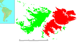
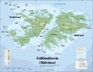
East Falkland ( English East Falkland , Spanish Isla Soledad ) is 6,605 square kilometers, the largest of the South Atlantic located Falkland Islands . The island is separated from its sister island West Falkland by the Falklandsund .
Population and economy
On East Falkland live about 2,100 inhabitants, which is by far the largest population of all Falkland Islands. In addition to the residents, around 2,000 British soldiers are stationed on the island.
The capital Stanley , the largest towns and the main port of the entire archipelago of the Falkland Islands are located in East Falkland. There are also 2 international airports on the island. The main sources of income for the population are: fishing , sheep breeding , public services , tourism and the military .
Important localities
- Stanley
- Port Louis
- Darwin
- Port San Carlos
- San Carlos
- Salvador
- Johnson's Harbor
- Fitzroy
- Mare Harbor
- Goose Green
geography
The highest point on the island is Mount Usborne , which is 705 m high . The island is mostly with Sansevieria -bewachsenen boulder fields, heaths and bogs covered. The climate, fauna and flora correspond to the conditions of the entire archipelago and are subpolar. The Volunteer Point is an important landmark for shipping.
The southern part, the Lafonia peninsula , is essentially separated from the northern part by the Choiseul Sound and only connected to the northern part by a narrow isthmus at Goose Green .
history
The island was uninhabited until the European discovery.
- Discovery by John Davis in 1592 .
- 1690 First landing by John Strong .
- 1764 Louis Antoine de Bougainville founds the first French settlement in East Falkland . ("Port Saint Louis")
- 1769 French sell their possessions to the Spanish .
- 1820 Americans drive out British whalers at the request of Argentina .
- 1831 US warships destroy port facilities. The US declares the islands to be no man's land .
- 1833 The British occupy the entire archipelago .
- 1837 Establishment of a British colonial administration.
- 1843 Port Stanley (now Stanley) is founded.
- 1982 Falklands War
See also
Web links
- www.falklandislands.com (portal in English)
- Official website of the government (English) including a detailed map
- Argentine Map of the Malvines (Spanish)


