
Egenhausen
| coat of arms | Germany map | |
|---|---|---|

|
Coordinates: 48 ° 34 ' N , 8 ° 37' E |
|
| Basic data | ||
| State : | Baden-Württemberg | |
| Administrative region : | Karlsruhe | |
| County : | Calw | |
| Height : | 535 m above sea level NHN | |
| Area : | 10.01 km 2 | |
| Residents: | 2009 (December 31, 2018) | |
| Population density : | 201 inhabitants per km 2 | |
| Postal code : | 72227 | |
| Area code : | 07453 | |
| License plate : | CW | |
| Community key : | 08 2 35 022 | |
| LOCODE : | DE EHU | |
| Address of the municipal administration: |
Hauptstrasse 19 72227 Egenhausen |
|
| Website : | ||
| Mayor : | Sven Holder | |
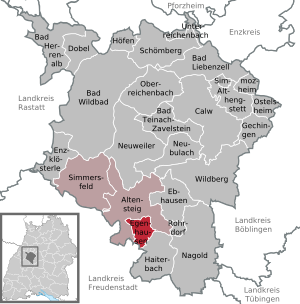
| Location of the municipality of Egenhausen in the district of Calw | ||
  |
||

Egenhausen is a small community and a resort in the Calw district in Baden-Württemberg . It belongs to the Northern Black Forest region .
geography
location
The community lies between the Black Forest and Heckengäu at the foot of the Cape at an altitude of 493 to 627 meters.
Community structure
The village of Egenhausen, the village of Ölmühle and the houses in Kapf belong to the municipality of Egenhausen.
history
In the municipality of is right Bömbachs on the slopes of Egenhauser Kapfes the Outbound village Sindelsteta. Sindelstetten appears for the first time in a document dated to the year 1005, but forged, from the 12th century and around 1100. As early as the middle of the 14th century, the hamlet was only mentioned in various documents as a district of Egenhausen ("both Egenhausen"), but was still mentioned as a district and the residents of Sindelstetten in tax books at the beginning of the 16th century. In the second half of the 16th century, the place was probably finally given up - in favor of Egenhausen. In 1624 Sindelstetten is referred to as a lost hamlet .
Egenhausen itself was first mentioned in a document in 1353. In 1398 the Counts of Hohenberg sold the place to the Margraviate of Baden , before Württemberg bought it up in 1603 and incorporated it into the Altensteig office . For centuries, the place shared the fate of the city of Altensteig , only 3 km away , but was able to maintain its independence through the district and community reforms in Baden-Württemberg. In 1811 Altensteig came to the Nagold District Office , and in 1938 it was finally incorporated into the Calw district.
To the north-west of the village there was probably a chapel from the High Middle Ages just before the Altensteiger “Turmfeld” industrial park on the Egenhauser district . The chapel to the troughs is likely to have been located in the area of the former connecting road from Spielberg to Altensteig shortly before the now-capped confluence with today's relief road to the B28. The Gewann still bears the related name Trögelsbach today , as does the relief road and a nearby road on the Altensteiger district. A map from the beginning of the 17th century still shows the foundation walls of the chapel.
Religions
- The Evangelical Church Congregation Egenhausen has been part of the Evangelical Church Community of Spielberg-Egenhausen and the Calw-Nagold Church District in the Evangelical Church in Württemberg since 2014, together with the Spielberg parish
- New Apostolic Church Egenhausen
- Liebenzell Community Egenhausen
politics
Municipal council
The local council in Egenhausen has ten members. In the local elections on May 26, 2019 in Egenhausen, the majority vote system was used. This means that only one list was drawn up and the applicants with the highest number of votes were selected. The municipal council consists of the voluntary councilors and the mayor as chairman with voting rights. The turnout was 68.49% (2014: 60.24%).
mayor
In November 2014, Sven Holder was elected the new mayor with 80.6% of the vote. Predecessor Frank Buob did not take up office after 24 years in office.
coat of arms
The coat of arms shows a silver thistle with a silver flower, a rooted golden stem and six golden leaves on a red background.
Sons and daughters of the church
- Johannes Rath (1876–1945), politician (DVP), member of the state parliament
literature
- Burkhart Oertel : Ortssippenbuch Egenhausen, municipality in the Calw district in Württemberg, 1595–1952. Neubiberg: Self-published by the author 2008 (= Württembergische Ortssippenbücher 88)
Web links
- Internet presence of the municipality of Egenhausen
- Worth seeing in the church district Nagold: Egenhausen
Individual evidence
- ↑ State Statistical Office Baden-Württemberg - Population by nationality and gender on December 31, 2018 (CSV file) ( help on this ).
- ^ The state of Baden-Württemberg. Official description by district and municipality. Volume V: Karlsruhe District Kohlhammer, Stuttgart 1976, ISBN 3-17-002542-2 . Pp. 467-520
- ↑ Dietmar Waidelich, The disappeared Sindelstetten - the "on-site" of Egenhausen? , in: Dietmar Waidelich, local history from Altensteig and Simmersfeld . Tübingen 1985, p. 15.
- ↑ Waidelich, Heimatgeschichtliches , pp. 17–18.
- ↑ Dietmar Waidelich, The Chapel of the Troughs and the Laurentius Chapel of Sindelstetten . In: Spielberg through the ages . Horb am Necker, 1998. p. 58.
- ↑ Hans Stahl, Early representation in the map image. Spielberg and its surroundings . In: Spielberg through the ages . Horb am Neckar 1998. Figure 26 p. 63.
- ^ Website of the entire parish of Spielberg-Egenhausen

Altensteig | Althengstett | Bad Herrenalb | Bad Liebenzell | Bad Teinach-Zavelstein | Bad Wildbad | Calw | Dobel | Ebhausen | Egenhausen | Enzklösterle | Gechingen | Haiterbach | Höfen an der Enz | Nagold | Neubulach | Neuweiler | Oberreichenbach | Ostelsheim | Rohrdorf | Schömberg | Simmersfeld | Simmozheim | Unterreichenbach | Wildberg