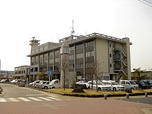
Ena (Gifu)
| Ena-shi 恵 那 市 |
||
|---|---|---|
|
|
||
| Geographical location in Japan | ||
| Region : | Chūbu | |
| Prefecture : | Gifu | |
| Coordinates : | 35 ° 27 ' N , 137 ° 25' E | |
| Basic data | ||
| Surface: | 504.19 km² | |
| Residents : | 48,777 (June 1, 2019) |
|
| Population density : | 97 inhabitants per km² | |
| Community key : | 21210-5 | |
| Symbols | ||
| Flag / coat of arms: | ||
| Tree : | Acer pycnanthum | |
| Flower : | Lilium japonicum | |
| town hall | ||
| Address : |
Ena City Hall 1 - 1 - 1 , Shōge, Nagashima-chō Ena -shi Gifu 509-7292 |
|
| Website URL: | http://www.city.ena.lg.jp/ | |
| Location Enas in Gifu Prefecture | ||
Ena ( Japanese 恵 那 市 , - shi ) is a city in the Japanese prefecture of Gifu .
geography
Ena is west of Nakatsugawa .
The Kiso River flows through the city from northeast to northwest.
history
The city of Ena was founded on April 1, 1954 . On October 25, 2004 the Chō Akechi ( 明智 町 , -chō ), Iwamura ( 岩村 町 , -chō ), Kamiyahagi ( 上 矢 作 町 , -chō ) and Yamaoka ( 山岡 町 , -chō ), as well as the Mura Kushihara ( 串 原 村 , -mura ) from the Ena-gun incorporated into districts.
traffic
Ena can be reached by road via the Chūō Highway , National Road 19 (to Nagoya and Nagano ) and National Roads 257, 363, 418 and Nakasendō .
The train connection is guaranteed by the JR . The city lies on the main Chūō line to Tokyo and Nagoya .
Neighboring cities and communities
The neighboring communities are Nakatsugawa , Mizunami and Toyota .
Web links
- Hiroshige Museum (English)


