
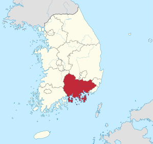
Gyeongsangnam-do
Coordinates: 35 ° 18 ' N , 128 ° 18' E
| Gyeongsangnam-do | |
|---|---|
| Hangul : | 경상남도 |
| Hanja : | 慶 尙 南 道 |
| Revised Romanization : | Gyeongsangnam-do |
| McCune-Reischauer : | Kyŏngsang-namdo |
| Basic data | |
| Surface: | 10,518 km² |
| Residents: | 3,334,524 (as of 2015) |
| Population density : | 317 inhabitants per km² |
| Structure : | 10 cities ( Si ) 10 counties ( Gun ) |
| Administrative headquarters : | Changwon |
  |
|
Gyeongsangnam-do (South Gyeongsang) is a province in the southeast of South Korea . It borders Gyeongsangbuk-do to the north and the Sea of Japan to the east . The province is bounded in the south by the Korea Road , in the west by Jeollabuk-do and Jeollanam-do . The capital of the province is Changwon . The province had 3.3 million inhabitants in 2015.
geography
Most of the largely flatland province is irrigated by the Naktong River and its tributaries. The Gimhae River Delta is an important granary in South Korea . The highest point in the western mountain region is the Jirisan at 1915 meters .
There is a mildly warm climate with average temperatures between 2 ° C in winter and 25 ° C in August. The average annual rainfall is 1500 mm.
economy

Agricultural products in Gyeongsangnam-do include rice , beans , potatoes, and barley . The province is known for the production of cotton . Sesame seeds and fruits are grown along the south coast . Marine products and fishing are also important.
Light industry can be found in the cities of Jinju , Tongyeong, and Samchonpo . The region's significant heavy industry (shipbuilding, aerospace, automotive, mechanical engineering and electrical engineering) can be found primarily in the cities of Ulsan , Masan and Jinhae on the south coast. A free trade zone was set up around Busan and Jinhae, which are independently administered like Ulsan . Another free trade zone is located near Masan. Hadong County and neighboring areas in Jeollanam-do Province are part of the Gwangyang Bay development project.
tourism
The Haein Temple , built in 802 , attracts v. a. domestic tourists. The temple is located in the Gaya-san National Park near the border with Gyeongsangbuk-do .
Administrative division
Gyeongsangnam-do is divided into eight cities and ten counties.
| map | # | Surname | Hangeul | Hanja | Population (2010) |
|---|---|---|---|---|---|

|
|||||
| - Cities - | |||||
| 1 | Changwon- si | 창원 | 昌 原 | 1,058,021 | |
| 2 | Gimhae -si | 김해 | 金海 | 494.510 | |
| 3 | Jinju -si | 진주 | 晉州 | 337,896 | |
| 4th | Yangsan -si | 양산 | 梁山 | 252.507 | |
| 5 | Geoje -si | 거제 | 巨 濟 | 231.271 | |
| 6th | Tongyeong -si | 통영 | 統 營 | 129,366 | |
| 7th | Thingon -si | 사천 | 泗 川 | 107,524 | |
| 8th | Miryang -si | 밀양 | 密 陽 | 99.128 | |
| - Counties - | |||||
| 9 | Haman gun | 함안군 | 咸安 郡 | 60,794 | |
| 10 | Geochang -gun | 거창군 | 居 昌 郡 | 57,323 | |
| 11 | Changnyeong gun | 창녕군 | 昌寧 郡 | 55.189 | |
| 12 | Goseong gun | 고성군 | 固 城 郡 | 51,703 | |
| 13 | Namhae -gun | 남해군 | 南海 郡 | 43,919 | |
| 14th | Hapcheon gun | 합천군 | 陜 川 郡 | 43,639 | |
| 15th | Hadong gun | 하동군 | 河東 郡 | 41,862 | |
| 16 | Hamyang -gun | 함양군 | 咸陽 郡 | 38.002 | |
| 17th | Sancheong gun | 산청군 | 山 淸 郡 | 31,898 | |
| 18th | Uiryeong gun | 의령군 | 宜 寧 郡 | 25.602 | |
Web links
- Province website (English, other languages selectable)
Special City:
Seoul
Special Autonomous City:
Sejong
Major Cities:
Busan |
Daegu |
Daejeon |
Incheon |
Gwangju |
Ulsan
provinces:
Chungcheongbuk-do |
Chungcheongnam-do |
Gangwon-do |
Gyeonggi-do |
Gyeongsangbuk-do |
Gyeongsangnam-do |
Jeollabuk-do |
Jeollanam-do
Special Autonomous Province:
Jeju-do