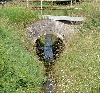
Hainbach (Woogbach)
|
Hainbach am Unterlauf also Wooggraben and Krebsbächel |
||
|
Hainbach within Walsheim |
||
| Data | ||
| Water code | DE : 2378964 | |
| location |
Dahn-Annweiler-Felsenland
|
|
| River system | Rhine | |
| Drain over | Woogbach → Speyerbach → Rhine → North Sea | |
| source | on the southeast flank of the Roßberg in the Haardt 49 ° 15 '31 " N , 8 ° 2' 23" E |
|
| Source height | 423 m above sea level NHN | |
| muzzle | on the north-eastern outskirts of Dudenhofen from the right into the Woogbach , a left branch of the Speyerbach Coordinates: 49 ° 19 '6 " N , 8 ° 23' 36" E 49 ° 19 '6 " N , 8 ° 23' 36" E |
|
| Mouth height | approx. 101 m above sea level NHN | |
| Height difference | approx. 322 m | |
| Bottom slope | approx. 9.6 ‰ | |
| length | 33.6 km | |
| Catchment area | 53.9 km² | |
| Right tributaries | Ranzgraben , Schleidgraben | |
| Communities | s. History section | |
The Hainbach , historically also Heimbach (see section history ), on the lower reaches also Wooggraben and Krebsbächel , is a 33 km long stream in Rhineland-Palatinate and a right tributary of the Woogbach ; this separates in Hanhofen above the Hainbach estuary to the left from the Speyerbach and flows back in Speyer .
In the Middle Ages there was a fortified cloister courtyard on the middle course of the Hainbach, the Heimbach Commandery , which served a Catholic religious order as the regional administrative center.
geography
course
The main source of the Hainbach rises at a height of 423 m on the southeast flank of the 637 m high Roßberg in the Haardt , the eastern edge of the Palatinate Forest , two secondary sources on the left are 100 m away. The stream then flows around the Teufelsberg ( 597.6 m ) first to the west and then to the south. After 4 km it leaves the low mountain range between Frankweiler and Gleisweiler (here it feeds the unique forest shower ), passes the narrow hill zone of the Grabenbruch , where it crosses under the German Wine Route , and enters the Rhine plain . Initially in an easterly direction, later in a north-easterly direction, the Hainbach flows through Böchingen , Walsheim , Knöringen , Essingen and, on the southern edge of the Gäus, the community of Hochstadt , the districts of Zeiskam and Lustadt and the community of Weingarten . In Schwegenheim it turns north, from Harthausen it is called Wooggraben and changes its direction to the east. On the southwestern outskirts of Dudenhofen he crosses the run in embankment Speyerbach in Dole , according to the previously responsible for maintaining the passage twelve Erbbeständern Zwölfmanndole was called. It passes the place as Krebsbächel in a mostly canalised bed and finally flows into the Woogbach from the right on the northeastern edge of the village directly north of the federal highway 39 at a height of about 101 m . This is also called Nonnenbach and is a left branch of the Speyerbach, which reunites with its right main arm shortly before the mouth of the Speyerbach.
Tributaries
The Hainbach has two right tributaries, both of which come from the hill zone of the Grabenbruch. The approximately 2.5 km long Ranzgraben has its source south of Böchingen and its mouth above Walsheim. The approximately 4 km long Schleidgraben rises east of Landau-Nußdorf and flows into the southern edge of Essingen.
history

In 1185 Emperor Friedrich Barbarossa donated extensive land to the Order of St. John in the Zeiskam area north of the village on the Hainbach. The order, whose Catholic successor organization was called the Order of Malta after the Reformation , founded its regional administrative center there, the Heimbach Commandery , and named it after the Bach, whose name was then spelled with m .
In 1525, during the Peasants' War , the complex including the church was sacked and permanently destroyed by rebellious farmers from the Nussdorf heap . In 2011, the municipality of Zeiskam opened a memorial to the sparse remains, which consists of a Gothic pointed arch made of sandstone.
Individual evidence
- ↑ a b c d e GeoExplorer of the Rhineland-Palatinate Water Management Authority ( information )
- ↑ a b Wooggraben is the official name of the entire Hainbach in the RP water management administration, while the Woogbach is managed there as the Nonnenbach .
- ^ Philipp Fauth : Hydrographisches vom Speyerbache . In: Palatinate local history . tape I . Verlag des Historisches Museum der Pfalz, Speyer 1905, p. 10-11 .

