Hammerbichl
| Hammerbichl pass | |||
|---|---|---|---|
|
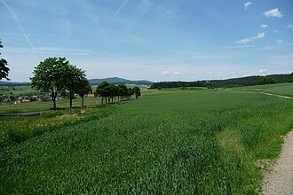
View northwest over the Windflach at Hammerbichl and Schenkenfelden, in the back the Sternstein |
|||
| Compass direction | west | east | |
| Pass height | 786 m above sea level A. | ||
| district | Urfahr environment | Free City | |
| Watershed | Stegmühlbach → Vltava → Elbe → North Sea | Small Gusen → Gusen → Danube → Black Sea | |
| Valley locations | Schenkenfelden | Hirschbach i.Mkr. | |
| expansion | Tischberger Strasse (L1499) | ||
| Mountains | Leonfeldner highlands | ||
| profile | |||
| Ø pitch | 3.5% (52 m / 1,500 km) | 5.8% (146 m / 2,500 km) | |
| Map (Upper Austria) | |||
|
|
|||
| Coordinates | 48 ° 30 ′ 1 ″ N , 14 ° 23 ′ 1 ″ E | ||
Hammerbichl is a locality in the Mühlviertel of Upper Austria , which belongs to the market town of Schenkenfelden in the Urfahr-Umgebung district, as is a pass of the European main watershed .
geography
Hammerbichl is located about 25 kilometers north of the city center of Linz , 8½ kilometers west of Freistadt and 7 kilometers southeast of Bad Leonfelden , a few kilometers south of the Czech border, between Markt Schenkenfelden and Tischberg .
The location, a single homestead, is in the Leonfeldner highlands at 780 m above sea level. A. Height. Here is also the watershed between Stegmühlbach and Kleiner Gusen , the source of which is located directly southeast below. The former flows northward into the Moldau (Vltava) , which belongs to the Elbe catchment area , the Gusen runs southward in the Danube catchment area . Thus, the water flows west to the North Sea , east to the Black Sea . The top of the pass is already in the municipality of Hirschbach in the Mühlkreis , which means that the location also represents the Urfahr-Umgebung / Freistadt district border . To the south, near Lichtenstein , lies the southernmost point of the central watershed in the Bohemian Massif.
The L1499 Tischberger Straße runs over the hill (from the L1489 in Schenkenfelden via Tischberg to the L1498 in Hirschbach im Mühlkreis ).
|
||||||||||||||||||||||||||
| Calvary | Oberdorf (district of Hirschbach i.Mkr. , District of Freistadt ) | Tischberg (district of Hirschbach i.Mkr. , District of Freistadt ) |
| Schenkenfelden |

|
Oberhirschgraben (district of Hirschbach i.Mkr. , District of Freistadt ) |
| Lichtenstein | Vorwald (Gem. Hirschbach i.Mkr. , District Freistadt ) |
Infrastructure and sights
Off the road (north) is a stone pillar to the European watershed ( 790 m above sea level ).
The area is a popular hiking area, the path from Schenkenfeldener Kalvarienberg also runs southwards.
proof
- 41622 - Schenkenfelden. Community data, Statistics Austria .
- ↑ a b Hammerbichl (Tischberg) , entry in passknacker.com
- ↑ Hammerbichl , entry in motorradland.ch
- ^ Johann Lenzenweger, Wolfgang Wittmann: Mühlviertel: 50 valley and mountain hikes between the Danube and the Bohemian Forest . Bergverlag Rother, 2006, No. 28, p. 110 ff.


