High franc
| Federal states : |
|
| Area : | 1,556.98 |
| Residents : | 215,000 |
| Population density : | 138 inhabitants / square kilometer |
| Structure: | 1 district-free city , 2 districts |
High Franconia - also known as Northeast Upper Franconia - includes the Hofer Land with the independent city of Hof (Saale) , the district of Hof and the district of Wunsiedel in the Fichtel Mountains . Hochfranken emerged from the Upper Franconian East planning region in the Bavarian administrative district of Upper Franconia .
General
The term Hochfranken does not designate an administrative area or a geo-historical region, but is a new word recently created to support an initiative for location marketing and regional management. The previously common designation Northeast Upper Franconia is to be successively replaced by High Franconia. One example is the Sparkasse Hochfranken , whose business areas are the city of Hof and the districts of Hof and Wunsiedel in the Fichtelgebirge. From 2019, however, the city and district of Hof have founded their own image campaign under the name Hofer Land. It has been criticized many times that this could result in competition with high francs.
This initiative, with the aim of using the central location of the region in Europe as a bridgehead to eastern Central Europe , is intended to alleviate the major structural problems ( emigration and aging ) caused by the peripheral location at the Iron Curtain .
Geography and climate
Northeast Upper Franconia is a geographical unit, delimited in the west and south-west to the rest of Upper Franconia, in the north to Thuringia, in the north-east to Saxony, in the south-east to the Upper Palatinate and in the east to the Czech Egerland. The northern sub-region is also known as Hofer Land , the southern in the Fichtelgebirge as Sechsämterland .
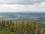
Characterized by its high altitude with the Fichtelgebirge , a low mountain range up to 1051 meters high in northeast Bavaria and the Franconian Forest , both of which are connected by the Münchberg plateau , and the Selb-Wunsiedler plateau in the east, Upper Franconia is on average significantly higher than the rest of Upper Franconia and the western part of Saxony. The valley of the Saxon Saale when crossing to Thuringia is the lowest point in Upper Franconia .
Upper Franconia has a strongly continentally influenced climate with cold winters and a short, hot summer period. The continentally influenced climate results from the Franconian Forest, which seals off to the west and influences the otherwise common west wind drift. The central Fichtelgebirge has a horseshoe shape open to the east with continental weather conditions in summer and in winter favored by the boehm wind . In winter, the lowest temperatures in Germany are often recorded in the Upper Franconia region, along with the eastern parts of Bavaria and Saxony. The Bavarian part of the area swept by the Böhmwind is popularly known as "Bavarian Siberia".
population
Metropolitan areas
There are several metropolitan areas in the region . The largest is Hof with the municipalities of Oberkotzau and Döhlau . Around 57,000 people live in the metropolitan area. In addition, there is the Marktredwitz - Wunsiedel - Waldershof agglomeration in the south of the Fichtelgebirge . It has around 30,000 inhabitants.
traffic
High Franconia can be easily reached by car and train. In the west, Hochfranken is opened up in a north-south direction by the A 9, in the north by the A 72 from Chemnitz and in the east by the A 93 from Regensburg .
Street
Berlin and Munich can each be reached in three hours with the connection to the A 9 . There is also a connection to the A 72 with the connection to Chemnitz / Dresden and the beginning of the A 93 in the direction of Regensburg with a connection to Prague.
The Hochfranken motorway triangle at the confluence of the A 93 and A 72 in the Trogen municipality northeast of Hof bears the name of the region.
rail
Hochfranken is located on the central railway lines of the DB . Trains run regularly from Hof Hauptbahnhof to Dresden, Leipzig, Nuremberg, Munich and Bamberg. With the connection to Leipzig and Dresden you can continue your journey to Berlin and with the connection to Bamberg you can continue to Frankfurt am Main.
air
Up until the beginning of 2012, a plane ran twice a day from the Hof-Plauen airfield to Frankfurt am Main and back. Due to the insolvency of the previous operator Cirrus Airlines, there are currently no more scheduled flights. Currently there are only charter and business flights from the airport.
Long-distance bus
Flixbus has stops in Hof and Marktredwitz. The stop in Selb was canceled without replacement in 2019 due to low demand and to save time.
economy
Upper Franconia has a relatively high industrial density ( ceramics , plastics , textiles , mechanical engineering based on medieval mining ). In addition, there is a strong historical link with the Saxon industrial area and the Egerland ( Euregio Egrensis ).
A major structural change has taken place in the last 20 years. In addition to the increasing loss of the traditionally dominant porcelain and textile industry, from the point of view of business associations, logistics, service and more innovative processing companies form the backbone of the Upper Franconian economy.
Selected locations
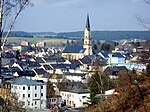
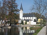
Upper Franconia covers a total area of around 1,550 square kilometers with almost 215,000 inhabitants in 45 municipalities. The most populous cities are Hof followed by Marktredwitz, Selb, Münchberg and Wunsiedel in the Fichtel Mountains. The following eleven municipalities have more than 5,000 inhabitants:
| City and coat of arms |
Status license plate location |
Residents | Striking picture |
|---|---|---|---|
| court |
|
46,286 (December 31, 2010) |

|
| Marktredwitz |
|
17,253 (December 31, 2010) |

|
| Same |
|
15,894 (December 31, 2010) |

|
| Münchberg |
|
10,882 (December 31, 2010) |

|
| Wunsiedel | 9,515 (December 31, 2010) |

|
|
| Rehau |
|
9,427 (December 31, 2010) |

|
| Helmbrechts |
|
8,873 (December 31, 2010) |

|
| Naila |
|
8,071 (December 31, 2010) |

|
| Schwarzenbach on the Saale |
|
7,290 (December 31, 2010) |

|
| Arzberg | 5,566 (December 31, 2010) |

|
|
| Oberkotzau |
|
5,536 (December 31, 2010) |

|
Web links
Individual evidence
- ↑ Statistics atlas Bavaria. (No longer available online.) In: www.statistik.bayern.de. Archived from the original on March 4, 2016 ; accessed on January 14, 2017 . Info: The archive link was inserted automatically and has not yet been checked. Please check the original and archive link according to the instructions and then remove this notice.
- ↑ Katja Auer, Olaf Przybilla: Hof-Plauen Airport before the end: Crashed . In: sueddeutsche.de . ISSN 0174-4917 ( sueddeutsche.de [accessed January 15, 2017]).
- ↑ Statistics atlas Bavaria. (No longer available online.) In: www.statistik.bayern.de. Archived from the original on March 4, 2016 ; accessed on January 14, 2017 . Info: The archive link was inserted automatically and has not yet been checked. Please check the original and archive link according to the instructions and then remove this notice.


