Inveraray
|
Inveraray Scottish Gaelic Inbhir Aora |
||
|---|---|---|
| Inveraray main street | ||
| Coordinates | 56 ° 14 ′ N , 5 ° 4 ′ W | |
|
|
||
| Residents | 596 2011 census | |
| administration | ||
| Post town | INVERARAY | |
| ZIP code section | PA32 | |
| prefix | 01499 | |
| Part of the country | Scotland | |
| Council area | Argyll and Bute | |
| British Parliament | Argyll and Bute | |
| Scottish Parliament | Argyll and Bute | |
| Website: http://www.inveraray-argyll.com/ | ||
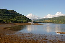
Inveraray ( Gaelic : Inbhir Aora ) is a village in the Scottish Council Area Argyll and Bute . It is located on the banks of the Loch Fyne estuary at the entrance to the Holy Loch Bay , about 32 kilometers northwest of Helensburgh and southeast of Oban . The 1991 census recorded 512 inhabitants in Inveraray. This means that the number of inhabitants has remained almost unchanged since 1951. By 2011 the population had risen to 596.
history
The original Inveraray was a little north of today's town. In the course of the construction of Inveraray Castle by Archibald Campbell , the 3rd Duke of Argyll in the second half of the 18th century, today's Inveraray was built as a planned town from 1743. The buildings of the old settlement near the castle were demolished between 1758 and 1776. As architects, William Adam , John Adam and Robert Mylne were mainly responsible for planning the new buildings.
traffic
Inveraray is located directly on the A83 , which connects the Kintyre peninsula with the Central Belt . The A819 leads north and ends on the A85 between Oban and Crianlarich near Dalmally . A connection to the railway network does not exist and was also not available in the past. A ferry from Glasgow used the jetty regularly until the 20th century . However, operations were then discontinued.
Attractions
Inveraray is a tourist center in the region. Most of the inner area of Inveraray is listed. 23 structures or ensembles of buildings are listed in the highest Scottish monument category A alone. There are also ten other Category A structures on the Inveraray Castle grounds outside the village. The buildings in the town center are built in the Georgian style and are often plastered and whitewashed with Harl . The historical museum village Auchindrain is located a few kilometers south of the village .
Category A structures within Inveraray
- Inveraray old rectory
- Arkland
- Black's Land
- Chamberlain's House
- Duke's Tower
- Factory land
- Fern Point
- Ferry Land
- Inveraray prison wall
- George Hotel
- Inveraray Courthouse
- Gillies' house
- Inveraray Parish Church
- Ivy House
- Mackenzie's land
- Inveraray market cross
- Morrison's Land
- Relief land
- Temperance Hotel
- The Great Inn
- Inveraray Archway
- Town House
- Ornamental wall by Inveraray
Category A building on the grounds of Inveraray Castle
- Aray Bridge
- Carloonan Doocot
- Dubh Loch Bridge
- Garden Bridge
- Garron Bridge
- Garron Lodge
- Inveraray Castle
- Maam steading
- Watchtower of Inveraray Castle
- Ornamental wall of the Garron Lodge
Individual evidence
- ^ List of Gaelic expressions
- ↑ a b c d Inveraray. Argyll and Bute. In: David Munro, Bruce Gittings: Scotland. An Encyclopedia of Places & Landscapes. Collins et al., Glasgow 2006, ISBN 0-00-472466-6 .
- ↑ entry. In: Gazetteer for Scotland. 2011.
- ↑ 2011 census
- ↑ Inveraray. In: Francis H. Groome: Ordnance Gazetteer of Scotland: A Survey of Scottish Topography, Statistical, Biographical and Historical. Volume 4: (Har - Lib). Thomas C. Jack, Grange Publishing Works, Edinburgh et al. 1885, pp. 293-295 .


