Irdyn
| Irdyn | ||
| Ірдинь | ||

|
|
|
| Basic data | ||
|---|---|---|
| Oblast : | Cherkasy Oblast | |
| Rajon : | Cherkasy Raion | |
| Height : | 93 m | |
| Area : | 1.851 km² | |
| Residents : | 846 (2014) | |
| Population density : | 457 inhabitants per km² | |
| Postcodes : | 19630 | |
| Area code : | +380 472 | |
| Geographic location : | 49 ° 22 ' N , 31 ° 41' E | |
| KOATUU : | 7124955300 | |
| Administrative structure : | 1 urban-type settlement | |
| Address: | вул. Леніна 2 19630 смт. Ірдинь |
|
| Statistical information | ||
|
|
||
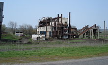
Irdyn ( Ukrainian Ірдинь ; Russian Ирдынь ) is an urban-type settlement in the Ukrainian Cherkassy Oblast with about 850 inhabitants (2014).
The village, founded in 1930 as a settlement for the workers of the newly created peat factory, is located in the west of Cherkasy Rajon on the T-24-08 territorial road and in 1941 received the status of an urban-type settlement. The place is on the edge of the Irdyner Swamp (Ірдинське болото), a 7375 hectare swamp area.
Until August 26, 2015 Irdyn was part of the settlement council of the same name, since then the village has been part of the newly created village community (сільська громада) Bilosirja .
Individual evidence
- ↑ Demographics of Ukrainian cities on pop-stat.mashke.org, accessed on September 9, 2014
- ↑ Article Irdyn in the Great Soviet Encyclopedia (BSE) , 3rd edition 1969–1978 (Russian)


