Katori (Chiba)
| Katori-shi 香 取 市 |
||
|---|---|---|
| Geographical location in Japan | ||
|
|
||
| Region : | Kanto | |
| Prefecture : | Chiba | |
| Coordinates : | 35 ° 54 ' N , 140 ° 30' E | |
| Basic data | ||
| Surface: | 262.31 km² | |
| Residents : | 73.110 (October 1, 2019) |
|
| Population density : | 279 inhabitants per km² | |
| Community key : | 12236-0 | |
| Symbols | ||
| Flag / coat of arms: | ||
| Tree : | cherry | |
| Flower : | Iris ( Japanese Swamp Iris , Iris laevigata ) | |
| Bird : | Warbler ( Drosselrohrsänger , brewing warbler ) | |
| town hall | ||
| Address : |
Katori City Hall Ro-2127 Sawara Katori -shi Chiba 287-8501 |
|
| Website URL: | http://www.city.katori.lg.jp/ | |
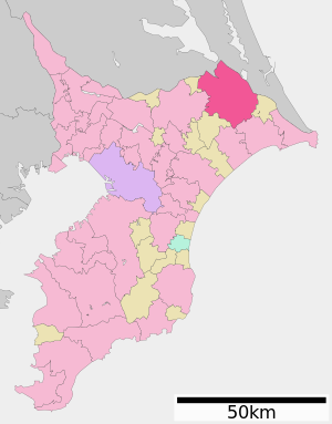
| Location Katoris in Chiba Prefecture | ||
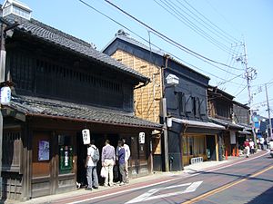
Katori ( Japanese 香 取 市 , -shi ) is a city in Japan in Chiba Prefecture .
geography
Katori is east of Tokyo and Narita , northeast of Chiba and west of Chōshi . The clay flows the city from northwest to northeast.
Attractions
One of the sights is the Shinto shrine Katori-jingū .
traffic
- Street:
- Higashikantō Highway to Tōkyō or Kashima
- National Road 125 to Kumagaya
- Train:
sons and daughters of the town
- Iizasa Ienao (1387–1488) ( Goshi ( Landsamurai ))
- Takao Sakurai (1941-2012), boxer
Neighboring cities and communities
Web link
Commons : Katori - collection of images, videos and audio files


