Kleinmühlingen
|
Kleinmühlingen
Bördeland municipality
|
||
|---|---|---|
| Coordinates: 51 ° 56 ′ 53 ″ N , 11 ° 44 ′ 44 ″ E | ||
| Area : | 10.49 km² | |
| Residents : | 640 (December 31, 2006) | |
| Population density : | 61 inhabitants / km² | |
| Incorporation : | December 28, 2007 | |
|
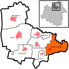
Location in Saxony-Anhalt |
||
Kleinmühlingen (until 1997 Klein Mühlingen ) is a district of the municipality of Bördeland in the Salzlandkreis in Saxony-Anhalt . Until December 28, 2007 Kleinmühlingen was an independent municipality in which 640 inhabitants lived on 10.49 km² (as of December 31, 2006).
geography
The municipality of Kleinmühlingen is located in the southeast of the Magdeburg Börde near the cities of Calbe (Saale) and Schönebeck (Elbe) and is surrounded by extremely productive soil. The vineyard (111 m above sea level), west of the municipality, towers over the undulating landscape by over 30 meters. To the southeast lies the smaller Kirchberg (88 m. Above sea level). Kleinmühlingen is approx. 25 km from Magdeburg .
history
middle Ages
The origin of Kleinmühlingen lies in the Slavic village of Gorenitz. It emerged when Wendish Slavs moved into the land between the Elbe and Bode, known as “ Northern Thuringia ” around AD 600, displacing the Germanic population previously resident there. Barrows on the Mühlberg prove that the area was already settled in the 1st millennium BC. In the course of Christianization by Charlemagne at the end of the 8th century, the northern Thuringia was repopulated by settlers of Germanic origin. In the 9th century it came under the influence of the Halberstadt diocese , and in 803 Charlemagne founded the county of Mühlingen . The center of the county was the place of the same name Mühlingen, later called " Großmühlingen ".
In the 13th century, Gorenitz was largely destroyed in the course of the armed conflicts between the Guelphs and the Staufers . From 1265 young farmers from Germanic Mühlingen settled there. As a sign of Germanization, Gorenitz was called "Klein Mühlingen" from 1271 onwards. The old Slavic village center was expanded to the west. The place was enlarged again between 1368 and 1371, when farmers moved in from surrounding villages that had become desolate.
Under Emperor Otto I , the county of Mühlingen was the fief of Margrave Gero . From 1034 the fiefdom passed to the Ascanians under Albrecht the Bear . Other feudal lords were the Counts of Dornburg (around 1130) and the Counts of Arnstein (from 1240). With the latter, a large part of the county came under the rule of the Archdiocese of Magdeburg . After the Arnsteiners died out in 1659, the county, now consisting only of Groß- and Klein-Mühlingen, fell back to the Askanians ( Anhalt ). When Prince Karl Wilhelm von Anhalt-Zerbst acquired the two Mühlingen in 1669 , the former county had already been converted into the "Mühlingen Office".
16th to 19th century
In 1550 Klein Mühlingen received its first school teacher. Between 1565 and 1626 the population of the village was decimated by about a third due to the plague epidemics . The Thirty Years War also hit the place hard. In January 1632 the village was sacked and devastated by Pappenheim's imperial troops . On April 17, 1632, Swedish soldiers caused a conflagration that destroyed twelve farms. After that, Klein Mühlingen lay desolate before the first of the peasants who had fled returned in 1645. For the year 1654 the number of farms was again given as 22. When after 1700 the craftsmen were given freedom of establishment, they settled in Klein Mühlingen mainly in the northern part of the town, which was expanded further.
On October 18, 1806, Klein Mühlingen was again the victim of looting by Napoleon's troops on their way to Berlin. Subsequently, food deliveries to the French army camp near Magdeburg were requested. In the course of the wars of liberation , the defeated French and after them the allied troops of Russia and Prussia made quarters in Klein Mühlingen, where the French again looted. In the second third of the 19th century, industrialization brought significant changes for Klein Mühlingen. Prince Alexander Carl von Anhalt-Bernburg prevented the Magdeburg – Halle railway line from going through the Mühlingen office, but the train station in Gnadau, six kilometers away, had a positive effect on Klein Mühlingen's economy from 1840 onwards. In 1849, near Klein Mühlingen, the mining of lignite began, so that new jobs were created. The expansion of the Chaussee from Schönebeck (Elbe) via Klein Mühlingen to Calbe (Saale) in 1870/71 brought about a further improvement in transport connections . In 1863 Klein Mühlingen came under the rule of the Duchy of Anhalt and was incorporated into the newly formed Bernburg district. Together with Großmühlingen it formed a Anhalt enclave in the Prussian district of Calbe .
20th century
On July 16, 1901, Klein Mühlingen received its first telephone connection with a public telephone. In 1901 and 1902 six families emigrated to the Prussian provinces of Posen and West Prussia . While Klein Mühlingen had 834 inhabitants in 1910, the number of inhabitants increased to 917 by 1939 , especially after 1920 due to the influx of emigrants from the eastern regions that were lost after the First World War the electrification of the place had started. During the First World War, the village had 30 soldiers killed in action; during the Second World War , 50 Kleinmühlinger died. American tanks passed the place on April 12, 1945, after which it was initially in American and later British occupied territory. From July 1, 1945, Klein Mühlingen belonged to the Soviet zone of occupation , which was converted into the German Democratic Republic on October 7, 1949 . After the abolition of the Länder in the GDR, the village came to the Magdeburg district in 1952 and was assigned to the Schönebeck district .
As an agricultural town, Klein Mühlingen mainly felt the socialist transformation in this sector. The site was spared from the land reform carried out in 1945 , as there were no farms over 100 hectares. There were deep cuts due to the conversion of agriculture to agricultural production cooperatives (LPG), which began in 1952 . In 1952 the LPG "New Life" was founded in Klein Mühlingen. At the same time, the pressure on the remaining private farms to join the LPG increased, with the result that numerous farmers fled to the Federal Republic . While there were still two individual farms in 1957, Klein Mühlingen was declared a “fully cooperative village” in 1960. At that time, the agricultural area of the LPG was 1265 hectares. In addition to agriculture, there was also extensive livestock farming. To improve the infrastructure, the roads to Barby, Tornitz and Zens were expanded and bus routes to Schönebeck and Calbe were set up. In 1964 Klein Mühlingen had 995 inhabitants. The Kleinmühlinger School was closed in 1983.
After German reunification
After the political change in 1989, Klein Mühlingen and the Schönebeck district came to the state of Saxony-Anhalt and at the same time was renamed “Kleinmühlingen”. After the LPG was dissolved, there was no longer a large farm in the village. Several industrial and service companies were created for this purpose. From 1994 Kleinmühlingen belonged to various administrative communities , most recently to the administrative community "Südöstliches Bördeland". With the district reform of 2007 , Kleinmühlingen moved to the newly founded Salzlandkreis with the district town of Bernburg . With effect from December 29, 2007, the village with 640 inhabitants was incorporated into the newly created municipality of Bördeland . In summer 2011 two storms hit Kleinmühlingen with floods and mudslides.
coat of arms
Blazon : “Split by silver and blue; on the left a silver eagle turned to the left at the gap with gold reinforcement and red tongue, on the right a blue windmill at the gap with a black roof and openings. "
The eagle was originally silver on a red shield. After the dynasty of the Counts of Barby and Mühlingen from the Arnstein family died out in 1659, the eagle in field 10 of the Anhalt state coat of arms remained silver, but turned left on a blue shield. This coat of arms and tinging , which has been in use for over 300 years , was adopted for both the communities of Großmühlingen and Kleinmühlingen.
The current coat of arms was designed in 1995 by the Magdeburg municipal heraldist Jörg Mantzsch and included in the approval process.
Attractions
- Evangelical Church of St. Salvator from the 17th century
- Replica of the Kleinmühlingen windmill , originally 19th century
- Course de la Paix cycling museum
traffic
Kleinmühlingen is connected to the towns of Schönebeck (Elbe) and Calbe (Saale) by country roads. The federal autobahn 14 ( Magdeburg - Halle ) leads past the community to the west (junction Calbe or Schönebeck ). The nearest train stations are in Eickendorf (Aschersleben – Magdeburg route), Gnadau and Calbe (Halle – Magdeburg route) and Schönebeck.
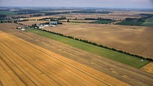
The airfield east of Kleinmühlingen is used by glider pilots, parachutists and private pilots. The ICAO code for this airport is EDOM .
partnership
There is a partnership with the Ramlingen-Ehlershausen district of the city of Burgdorf in Lower Saxony .
Individual evidence
- ^ StBA: Changes in the municipalities in Germany, see 2007
- ↑ Entry about the partnerships on the homepage of the city of Burgdorf.Retrieved on April 23, 2019, 12:29 am
Web links
literature
- Rudolf Kampe: The history of the village of Kleinmühlingen in Anhalt . Edited by Eckart Engel, Niedernwöhren 2007
- Eckart Engel (Ed.): Life in the Bördedorf Kleinmühlingen . undated, ISBN 978-3-00-028793-0


