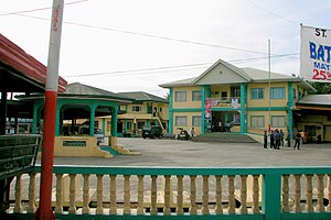
Labrador (Pangasinan)
| Municipality of Labrador | ||
| Location of Labrador in the Pangasinan Province | ||
|---|---|---|

|
||
| Basic data | ||
| Region : | Ilocos region | |
| Province : | Pangasinan | |
| Barangays : | 10 | |
| District: | 2. District of Pangasinan | |
| PSGC : | 015521000 | |
| Income class : | 4. Income bracket | |
| Households : | 3830 May 1, 2000 census
|
|
| Population : | 23,201 August 1, 2015 census
|
|
| Coordinates : | 16 ° 2 ′ N , 120 ° 8 ′ E | |
| Postal code : | 2402 | |
| Area code : | +63 75 | |
| Geographical location in the Philippines | ||
|
|
||
Labrador is a municipality in the Philippine province of Pangasinan and is located on the Gulf of Lingayen . In 2015, 23,201 people lived in the area. In 1575 the first Christian chapel in the province was built in Baranggay Uyong . The municipality has several beaches on the coast. Immediately afterwards are the first foothills of the Zambales Mountains and the terrain rises steeply in parts.
Labrador is divided into the following ten barangays :
|
|

