List of Bielefeld light rail stations
The list of Bielefeld light rail stations provides an overview of all tram and light rail stations in Bielefeld (name from 1991). The network covers a total of 71.6 km. The average distance between stops, with 64 stops, is 450 m. Seven stations are underground stations . Outside of this count, there is also the stop at Obernstraße, which stops at irregular intervals.
When the light rail tunnel went into operation in April 1991, some of the previous stops were omitted or they were merged into new, longer elevated platforms or underground stops. This considerably lengthened some of the footpaths to the stops. The following were no longer served:
- Line 1 Brökerstraße, Stadtwerke and Brüggemannstraße (merged to Sudbrackstraße)
- Line 2 Brökerstraße, Nicolaifriedhof (previously one-way service between Beckhausstraße and Stadtheider Straße)
- Line 3 Bahnhofstraße (on Feilenstraße), Meller Straße, Pestalozzistraße and Apfelstraße (replaced by Wittekindstraße, Nordpark).
- The previous stops at Hermannstrasse and Regional Court were merged; the new, longer elevated platform of the district court is located between these former stops.
- The Berliner Platz stop (now Willy-Brandt-Platz) was omitted for all lines. For three decades from 1956 to 1986 this was the central meeting point for trams. The railways waited 5 minutes for the connections outside the peak traffic. There were thus three separate transfer points in the city (Jahnplatz for city and regional buses, central station, Berliner Platz). The travel time from the main train station to Jahnplatz was very long and one of the reasons for the ever-decreasing number of trams.
- The Viktoriastraße and Kesselbrink stops on line 3 were no longer available when the line was relocated to Niederwall at the end of September 1986.
- The Landgericht stop on line 12 (the stop was on Kreuzstraße, only in the direction of Senne, regardless of the Landgericht stop on lines 1 and 2)
The list is divided into two parts: subway stations and other stations.
Overview of the lines
| line | Line route |
|---|---|
| 1 | Schildesche - Hauptbahnhof - Jahnplatz - Bethel - Brackwede Bahnhof - Senne |
| 2 | Altenhagen - Milse - Baumheide - Central Station - Jahnplatz - Sieker |
| 3 | Babenhausen-Süd - Hauptbahnhof - Jahnplatz - Sieker Mitte - Stieghorst |
| 4th | Lohmannshof - University - Central Station - Jahnplatz - Town Hall - Dürkopp Tor 6 |
In addition to these lines, there are also repeater lines and special line names for trips to / from the depot (10, 12, 13 and 18). They have not been entered here or in the list of stations.
The list is structured as follows:
- Station and location: name of the station and a link to the location map
- Line: Light rail line (s) that serve or serve the station
- City district: City district in which the station is located
- Connections: transfer options ("bus" for city, regional and night bus routes, "night bus" for stops exclusively by bus night and early morning)
- Structural design: information on platforms, accessibility
- Notes: Other information about the station
- Environment: Nearby destinations
- Picture (s): A picture of the station, at the subway stations from the inside and from the entrance
List of subway stations
| Station location |
Line (s) |
Borough |
connections |
Structural design | Remarks | Surroundings | photos |
|---|---|---|---|---|---|---|---|
| Beckhausstrasse 52 ° 2 ′ 0 ″ N, 8 ° 32 ′ 33 ″ E |
2 | center | night bus | Elevators , side platforms, barrier-free, side platforms, high-floor | first tunnel station in the network, opened in 1971, rebuilt in 1990 (including raised and shortened platforms) |
 
|
|
| Central Station 52 ° 1 ′ 43 ″ N, 8 ° 32 ′ 2 ″ E |
1 2 3 4 |
center | Long-distance train regional train bus |
multi-storey, escalators , elevators, barrier-free, side and central platforms, high floor | opened in 1991 |
Bielefeld City Library Bielefeld City Hall |
 
|
| Jahnplatz 52 ° 1 ′ 24 ″ N, 8 ° 32 ′ 0 ″ E |
1 2 3 4 |
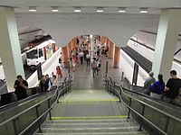
center | bus | Escalators, elevators, barrier-free, central platform, high floor | opened in 1991 | Old cemetery Kesselbrink Bahnhofstrasse Süsterkirche Old town Nicolaikirche old town Jahnplatz |
|
| Nordpark 52 ° 2 ′ 15 ″ N, 8 ° 31 ′ 25 ″ E |
3 | center | bus | Elevator, central platform, barrier-free, high floor | opened in 1991 | North park |
 
|
| Rudolf-Oetker-Halle 52 ° 1 ′ 44 ″ N, 8 ° 30 ′ 51 ″ E |
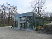
4th | center | bus | Elevators, escalators, central platform, barrier-free, high-floor | opened April 2000,
planned as the "Bürgerpark" stop |
SchücoArena public park, Rudolf-Oetker-Halle police headquarters |
|
|
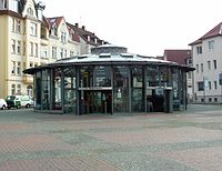
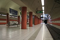
Siegfriedplatz 52 ° 1 ′ 40 ″ N, 8 ° 31 ′ 20 ″ E |
4th | center | bus | Elevator, central platform, barrier-free, high floor | opened April 2000 |
|
|
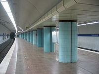
| Wittekindstrasse 52 ° 1 ′ 58 ″ N, 8 ° 31 ′ 33 ″ E |
3 | center | bus | Central platform, elevator, high floor | opened in 1991 | SchücoArena |
|
List of overground light rail stations
| Station location |
Line (s) |
Borough |
connections |
structural design | Remarks | Surroundings | photos |
|---|---|---|---|---|---|---|---|
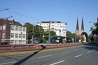
| Adenauerplatz 52 ° 1 ′ 2 ″ N, 8 ° 31 ′ 31 ″ E |
1 | center | Bus (art gallery) | Central platform, barrier-free, high-floor |
Kunsthalle Altstadt Sparrenburg Natural History Museum Neustädter Marienkirche Bielefelder Kunstverein Winzerscher Garten |
|
|
| Altenhagen 52 ° 3 ′ 27 ″ N, 8 ° 37 ′ 37 ″ E |
2 | Heepen | Central platform. barrier-free, high-floor | Terminal stop 2 commissioned December 6, 2015 |

|
||
| On the hoof 52 ° 2 ′ 28 ″ N, 8 ° 31 ′ 23 ″ E |
3 | Shield ash | night bus | Central platform, high floor, barrier-free |

|
||
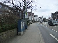
| August-Bebel-Strasse 52 ° 0 ′ 46 ″ N, 8 ° 32 ′ 12 ″ E |
2 | center | night bus | Street stop, not barrier-free | WDR studio Bielefeld |
|
|
| Babenhausen South 52 ° 3 ′ 18 ″ N, 8 ° 31 ′ 7 ″ E |
3 | Shield ash | bus | Side platforms, high-floor, barrier-free | Terminal stop 3 Commissioning at the end of September 1980, first stop with elevated platform; also called Splittenbrede |

|
|
| Tree heather 52 ° 3 ′ 0 ″ N, 8 ° 35 ′ 49 ″ E |
2 | Heepen | bus | Side platforms, escalators (today only out of town), elevator, barrier-free, trough structure | Commissioning May 30, 1969 |

|
|
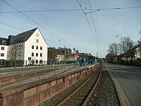
| Bethel 52 ° 0 ′ 47 ″ N, 8 ° 31 ′ 16 ″ E |
1 | Gadderbaum | bus | Central platform, barrier-free, high-floor |
Von Bodelschwingh Foundation Bethel Dr. Oetker |
|
|
| Brackwede train station 51 ° 59 ′ 54 ″ N, 8 ° 30 ′ 7 ″ E |
1 | Brackwede | Bus regional train, long-distance bus (not barrier-free, stairs) |
Central platform, barrier-free, high-floor | Elevated platform since September 1997 | Bielefeld-Brackwede train station |

|
| Brackwede (turn) 51 ° 59 ′ 9 ″ N, 8 ° 30 ′ 56 ″ E |
1 | Brackwede | Street stop, not barrier-free | Requirement stop for amplifier trips,
Until the beginning of the 90s, the reversing loop was then converted to the end of the stump |
|||
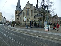
| Brackwede Church 51 ° 59 ′ 17 ″ N, 8 ° 30 ′ 50 ″ E |
1 | Brackwede | bus | Street stop, not barrier-free | Ev. Bartholomäuskirche |
|
|
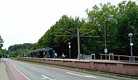
| Bültmannshof 52 ° 2 ′ 9 ″ N, 8 ° 30 ′ 15 ″ E |
4th | Shield ash | night bus | Central platform, barrier-free, high-floor | Commissioning April 2000 |
|
|
| Buschbachtal 52 ° 3 ′ 24 ″ N, 8 ° 37 ′ 4 ″ E |
2 | Heepen | Central platform. barrier-free, high-floor | Commissioning December 6, 2015 |

|
||
| Deciusstrasse 52 ° 2 ′ 47 ″ N, 8 ° 32 ′ 38 ″ E |
1 | Shield ash | bus | Central platform, barrier-free, high-floor | formerly "Hamfeldstrasse" |

|
|
| Dürkopp Tor 6 52 ° 1 ′ 11 ″ N, 8 ° 32 ′ 33 ″ O |
4th | center | Butt end point single track, side platform, barrier-free, high-floor | In the period from April 13th, 2019 (from July 3rd, 2019 with elevated platform) to December 6th, 2019 it was used as the provisional terminus of line 3. Commissioning as the final stop of line 4 on December 7th, 2019 | |||
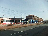
| Eggeweg 52 ° 0 ′ 20 ″ N, 8 ° 30 ′ 38 ″ E |
1 | Gadderbaum | bus | Central platform, barrier-free, high-floor |
|
||
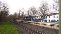
| Elpke 52 ° 0 ′ 17 ″ N, 8 ° 34 ′ 36 ″ E |
3 | Stieghorst | Night bus (Flensburger Strasse) | Central platform, barrier-free, high-floor | Commissioning August 26, 1995 |
|
|
| Finkenstrasse 52 ° 2 ′ 17 ″ N, 8 ° 33 ′ 51 ″ E |
2 | center | night bus | Central platform, barrier-free, high-floor | |||
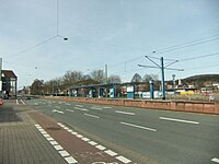
| Friedrich-List-Strasse 52 ° 0 ′ 34 ″ N, 8 ° 31 ′ 0 ″ E |
1 | Gadderbaum | bus | Central platform, barrier-free, high-floor |
|
||
| Gaswerkstrasse 51 ° 59 ′ 39 ″ N, 8 ° 30 ′ 24 ″ E |
1 | Brackwede | bus | Street stop, not barrier-free |

|
||
| Comprehensive School Stieghorst 52 ° 0 ′ 7 ″ N, 8 ° 35 ′ 4 ″ E |
3 | Stieghorst | Side platforms, barrier-free, high-floor | Commissioning September 28, 1996 |

|
||
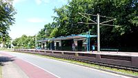
| Graf-von-Stauffenberg-Strasse 52 ° 1 ′ 58 ″ N, 8 ° 30 ′ 31 ″ E |
4th | Shield ash | night bus | Central platform, barrier-free, high-floor | Commissioning in April 2000, planned as the "Police Headquarters" stop |
|
|
| Hartlager Weg 52 ° 0 ′ 47 ″ N, 8 ° 33 ′ 27 ″ E |
3 | center | bus | Road stop | |||
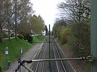
| Heath Gardens 52 ° 3 ′ 9 ″ N, 8 ° 32 ′ 43 ″ E |
1 | Shield ash | night bus | Side platforms, high-floor not barrier-free, only accessible via stairs | Commissioning April 1968 |
|
|
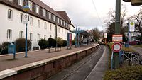
| Johannesstift 52 ° 2 ′ 27 ″ N, 8 ° 32 ′ 35 ″ E |
1 | Shield ash | night bus | Central platform, barrier-free, high-floor |
Johannesstift Miele Hospital in Bielefeld |
|
|
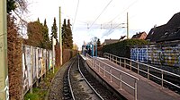
| Kattenkamp 52 ° 2 ′ 59 ″ N, 8 ° 32 ′ 38 ″ E |
1 | Shield ash | Central platform, barrier-free, high-floor | The old elevated platform was demolished in 2011 and replaced by a longer and narrower elevated platform for the planned use by Vamos . Next to the barrier-free stop is the non-barrier-free Kattenkamp Kehre stop . |
|
||
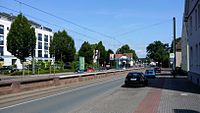
| Koblenzer Strasse 52 ° 2 ′ 58 ″ N, 8 ° 31 ′ 17 ″ E |
3 | Shield ash | night bus | Central platform, barrier-free, high-floor | Elevated platform since March 1996 |
|
|
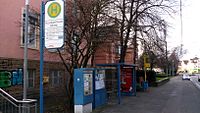
| Hospital center 52 ° 0 ′ 56 ″ N, 8 ° 32 ′ 44 ″ E |
3 | center | night bus | Central platform, barrier-free, high-floor | former name "hospital"
Elevated platform since December 7th, 2019 |
Bielefeld Clinic |
|
| District Court 52 ° 1 ′ 2 ″ N, 8 ° 31 ′ 59 ″ E |
1 2 |
center | night bus | Central platform, barrier-free, high-floor |
District Court Bielefeld District Court Bielefeld Altstadt Sparrenburg |

|
|
| Lange Straße 52 ° 2 ′ 39 ″ N, 8 ° 31 ′ 21 ″ E |
3 | Shield ash | night bus | Road stop |

|
||
| Lohmannshof 52 ° 2 ′ 43 ″ N, 8 ° 29 ′ 7 ″ E |
4th | Dornberg | bus | Side platforms, barrier-free, high-floor | Terminal stop 4 Commissioning at the end of September 2002. Generous transfer facility for trams and buses. The planning provided for a transfer hub in the direction of Werther . However, the direct lines to Werther were and will continue to be run via Wertherstrasse parallel to the Stadtbahn, so the original plans were never implemented. |

|
|
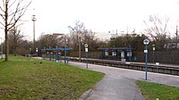
| Luther Church 52 ° 0 ′ 33 ″ N, 8 ° 33 ′ 47 ″ E |
3 | center | bus | Side platforms, barrier-free, high-floor | Commissioning August 26, 1995 | Sieker Friedhof Lutherkirche |
|
| Marktstrasse 52 ° 1 ′ 8 ″ N, 8 ° 32 ′ 23 ″ E |
3 | center | Central platform, barrier-free, high-floor | Commissioning December 7th, 2019. Replacement for Ravensberger Strasse and August-Schröder-Strasse | |||
| Milse 52 ° 3 '28 "N, 8 ° 36' 38" E |
2 | Heepen | bus | Central platform, barrier-free, high-floor | Commissioning in April 1978 with a turning loop, in 2008 as an advance payment for the extension to Altenhagen, conversion to the butt end point |

|
|
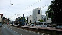
| Mozartstrasse 52 ° 0 ′ 30 ″ N, 8 ° 32 ′ 35 ″ E |
2 | center | night bus | Central platform, barrier-free, high-floor | Elevated platform since September 2010 |
|
|
| Nikolaus-Dürkopp-Strasse 52 ° 1 ′ 12 ″ N, 8 ° 32 ′ 9 ″ E |
center | low side platform, not barrier-free | Only for trips on line 18. Alternative stop, as the Rathaus stop cannot be reached on route 18. | ||||
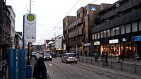
| Normannenstrasse 51 ° 59 ′ 27 ″ N, 8 ° 30 ′ 34 ″ E |
1 | Brackwede | bus | Street stop, not barrier-free | District Office of the Sacred Heart of Jesus Church |
|
|
| Obernstrasse 52 ° 1 ′ 9 ″ N, 8 ° 31 ′ 32 ″ E |
center | Bus (art gallery) | low side platform, not barrier-free | used for amplifier trips and in the event of operational disruptions, was initially called "Waldhof" |
Kunsthalle Bielefeld Old Town Obernstrasse |

|
|
| Oststrasse 52 ° 0 ′ 51 ″ N, 8 ° 33 ′ 2 ″ E |
3 | center | bus | Central platform, barrier-free, high-floor |

|
||
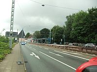
| Prießallee 52 ° 0 ′ 22 ″ N, 8 ° 32 ′ 56 ″ E |
2 | center | night bus | Central platform, barrier-free, high-floor | Elevated platform since May 2010 |
|
|
| Town hall 52 ° 1 ′ 16 ″ N, 8 ° 32 ′ 4 ″ E |
1 2 3 4 |
center | bus | Side platforms, barrier-free, high-floor | Final stop 4 stop in the ramp area of the StadtBahn tunnel |
Town Hall and Old Town Hall Alter Markt Leineweberdenkmal Evangelical Church of Westphalia Old Town Stadttheater Artists Unlimited |

|
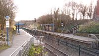
| Roggenkamp 52 ° 0 ′ 25 ″ N, 8 ° 34 ′ 15 ″ E |
3 | Stieghorst | Side platforms, barrier-free, high-floor | Commissioning August 26, 1995 |
|
||
| Rose height 51 ° 59 ′ 1 ″ N, 8 ° 31 ′ 34 ″ E |
1 | Brackwede | bus | Side platforms, barrier-free, high-floor | Rosenhöhe Clinic |

|
|
| Schelpmilser Weg 52 ° 3 ′ 12 ″ N, 8 ° 36 ′ 11 ″ E |
2 | Heepen | Side platforms, barrier-free, high-floor | Commissioning April 1978 | |||
| Schildesche 52 ° 3 ′ 21 ″ N, 8 ° 32 ′ 43 ″ E |
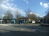
1 | Shield ash | bus | Side platforms, barrier-free, high-floor | Terminal 1, commissioned in April 1968, replaced the Schildesche Markt stop, the route over the stretch of the disused Bielefelder Kreisbahnen , formerly “An der Reegt”, conversion to elevated platform September 1996 - the loop has been used in a counterclockwise direction since then. |
Obersee |
|
| Schillerstrasse 52 ° 2 ′ 13 ″ N, 8 ° 33 ′ 32 ″ E |
2 | center | night bus | Central platform, barrier-free, high-floor | |||
| Schüco 52 ° 2 ′ 35 ″ N, 8 ° 34 ′ 37 ″ E |
2 | center | night bus | Central platform, barrier-free, high-floor | Formerly the “Karolinenstraße” stop, previously with an additional triangular bend for emergency trips, today with a turning track | Schüco | |
| Seidenstickerstraße 52 ° 2 ′ 53 ″ N, 8 ° 35 ′ 27 ″ E |
2 | center | Side platforms, barrier-free, high-floor | Commissioning May 30, 1969 | |||
| Senne 51 ° 58 ′ 45 ″ N, 8 ° 32 ′ 7 ″ E |
1 | Senne | bus | Side platforms, barrier-free, high-floor | End stop 1 turning loop clockwise, passing track at the exit platform |

|
|
| Sennefriedhof 51 ° 58 ′ 52 ″ N, 8 ° 31 ′ 46 ″ E |
1 | Brackwede (north platform) Senne (south platform) |
night bus | Side platforms, barrier-free, high-floor | Sennefriedhof |

|
|
| Sieker 52 ° 0 ′ 17 ″ N, 8 ° 33 ′ 29 ″ E |
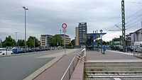
2 | center | bus | Side platforms, barrier-free, high-floor | End stop 2 turning loop, conversion to elevated platform 2010 - loop has been used in a counterclockwise direction since then. |
MoBiel depot and administration |
|
| Sieker center 52 ° 0 ′ 44 ″ N, 8 ° 33 ′ 45 ″ E |
3 | center | bus | low side platforms, not barrier-free | Until August 1995 final stop with a turning loop, former names also "Brennerstr." Or "Otto-Brenner-Str." |

|
|
| Stadtheider Strasse 52 ° 2 ′ 9 ″ N, 8 ° 33 ′ 17 ″ E |
2 | center | night bus | Central platform, barrier-free, high-floor | |||
| Stieghorst 52 ° 0 ′ 4 ″ N, 8 ° 35 ′ 20 ″ E |
3 | Stieghorst | bus | Central platform, barrier-free, high-floor | Terminal stop 3 commissioned September 28, 1996 |
District center Stieghorst |

|
| Sudbrackstrasse 52 ° 2 ′ 10 ″ N, 8 ° 32 ′ 20 ″ E |
1 | center | bus | Side platforms, barrier-free, high-floor | Stadtwerke Bielefeld |

|
|
| Teutoburger Strasse 52 ° 0 ′ 38 ″ N, 8 ° 32 ′ 23 ″ E |
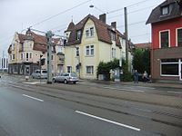
2 | center | night bus | Street stop, not barrier-free |
|
||
| University 52 ° 2 ′ 23 ″ N, 8 ° 29 ′ 48 ″ E |
4th | Shield ash | bus | Central platform, bridge to the university, escalators, elevator, barrier-free, high floor | Commissioning of a provisional final stop in April 2000. Completion of the stop system with bridge October 2001. The largest above-ground stop. |
Bielefeld University Laboratory School |

|
| Voltmannstrasse 52 ° 3 ′ 14 ″ N, 8 ° 31 ′ 9 ″ E |
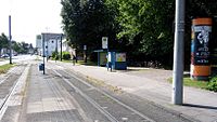
3 | Shield ash | night bus | Street stop, not barrier-free | Until September 1980 final stop with triangular bend. |
|
|
|
Wellensiek 52 ° 2 ′ 33 ″ N, 8 ° 29 ′ 24 ″ E |
4th | Dornberg | night bus | Central platform, barrier-free, high-floor | Commissioning at the end of September 2002. The stop was demolished in 2012 because of the new campus or university of applied sciences and was rebuilt to a considerably larger extent | Campus North Bielefeld University of Applied Sciences |

|
| Windelsbleicher Strasse 51 ° 59 ′ 9 ″ N, 8 ° 31 ′ 5 ″ E |
1 | Brackwede | bus | Street stop, not barrier-free |

|
||
| Ziegelstrasse 52 ° 2 ′ 21 ″ N, 8 ° 34 ′ 9 ″ E |
2 | center | night bus | Central platform, barrier-free, high-floor |
List of former above-ground light rail stations
| Station location |
Line (s) |
Borough |
connections |
structural design | Remarks | Surroundings | photos |
|---|---|---|---|---|---|---|---|
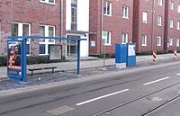
| August-Schröder-Strasse 52 ° 1 ′ 11 ″ N, 8 ° 32 ′ 20 ″ E |
3 | center | Street stop, not barrier-free | Commissioning September 26, 1986, was served until December 6, 2019. Replaced by the new stop 'Marktstraße' (elevated platform) |
|
||
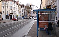
| Ravensberger Strasse 52 ° 1 ′ 4 ″ N, 8 ° 32 ′ 23 ″ E |
3 | center | night bus | Street stop, not barrier-free | Was served until December 06, 2019. Replaced by the new stop 'Marktstraße' (elevated platform) |
|
Web links
Individual evidence
- ↑ moBiel - facts and figures. Retrieved April 5, 2015 .


