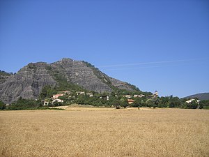
Marcoux (Alpes-de-Haute-Provence)
| Marcoux | ||
|---|---|---|

|
|
|
| region | Provence-Alpes-Cote d'Azur | |
| Department | Alpes-de-Haute-Provence | |
| Arrondissement | Digne-les-Bains | |
| Canton | Digne-les-Bains-1 | |
| Community association | Provence-Alpes agglomeration | |
| Coordinates | 44 ° 8 ′ N , 6 ° 17 ′ E | |
| height | 604-1,311 m | |
| surface | 32.17 km 2 | |
| Residents | 464 (January 1, 2017) | |
| Population density | 14 inhabitants / km 2 | |
| Post Code | 04420 | |
| INSEE code | 04113 | |
 Marcoux |
||
Marcoux is a french commune with 464 inhabitants (at January 1, 2017) in the department of Alpes-de-Haute-Provence in the region Provence-Alpes-Cote d'Azur . It belongs to the Arrondissement of Digne-les-Bains and the canton of Digne-les-Bains-1 . The residents call themselves Marcousiens .
geography
The village is 730 m above sea level. 1,035 hectares of the municipality mark are forested. The Bléone flows through Marcoux . The neighboring communities are Le Brusquet in the north, Draix in the northeast, Archail in the east and Digne-les-Bains in the south and west.
Population development
| year | 1962 | 1968 | 1975 | 1982 | 1990 | 1999 | 2008 | 2012 |
|---|---|---|---|---|---|---|---|---|
| Residents | 180 | 166 | 305 | 390 | 414 | 402 | 492 | 516 |
Attractions
- Saint-Etienne church, a monument historique
Web links
Commons : Marcoux - collection of images, videos and audio files

