
Au SG
| SG is the abbreviation for the canton of St. Gallen in Switzerland and is used to avoid confusion with other entries of the name Au . |
| Au | |
|---|---|
 |
|
| State : |
|
| Canton : |
|
| Constituency : | Rhine Valley |
| BFS no. : | 3231 |
| Postal code : | 9434 Au 9435 Heerbrugg |
| UN / LOCODE : | CH AUS (Au SG) CH HEE (Heerbrugg) |
| Coordinates : | 765 554 / 255904 |
| Height : | 405 m above sea level M. |
| Height range : | 399–653 m above sea level M. |
| Area : | 4.65 km² |
| Residents: | 7789 (December 31, 2018) |
| Population density : | 1675 inhabitants per km² |
| Website: | www.au.ch |
| Location of the municipality | |
  |
|
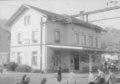
Au is a political municipality in the cultural landscape of the St. Gallen Rhine Valley in the canton of St. Gallen in eastern Switzerland . Au belongs politically to the constituency of the Rhine Valley .
geography
Au is located in the Alpine Rhine Valley in the region of St. Gallen Rhine Valley , on the western shore of the Alpine Rhine . The community consists of the settlement centers Au (coat of arms mountain with moon) with the village parts Haslach , Hard , Monstein , as well as the hamlet Oberfahr and parts of the village Heerbrugg (coat of arms river with bridge).
The highest point is the Meldegg at 652 meters above sea level, the lowest point is the inland canal on the border with the municipality of St. Margrethen at 401 meters above sea level.
The hamlet of Oberfahr (derived from the upper ferry ) is located a little to the south-east of the settlement center of Au. Originally it was a border station at the ferry that crossed the Rhine. The place Heerbrugg probably corresponds to that of the St. Gallen abbot Ulrich III around 1078 . built fortress Hêrburch . Heerbrugg, as the center of the Middle Rhine Valley , extends over the border of the political community of Au to Berneck , Balgach and Widnau .
Area balance
In 2009 Au had 471 ha of municipal space. 229 hectares are artificially created areas (cultivated land). Of this, 101 ha are paved areas, 52 ha buildings, 40 ha lawns, 21 ha trees on artificially created areas, 13 ha mixed small structures and 2 ha bed structures. The grass and herb vegetation occupies 189 hectares. The area of the bush vegetation is 10 hectares, on which 6 hectares of vines grow. The tree vegetation extends over 24 hectares, of which 8 hectares are closed trees, 8 hectares are groups of trees, 4 hectares are linear trees, 3 hectares are forest strips and 1 hectare is walnuts. Water and wet areas extend over 17 ha, the area without vegetation is 2 ha.
history

Called Diken Auwe in 1316 , Au emerged from the original settlements of Au Haslach, Hard and Monstein, at the narrow point between Heldsberg and the Rhine. Originally belonging to the Reichshof Lustenau and from 1395 under Hohenems rule , Au was under federal territory from 1490. These became their own lower court in 1593 as Hof Widnau-Haslach. In 1775 they separated into the Au, Widnau and Schmitter farms. The property in Lustenau , the "Schweizerried", was retained. 1766–76 the Counts of Harrach were given lower court over Au, 1782–98 those of Salis-Soglio . Until 1853 the latter also owned Monstein Castle. In 1803 the canton of St. Gallen was founded and Au remained united with the municipality of Berneck until 1805.
In 1721 a Catholic chapel was built in Au, which was later replaced by church buildings (1804 and 1925). A Catholic parish in Au was founded in 1802, which was the first replacement by Berneck. The connection to the Rorschach - Sargans railway network took place in 1858 with the two stations Au and Heerbrugg. A new industrial settlement then grew up in Heerbrugg , which Au shares with the communities of Balgach , Berneck and Widnau . Heerbrugg train station is on the ground of Au. At the end of the 19th century the embroidery industry flourished, with the result that between 1900 and 1910 the proportion of foreigners rose from 8.5% to 32.4%. Since 1952 there is a parish of the Reformed Church in Au .
Paul Grüninger was a Swiss teacher, Swiss champion as a football player and from 1919 police captain in St. Gallen . He married Alice Federer, who came from a respected merchant family from Au. The St. Gallen police commander, Hauptmann Grüninger, saved several hundred Jewish and other refugees from Nazi persecution and extermination in the years 1938–39. In 1939 he was suspended from service and his pension claims were denied . He had to give up his official apartment. Since October 29, 2005, a plaque has been reminding us of the years (1955–72) when the Grüninger couple rented an inexpensive three-room apartment in Au, at Kirchweg 4. In 1993 he was politically rehabilitated and has since been honored several times posthumously. He was buried in Au SG in the local cemetery
On September 19, 1988, immediately after the exit signal from the station, eight tank wagons loaded with kerosene derailed from a freight train traveling in the direction of St. Margrethen . Part of the kerosene caught fire and a large amount spilled into the inland canal and drifted down the canal while burning. The cause of the derailment was the broken hub of an overheated wagon wheel.
population

Of the 5,778 inhabitants who lived in the political municipality of Au at the end of 2018, 3,370 people lived in the village of Au and 2,408 in the Au district of Heerbrugg.
| Population development | ||||||||
|---|---|---|---|---|---|---|---|---|
| year | 1837 | 1850 | 1900 | 1910 | 1950 | 1970 | 1990 | 2010 |
| population | 917 | 875 | 1314 | 2437 | 2636 | 4944 | 5778 | 6993 |
Attractions

Catholic Church of Au
Railway Station (1976)

Personalities
- Paul Grüninger (* 1891; † 1972), teacher, soccer player and from 1919 police captain in St. Gallen
- Roland Köhler (* 1955), publisher
- Jörg Stiel (* 1968), soccer goalkeeper
Web links
- Official website of the municipality of Au SG
- Markus Kaiser: Au (SG). In: Historical Lexicon of Switzerland .
- Primary school Au-Heerbrugg
Individual evidence
- ↑ Permanent and non-permanent resident population by year, canton, district, municipality, population type and gender (permanent resident population). In: bfs. admin.ch . Federal Statistical Office (FSO), August 31, 2019, accessed on December 22, 2019 .
- ^ Church in numbers. Municipality of AU (SG), accessed on January 21, 2020 .
- ↑ Markus Kaiser: Heerbrugg. In: Historical Lexicon of Switzerland . February 20, 2017. Retrieved June 25, 2019 .
- ↑ Land cover statistics: Land cover (NOLC04) by district and municipality, in hectares
- ↑ a b Markus Kaiser: Au (SG). In: Historical Lexicon of Switzerland . September 15, 2009 , accessed June 25, 2019 .
- ↑ http://www.paul-grueninger.ch/pagine/stiftung/werwar.html
- ↑ http://www.appenzellerzeitung.ch/ostschweiz/ostschweiz/tb-os/Grueningers-Spuren-im-Rheintal;art120094,2629932
- ↑ http://www.paul-grueninger.ch/pagine/stiftung/gedenkafel.html
- ↑ http://www.au.ch/de/portrait/geschichte/
- ^ Paul Ernst Grüninger at knerger.de
- ^ David Schiesser: Derailment of a kerosene freight train in Au (SG) on Sept. 19, 1988. A historical guest article. In: Blog 24 ÖV - Switzerland - Europe. Marcel Manhart, March 4, 2011, accessed April 1, 2015 .
- ^ STAT-TAB: The interactive statistics database, population development by region, 1850–2000. Swiss Confederation, accessed on January 7, 2014 .
- ↑ STAT-TAB: The interactive statistics database, population status. Swiss Confederation, accessed on June 19, 2017 .
Remarks
- ↑ The areas are given by the Federal Statistical Office in hectares (ha)