
Balgach
| Balgach | |
|---|---|
 |
|
| State : |
|
| Canton : |
|
| Constituency : | Rhine Valley |
| BFS no. : | 3232 |
| Postal code : | 9436 |
| UN / LOCODE : | CH BAL (Balgach) CH HEE (Heerbrugg) |
| Coordinates : | 763.73 thousand / 252969 |
| Height : | 404 m above sea level M. |
| Height range : | 400–712 m above sea level M. |
| Area : | 6.52 km² |
| Residents: | 4798 (December 31, 2018) |
| Population density : | 736 inhabitants per km² |
| Website: | www.balgach.ch |
| Location of the municipality | |
  |
|

Balgach is a political municipality in the cultural landscape of the St. Gallen Rhine Valley in the canton of St. Gallen in eastern Switzerland . Politically, Balgach is part of the Rheintal constituency . The community consists of the village of the same name and part of the village of Heerbrugg .
geography
Balgach is located on Hauptstrasse 13 , at the foot of the western slope of the St. Gallen Rhine Valley , between the communities of Au to the north and Rebstein to the south. To the east, Widnau , Oberriet and Diepoldsau border the borders of Balgach. To the west, Balgach extends up to the ridge of the «Hümpeler» mountain, to the municipal boundaries of Berneck ( SG ), Reute ( AR ) and Oberegg ( AI ).
The forest, which covers the foothills of Appenzeller country (Hümpeler), ie in the south bird forest, in the middle Kirchenwald and north Hümpelerwald . On Hümpeler the main water intake located Hümpelerquelle which supplies a large part of the community with water. The highest point that is assigned to the Hümpelerberg is called Nonnenbommert 641 m above sea level. M. Below the woods, on the Boden (Bodenstrasse), is the Boden quarter, which is built on with a few villas.
The exclusive location at the foot of the vineyards offers a view over the Rhine Valley from Lake Constance to Säntis . To the south of it, on another hill, which is separated from the ground by a ravine , is the Grünenstein Castle . To the north of it, in the district of Heerbrugg on the northern end of the Hümpeler , are the Heerbrugg Castle and the Schmidheiny Villa . The historic village center can be found on the slope below Quartier Boden , which is listed in the federal inventory of protected sites of national importance in Switzerland ( ISOS ).
The main road 13 at the foot of the slope divides the village into two halves. On the eastern side are the old Mühlacker district and the recently built industrial and block buildings that extend east to the SBB railway line. To the east of the Chur-Rorschach railway line are the Riet sports complex and the Höchstern nature reserve . Further to the east, in the meads, some of which are designated as floodplains, are the Lärchenhof , Erlenhof , Lindenhof , Sonnenhof and Rietmüli farms . Right through it from south to north extends the countries Aach, an artificial drainage channel, which the many streams that the slopes of the Rhine valley of Marbach , dehydrate to Heerbrugg in the Rheintaler internal channel passes. Most of these streams have long been tunnelled under the villages. The tunnels begin on the slope above the village center and usually end shortly before or after the SBB line. In Heerbrugg, the Länderach is also directed into a tunnel, which runs under Widnau until shortly before it joins the inland canal. This is intended to increase flood security, because it causes the brooks and the Aach to overflow in predetermined flood areas, in the Mühlen.
Area balance
In 2009, Berneck had 654 hectares of community space. 142 ha are artificially created areas (cultivated land). 66 hectares of this are paved areas, 39 hectares are buildings, 22 hectares are lawns, 8 hectares are trees on artificially created areas, 5 hectares are mixed small structures and 2 hectares are bedding structures. The grass and herb vegetation occupies 341 hectares. The area of the bush vegetation is 32 hectares, on which 21 hectares of vines grow. The tree vegetation extends over 136 hectares, of which 104 hectares are closed trees, 18 h groups of trees, 10 hectares of linear trees, 3 hectares of forest strips and 1 hectare of walnuts. Water and wet areas extend over 1 ha, the area without vegetation is 2 ha.
population

On December 31, 2018, Balgach had a permanent resident population of 4,798.
- The gender distribution is balanced with 2414 men and 2384 women.
- 2138 are married and 2069 are single. 200 are widowed, 391 are divorced, unmarried or in partnership that has been legally dissolved.
There are 3,679 Swiss citizens and 1,119 citizens of other countries.
- Of the neighboring countries, there are 247 from Germany, 198 from Austria, 90 from Italy and 4 from France.
- From the rest of Europe, Croatia (117), Turkey (42), North Macedonia (31), Bosnia and Herzegovina (30), Spain (28) and Greece (17) are the most common countries of origin.
- Sri Lanka (18) and Eritrea (10) are other important countries of origin.
- 287 residents come from other states.
economy
Some farms are located on the plain facing the Rhine and vineyards extend up to the edge of the forest above the village. Apart from the industry in the district of Heerbrugg and the strongly grown industrial zone 'Wegen' on Rietstrasse, the municipality of Balgach has a rural character. Because of the densely populated residential buildings in recent years, Balgach is developing into the suburban district of Heerbrugg.
Several new companies have emerged from parts of the former Wild Heerbrugg company, some of which are still active in Balgach / Heerbrugg, but today belong to foreign parent companies. In addition to the companies Leica Geosystems , Safran Vectronix AG, SwissOptic AG, Polymeca AG and Escatec Electronics (all related to the former company Wild) there are also independent companies based in Balgach, such as Heule Werkzeuge AG, Microsynth AG, HEMAG AG, WZW OPTIC AG.
traffic
Balgach is served by the bus route 301 of the RTB Rheintal Bus . This is the successor to the Altstätten – Berneck trolleybus , which was discontinued in 1977 and which in turn replaced the Altstätten – Berneck tram that opened in 1897 in 1940 . The Widnau entrance of the A13 motorway is just under 6 km from the village center.
history
The village was first mentioned as Palgaa in 890/891 and belonged to the Barons von Sax in the 14th century, who sold it to Lindau Abbey in 1347 . In 1510, the St. Gallen Abbey acquired jurisdiction. Otto Oesch-Maggion (1864–1941), who grew up in Balgach, was part-time local parish clerk in Balgach, then administrator of the Bruggwald St. Gallen brickworks (J.Schmidheiny & Co.), wrote a chronicle of Balgach for many years. Oesch also produced a genealogical, handwritten work in which he recorded the families of Balgach over many generations up to around 1934.
Art and culture
Attractions
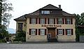
A building steeped in history is the old town hall on Steigstrasse, which today houses the local museum. It is on the list of cultural assets of national importance (KGS-No .: 8092).
There are 22 wells registered in the municipality, which are under the control of the water warden. 17 of them are located in the center of the village and the neighboring quarters alone. Many of them are decorated with artistic jewelry.
Also known is the red colored vine shelter called "Rebenhüttli" on Rebengasse in Balgach. It was built in 1904. The hut was planned on the instructions of the local community. Günther Grüner, a local artist, was responsible for planning the refuge. At the end of 2012 the hut burned down due to unknown causes and was rebuilt on top.

View of the center of Balgach. In the background the vineyards, the church forest and the Nonnenbommert

Eichholz fountain with the relief Im Eichenwald created by the sculptor Mädy Zünd
The Bad Balgach was part of the Nüesch winery

Viticulture has a long tradition in Balgach
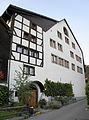
The «old town hall», local museum
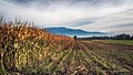
Fields in Balgach

The Rhine Lateral Canal forms the border between Balgach and Oberriet


Personalities
- Karl Berger (1898–1993), electrical engineer and lightning researcher
- Jakob Nüesch (1932–2016), biologist and President of ETH Zurich
- Johann Jakob Nüesch (1845–1895), landscape and genre painter
- Kurt Laurenz Metzler (* 1941), artist, sculptor, curator
- Edgar Oehler (* 1942), entrepreneur and politician (CVP)
- Albert Oesch (1897–1962), Roman Catholic clergyman
- Ernst Schmidheiny I (1871–1935), Swiss industrialist and politician, son of Jacob Schmidheiny (1838)
- Ernst Schmidheiny II. (1902–1985), Swiss industrialist and founder of the Ernst Schmidheiny Foundation , son of Ernst Schmidheiny (1871)
- Jacob Schmidheiny I. (1838–1905), Swiss entrepreneur
- Jacob Schmidheiny II. (1875–1955), Swiss entrepreneur, son of Jacob Schmidheiny (1838)
- Max Schmidheiny (1908–1991), Swiss engineer, industrialist and politician, 1978 founder of the Max Schmidheiny Foundation , son of Ernst Schmidheiny (1871)
- Stephan Schmidheiny (* 1947), Swiss entrepreneur and philanthropist, son of Max Schmidheiny
- Thomas Schmidheiny (* 1945), Swiss entrepreneur and art collector, son of Max Schmidheiny
- Jakob Laurenz Sonderegger (1825–1896), doctor and politician
- Richard Thalmann (1915–2002), pastor in Balgach from 1952 to 1960
- Meinrad Zünd (1916–1998), known as “Mädy” Zünd, artist and sculptor
- Albert Eschenmoser (* 1925), chemist and researcher in various fields of organic and bio-organic chemistry, citizen of Balgach
See also
literature
- Hans-Rudolf Galliker, Michael Köhler: Local history Balgach, From vine village to high-tech location . tape 2 . Local community, Balgach 2010, ISBN 978-3-03302415-1 , p. 167 .
- Walther Baumgartner, Christoph Egli, Therese Eschenmoser, Werner Kuster , Werner Ritter, Christoph Rohner, Peter Schaps: Rheintaler Köpfe, historical-biographical portraits from five centuries . Rheintaler Druckerei und Verlag AG, Berneck 2004, ISBN 3-03300265-X , p. 451 .
Web links
- Official website of the municipality of Balgach
- Johannes Vogel: Balgach. In: Historical Lexicon of Switzerland .
- Virtual archive of the company WILD Heerbrugg (English)
Individual evidence
- ↑ Permanent and non-permanent resident population by year, canton, district, municipality, population type and gender (permanent resident population). In: bfs. admin.ch . Federal Statistical Office (FSO), August 31, 2019, accessed on December 22, 2019 .
- ↑ Land cover statistics: Land cover (NOLC04) by district and municipality, in hectares. Swiss Confederation, December 31, 2009, accessed on October 22, 2019 .
- ^ STAT-TAB: The interactive statistics database, population development by region, 1850–2000. Swiss Confederation, accessed on June 21, 2015 .
- ↑ STAT-TAB: The interactive statistics database, population status. Swiss Confederation, accessed on June 21, 2015 .
- ↑ Permanent resident population by institutional structure, gender, marital status and age group. Swiss Confederation, December 31, 2018, accessed October 17, 2019 .
- ↑ Permanent resident population by institutional structure, place of birth and nationality. Swiss Confederation, December 31, 2018, accessed October 17, 2019 .
- ↑ escatec.com: ESCATEC Electronics, Heerbrugg, Switzerland ( Memento of the original dated December 9, 2008 in the Internet Archive ) Info: The archive link was inserted automatically and has not yet been checked. Please check the original and archive link according to the instructions and then remove this notice. , Accessed March 9, 2010.
- ^ Charles Knapp, Maurice Borel, Victor Attinger, Heinrich Brunner, Société neuchâteloise de geographie (editor): Geographical Lexicon of Switzerland . Volume 1: Aa - Emmengruppe . Verlag Gebrüder Attinger, Neuenburg 1902, p. 128 f., Keyword Balgach ( scan of the lexicon page ).
- ↑ Otto Oesch-Maggion: The Balgach court . Rheinthaler print shop, Altstätten 1930.
- ↑ Alois Oehler-Zeddel: Otto Oesch-Maggion. A biography and a historical overview of Balgach . In: Our Rhine Valley. 28, pp. 150-156 (1971).
- ↑ Otto Oesch-Maggion: Gender book of the court community Balgach. State Archives of the Canton of St. Gallen, 1934
- ^ Bernhard Anderes: The old town hall in Balgach SG. (Swiss Art Guide, No. 467). Ed. Society for Swiss Art History GSK. Bern 1990, ISBN 978-3-85782-467-8 .
- ↑ Municipality of Balgach photo album
- ↑ Ernst Nüesch: On the history of the Rebenhüttli . Ed .: Municipality of Balgach, Balger Ziitig. Balgach, S. 12-15 .