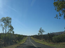
Namatjira Drive
| Namntjira Drive | |||||||||||||||||||
|---|---|---|---|---|---|---|---|---|---|---|---|---|---|---|---|---|---|---|---|

|
|||||||||||||||||||
| map | |||||||||||||||||||
| Basic data | |||||||||||||||||||
| Operator: | NT Roads | ||||||||||||||||||
| Start of the street: |
|
||||||||||||||||||
| End of street: |
west of Hermannsburg ( NT ) ( 23 ° 53 ′ S , 132 ° 23 ′ E ) |
||||||||||||||||||
| Overall length: | 157 km | ||||||||||||||||||
|
States : |
|||||||||||||||||||
| North of Gosses Bluff | |||||||||||||||||||
|
Course of the road
|
|||||||||||||||||||
The Namatjira Drive is a tourist road in the south of the Australian Northern Territory . It runs through the western MacDonnell Ranges, west of Alice Springs . Like Larapinta Drive , from which it branches off, it is part of the Red Center Way . The name Namatjira refers to Albert Namatjira (1902–1959), one of the most famous Aboriginal painters , who was born in Hermannsburg .
course
The initially paved, two-lane road branches 46 kilometers west of Alice Springs from Larapinta Drive (S2 / S6), takes the name State Road 2 and runs about 30 kilometers north of this near the main ridge of the MacDonnell Ranges, for the most part the area of West MacDonnell National Park . From the Glen Helen Resort the road is unpaved and continues west to Mount Zeil , the highest peak in the Northern Territory. There it turns south and meets Larapinta Drive again 43 kilometers west of Hermannsburg.
The highest point on the highway is 815 m , the lowest is 621 m .
Web links
source
Steve Parish: Australian Touring Atlas . Steve Parish Publishing. Archerfield QLD 2007. ISBN 978-1-74193-232-4 . P. 100
Individual evidence
- ↑ maps.bonzle.com - Namatjira Drive . Retrieved April 19, 2012.


