
Spratly Islands
![]() Map with all coordinates: OSM | WikiMap
Map with all coordinates: OSM | WikiMap
| Spratly Islands | |
|---|---|
| Geographical location | 8 ° 55 ' N , 113 ° 30' E |

|
|
| Chinese name | |
| Pinyin | Nánshā Qúndǎo |
| Abbreviation | 南沙群岛 |
| Long characters | 南沙群島 |
| Literal translation | Southern sand archipelago |
| Filipino / Tagalog name | |
| Filipino alphabet | Kapuluan ng Kalayaan |
| Literal translation | Freedom Archipelago |
| Malay name | |
| Latin alphabet | Kepulauan Spratly |
| Literal translation | Spratly Islands |
| Vietnamese name | |
| Vietnamese alphabet | Quầnđảo Trường Sa |
| Chữ Nôm | 群島 長沙 |
| Literal translation | Long sand archipelago |
.jpg)
  | |
Location of the Spratly Islands |
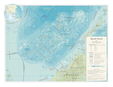
The Spratly Islands are a group of islands in the South China Sea .
The over 100 widely scattered reefs , atolls and small islands , the largest of which is Taiping Dao, covers an area of almost 0.5 km², are controversial between six states and are a political factor of uncertainty for Southeast Asia . The Republic of China , Vietnam and the People's Republic of China each lay claim to the entire archipelago, while Brunei , Malaysia and the Philippines each claim part of the islands. All of these states, with the exception of Brunei, occupy some of the islands, and there are military garrisons on over 40 of the otherwise uninhabited islands .
The interest in the Spratly Islands is partly explained by their strategic location on one of the world's most important shipping routes . In addition, some major oil and gas deposits are suspected here.
geography
The archipelago extends from WSW to ONO for around 1000 km. The nearest islands are about 420 km from Vietnam in the northwest, 160 km from Malaysia ( Sarawak Province ) in the southeast, 80 km from the Philippines in the southeast ( Palawan Island ), 900 km from the People's Republic of China ( Hainan Island ) in the north and from of the Republic of China (Taiwan) in the northeast over 1300 km.
The climate is tropical, the islands are flat, the highest point is 4 m on Southwest Cay.
history
Both Vietnam and China point to their archaeological finds on the archipelago. The first use is still controversial.
The name Spratly Islands goes back to Richard Spratly, a British captain who sighted one of the islands in 1843. In 1864, some Spratly Islands were captured as British territory by a British warship . As a result, the former colonies of Malaysia and Brunei also lay claim to some southern islands.
From 1933 to 1955, France claimed the islands as part of its Indochina colonies .
Before the outbreak of World War II the occupied Japanese Navy the islands in April 1939 and built on the largest island Taiping Island a submarine - Base . After Japan surrendered in 1945, the country had to renounce the Spratly Islands in the 1951 peace treaty of San Francisco . France as a colonial power in Indochina would have become the owner of the islands again. In the course of the defeat of the Kuomintang under Chiang Kai-shek on the Chinese mainland and the retreat to Taiwan , some Spratly Islands were occupied, including Taiping Dao. It is still under the control of the Republic of China to this day. In return, the People's Republic of China claimed the islands in 1951. After the defeat of the French in the Indochina War , France renounced the islands. Both North and South Vietnam made claims but did not occupy any of the islands.
In 1968 a Filipino businessman claimed some islands as private property, which resulted in the military occupation of eight islands by Filipino troops .
During the Vietnam War , all islands were assigned to the South Vietnamese province of Phước Tuy , based in Vũng Tau , by government decree in 1973 . In 1974 some islands were occupied by South Vietnamese troops , which led to a diplomatic crisis with the People's Republic of China. After the reunification of Vietnam in 1976, socialist Vietnam confirmed its claims to the archipelago.
In 1978 the Philippine government under President Ferdinand Marcos declared around 60 percent of the islands west of Palawan to be Philippine territory.
From 1980, the leadership of the People's Republic of China decided to directly occupy some Spratly Islands. For this purpose, the People's Liberation Army set up an amphibious marine corps and carried out more sea maneuvers. The PR China also increased its influence in the region by commissioning UNESCO to conduct marine research in this island region.
The presence of the Chinese Navy near the islands claimed by Vietnam led to serious clashes between the two countries. In a sea battle near Johnson Reef in 1988, the Chinese Navy sank two Vietnamese armed transport ships and damaged a landing craft so badly that it had to be abandoned on Guihan Jiao. The Vietnamese Navy had 64 soldiers killed and nine injured, the Chinese Navy six dead and 18 wounded. The Chinese navy occupied seven Spratly Islands with military units, some permanently. The Vietnamese islands in the immediate vicinity were also supposed to be blocked by the Chinese navy, but this was not successful in the long term.
China then set up a military base on Fiery Cross Reef . Sand heaps take place here; Since 2014, two runways have been built, which in April 2015 were interpreted on satellite images as a runway with an area of 505 m × 53 m and development potential over a length of 3000 m and a parallel parking area for aircraft.
China put two lighthouses on the disputed islands in the South China Sea into operation in October 2015 and is likely to plan to build more. After a US military ship sailed the waters around one of the islands occupied by the People's Republic of China, which is not recognized as Chinese by the other neighboring countries, the head of the Chinese Navy, Admiral Wu Shengli , warned the US via video conference with his US colleague Admiral John Richardson before carrying out "further provocations" as "one small incident could lead to war". According to Deputy Foreign Minister Liu Zhenmin , the People's Republic of China does not want to take part in an arbitration that the Philippines has initiated before the International Court of Justice in The Hague.
In 1990 the Malaysian armed forces occupied three islands in the south.
From 1995 onwards, the People's Republic of China also extended its claims to the Mischief Reef claimed by the Philippines . From a Chinese perspective, the entire archipelago is part of the Hainan Province . According to the US, up to 1,000 People's Liberation Army soldiers are said to be stationed on some of the ten islands occupied by China. With the outbreak of the financial and economic crisis in the summer of 1997 , China took advantage of the weakened positions of the ASEAN states by trying again to create a fait accompli step by step below the threshold of an open outbreak of military conflict.
Since 2014, China has been pouring sand on various reefs, building a 3000 m long runway and other facilities. These artificial island extensions could be part of a Chinese strategy that the American Admiral Harry B. Harris described as the "new Chinese sand wall".
In 2002, rules of conduct for free shipping were agreed.
In April 2018, China deployed missiles and cruise missiles on Fiery Cross, Subi and Mischief. Donald Trump's White House spokeswoman Sarah Huckabee Sanders then threatened China with short-term and long-term consequences.
Current control
Most of the islands are only a few hectares in size and can only be supplied by helicopter or small boats.
Vietnam


Vietnam occupies most of the Spratly Islands, especially islands in the west, south, north, and central area. Vietnam controls a total of six islands, 16 reefs and six sandbanks. Vietnamese soldiers are stationed on the islands . The islands controlled by Vietnam are:
- Đảo Trường Sa ( Spratly Island ) is the fourth largest of the Spratly Islands with 15 hectares and the main island of the Vietnamese Spratlys. There is a small airfield here .
- Đảo Song Tử Tây ( Southwest Cay ) is the sixth largest of the Spratly Islands with an area of 12 hectares .
- Đảo Sinh Tồn ( Sin Cowe Island ), 8 ha.
- Đảo Sơn Ca ( Sand Cay ), 7 ha.
- Đảo Nam Yết ( Namyit Island ), 5 ha.
- Đảo An Bang ( Amboyna Cay ), 1.6 ha. The Vietnamese Navy maintains a lighthouse here.
Republic of China (Taiwan)
The Republic of China has set up a permanent military base with a long runway on Taiping Dao (太平 岛 / Itu Aba) (46 ha). This largest natural of all the Spratly Islands is located in the north central area and is populated by 600 soldiers . Taiwan also controls the Zhongzhou Reef (中洲 礁 / Central Reef), about 5 km east of Taiping Dao. Both islands belong to the Tizard Bank (郑 和 群 礁). On January 28, 2016, Taiwanese President Ma Ying-jeou paid a brief visit to Taiping / Itu Aba Island (the first visit after eight years in office). The United States criticized the visit as "extremely unhelpful" . The People's Republic of China and Vietnam were also critical.
People's Republic of China

From the People's Republic of China , the Spratly Islands are included in the district-free city of Sansha . Administratively, they form the "hypothetical large community" Yongshu Jiao (永 暑 礁 虚拟 镇) in Sansha , which is made up of the "hypothetical community" Yongshujiao (永 暑 礁 虚拟 社区) on Yongshu Jiao and the village of Meiji (美 济 村) on Meiji Jiao composed.
The People's Republic of China currently controls the following 21 formations (reefs, banks and islands):
- Yongshu Jiao (永 暑 礁 / Fiery Cross Reef, 8,080 m², 9 ° 35 ′ N , 112 ° 58 ′ E ): rocks up to a height of 1 m above sea level (at high tide), but artificially developed; Guano deposits, naval surveillance base, artificially created military port , plantings of coconut palms , banyan trees and conifers, since 2011 the seat of the high command of the Chinese naval forces in the Spratly Islands area, equipped with facilities for data transmission via satellite, radar systems, artillery and several machine gun bases. Sand fillings, from 2014 construction of an airplane runway, which in April 2015 reached a length of 505 m and has the potential to expand to 3000 m. By February 2015, the area of the artificial island had grown to 230 hectares and exceeded the largest natural Spratly island Taiping Dao by five times;
- Banlu Jiao (半路礁/ Hardy Reef, 10 ° 8 ' N , 116 ° 8' O );
- Banyue Jiao (半月 礁 / Half Moon Shoal, 8 ° 52 ′ N , 116 ° 16 ′ E ): Atoll, the reefs of which rise to over 3 m above sea level in the southeast; In 1987 an exploration team visited the island and erected a stone pillar with Chinese emblems, which were removed by the Philippine Navy in 1995 ; in July 2012, the Chinese Navy regained control of the atoll;
- Lusha Jiao (禄 沙 礁 / Hopps Reef, 10 ° 15 ′ N , 115 ° 22 ′ E );
- Meiji Jiao (美 济 礁 / Mischief Reef, 9 ° 54 ′ N , 115 ° 32 ′ E ): The reef consists of some rocks that protrude slightly from the water, but have been expanded; In 1995 shelters for fishermen were built, in 2000 some military installations were built, since 2007 an economically used fish and shrimp farm has been operated and since 2011 there are 13 multi-storey buildings with a permanent stationing of 50 Chinese marines; on December 5, 2012 53 fishermen were used as permanent civilian population settled and the “village of Meiji” (美 济 村) founded, nearly a hundred more houses as accommodation for civilians are under construction;
- Pengbo Ansha (蓬勃暗沙/ Bombay Shoal, 9 ° 27 ' N , 116 ° 56' O ) protrudes Atoll with about 2 km in diameter, the reef at low tide from the water;
- Ren'ai Jiao (仁爱 礁 / Second Thomas Shoal, 9 ° 43 ′ N , 115 ° 53 ′ E );
- Sanjiao Jiao (三角礁/ Livock Reef, 10 ° 11 ' N , 115 ° 18' O );
- Wufang Jiao (五方礁/ Jackson Atoll, 10 ° 29 ' N , 115 ° 45' O );
- Xian'e Jiao (仙娥 礁 / Alicia Annie Reef, 9 ° 21 ′ N , 115 ° 26 ′ E );
- Xinyi Jiao (信义 礁 / First Thomas Shoal, 9 ° 20 ′ N , 115 ° 57 ′ E );
- Zhubi Jiao (渚 碧 礁 / Subi Reef, 10 ° 55 ′ N , 114 ° 5 ′ E ): The reef actually only protrudes from the water at low tide, but the Chinese Navy built on it with several three-story buildings; were further Kai Equipment and a helipad set;
- in the Jiuzhang Qunjiao (九章 群 礁 / Union Banks and Reefs):
- Anle Jiao (安乐礁/ Hallet Reef, 9 ° 56 ' N , 114 ° 31' O );
- Chigua Jiao (赤 瓜 礁 / Johnson South Reef, 9 ° 43 ′ N , 114 ° 17 ′ E ): In 1988 there was a bloody battle against Vietnamese troops here; the reef has been protected by an artificial dam since 1990; it iscompletely floodedat spring tide , at normal tide numerous rock peaks protrude clearly from the water; Quayside facilities and other fortifications as well as a permanently manned base of the Chinese Navy have now been built on these; in May 2014 a land area of around 11 hectares was filled up;
- Dongmen Jiao (东门 礁 / Hughes Reef, 9 ° 55 ′ N , 114 ° 30 ′ E ): The reefs of the atoll only protrude slightly above the water surface in a few places at low tide; there are smaller superstructures (stilt houses) of the Chinese Navy that are constantly manned;
- Niu'e Jiao (牛 轭 礁 / Whitsun Reef, 9 ° 58 ′ N , 114 ° 37 ′ E );
- Ximen Jiao (西门礁/ McKennan Reef, 9 ° 54 ' N , 114 ° 28' O );
- Zhuquan Jiao (主权礁/ Empire Reef, 9 ° 57 ' N , 114 ° 35' O );
- to Zhenghe Qunjiao (郑 和 群 礁 / Tizard Bank):
- Anda Jiao (安达礁/ Eldad Reef, 10 ° 21 ' N , 114 ° 42' O );
- Nanxun Jiao (南薰 礁 / Gaven Reef North, 10 ° 12 ′ N , 114 ° 13 ′ E ): The two reefs of the atoll do not protrude above the water surface at high tide; there are several multi-story structures (stilt houses) of the Chinese Navy, which are permanently manned and armed with anti-aircraft guns and artillery; In addition, there are extensive search radar and radio systems; since March 2014, an island with an area of around 18 hectares has been raised through land reclamation measures;
- in the Yinqing Qunjiao (尹 庆 群 礁 / London Reefs):
- Cuarteron Reef (华阳礁/ Cuarteron Reef, 8 ° 53 ' N , 112 ° 51' O ): In addition to protrude a few rocks in the north, the flood 1.2-1.5 m in from the water, the atoll is only seen at low tide; there are quays and some structures (stilt houses) of the Chinese Navy, which are constantly manned and armed with anti-aircraft guns and artillery; In addition, there are extensive search radar and radio systems, land reclamation measures began here in March 2014, and an island with an area of 25 hectares has now been raised.
In April 2018, the People's Republic of China deployed missile systems on three of the islands (Fiery Cross Reef, Subi Reef, Mischief Reef).
Philippines
The northern part is assigned to the Philippines . Around 200 civilians have been settled on the island of Thitu (Pagasa) (size 32 ha) since 1978, officially belonging to the Kalayaan municipality , which also includes six uninhabited islands and a reef. There is also a military base with an airfield. The Philippine Army maintains few soldiers on West York Island (Likas) (19 ha), on Northeast Cay (Parola) (13 ha), on Nanshan (Lawak) (8 ha) and Loaita (Kota) (6 ha).
The old landing ship Sierra Madre has been aground as a military post on the Ayungin Shoal reef (Second Thomas Shoal) since 1999 .
Malaysia
In addition to Terumbu Layang-Layang (also called Swallow Reef or Danwan Jiao弹丸 礁), Malaysia also controls Terumbu Ubi ( Ardasier Reef ), Terumbu Laya ( Dallas Reef ), Terumbu Siput ( Erica Reef ), Terumbu Peninjau ( Investigator Shoal ) and Terumbu Mantanani ( Mariveles Reef ). A signal was erected on Terumbu Semarang Barat Besar ( Royal Charlotte Reef ).
Brunei
Terumbu Semarang Barat Kecil , also known as Louisa Reef , was controlled by Malaysia until 2013, which then gave up its claims in favor of Brunei.
literature
- Bob Catleya, Makmur Keliat: Spratlys. The dispute in the South China Sea. Ashgate, Aldershot 1997, ISBN 1-85521-995-6 .
- Kay Möller: The Foreign Policy of the People's Republic of China 1949-2004: An Introduction. VS Verlag für Sozialwissenschaften, Wiesbaden 2005, ISBN 3-531-14120-1 .
- Marwyn S. Samuels: Contest for the South China Sea. Methuen, New York 1982, ISBN 0-416-33140-8 .
- Hans Scheerer, Patrick Raszelenberg: China, Vietnam and the territorial claims in the South China Sea. Institute for Asian Studies, Hamburg 2002, ISBN 3-88910-270-0 . (updated 2004)
- Olaf Schwennesen: China is going to sea. The Spratly Islands as a source of conflict in the South China Sea. Lang, Frankfurt a. M. 1996 (Kieler Schriften zur Politischen Wissenschaft, Volume 8), ISBN 3-631-30737-3 .
- Guiqin Wang: Territorial Disputes in the South China Sea. With particular reference to the status of the Spratly Islands. Tectum, Marburg 2005, ISBN 3-8288-8877-1 .
Web links
- The Spratly Islands at GlobalDefence.net
- The race of the Southeast Asian states for the Spratly Islands on the homepage of Wolfgang Bethge.
- Transcend Research Institute Paper 4: Spratly Islands (PDF file, 484 kB)
- Digital Gazetteer of the Spratly Islands
Individual evidence
- ↑ Run on the isles / key issue of raw materials. Dispute over the islands in the South China Sea . Junge Welt , July 2012, accessed June 17, 2020 .
- ↑ China creates facts in island dispute: Assumptions confirmed. In: orf.at , April 17, 2015.
- ↑ China put lighthouses on disputed islands into operation. In: orf.at , October 11, 2015.
- ↑ China's naval chief warns USA of war. In: orf.at , October 30, 2015.
- ↑ China is building an artificial island in the South China Sea. In: Spiegel online. November 28, 2014.
- ↑ Joseph S. Nye: China's Resolute Reach for Reefs and Islands. In: The press . July 22, 2015, accessed December 18, 2015.
- ↑ USA threatens China in the dispute over the South China Sea: "There will be consequences" Focus May 4, 2018
- ↑ Taiwan's Ma Ying-jeou visits disputed South China Sea island. In: BBC News. January 28, 2016, accessed February 17, 2016 .
- ↑ Amanda M. Macias: China quietly installed missile systems on strategic Spratly Islands in hotly contested South China Sea cnbc.com, May 2, 2018, updated January 30, 2020, accessed June 16, 2020.
- ↑ Kirsty Needham: Confirmed: China has deployed missiles on the Spratly Islands watoday.com.au, May 4, 2018, accessed June 16, 2020.
- ^ Mark J. Valencia, Jon M. Van Dyke, Noel A. Ludwig: Sharing the Resources of the South China Sea. University of Hawaii Press, Honolulu 1997, ISBN 0-8248-1881-4 , p. 36. ( Preview in Google Book Search)