Niederlausitzer Landrücke Nature Park
| Niederlausitzer Landrücke Nature Park | ||
|---|---|---|
|
|
||
| Location: | Brandenburg , Germany | |
| Next city: | Luckau | |
| Surface: | 587 km² | |
| Founding: | September 9, 1997 | |
| Address: | Nature park administration Alte Luckauer Str. 1 |
|
| Former opencast mine near Fürstlich Drehna | ||
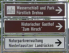
The Lower Lusatian Ridge Nature Park takes 580 square kilometers in area a central place among the eleven nature parks in Brandenburg one. The park is located west of the Spreewald in Niederlausitz . To the east it is bounded roughly on a line between the cities of Luckau and Calau , to the north by the course of the Dahme river , to the west it extends to just before the city of Dahme and to the south to Sonnewalde just before Finsterwalde . Well-known places in the nature park are Luckau and Fürstlich Drehna .
The Niederlausitzer Landrücke ridge emerged as a typical terminal moraine landscape at the end of the penultimate Ice Age , the Saale Ice Age . The north-west running Baruther glacial valley cut the so-called Lausitzer Grenzwall into the ridge as a striking geological symbol , which for Brandenburg standards slopes steeply to the glacial valley and forms a rich source area. To the northwest, the Niederlausitz ridge, interrupted by the Dahme valley, continues in the lower Fläming .
This nature park has its very own character, which is determined by an extensive lunar landscape with huge open- cast mines - the legacy of the former coal mining , which was discontinued around 1980. These opencast mining landscapes are located in the middle of the park and take up almost 7400 hectares of the total area.

In contrast to the barren sandy areas and gorges in the center, there are green meadows, fields, fish ponds, a Slavic castle complex, historic village centers, mansions all around . Watermills and rural parks in a lovely cultural landscape. In the north, agriculture dominates with extensive arable land , while in the south a large closed forest area: the Rochauer Heide , which, along with other now rare animals, is home to the rough-owl , which serves as the logo of the nature park.
The lunar landscape of the former open-cast mine, which may seem repulsive at first glance, has a special meaning for nature lovers and even more so for nature conservation , which only becomes apparent at second glance. Some areas remained without any human intervention for more than two decades, resulting in unique biotopes . With the rise of the groundwater and partly through a water supply through the Spree , extensive swamp areas and lakes form, for example the 700 hectare Schlabendorfer See . In the final stage of development, the water will cover a total area of around 1400 hectares. The mining lakes are already among the largest crane gathering and resting places in Germany.
The total natural water landscapes and succession areas such as around 50 hectares of dunes on Schlabendorfer lake bring a flora and fauna out that might arise in Germany than in any other environment like this: In yet sparse vegetation specialists conquer such Wiener tiger beetles , sand cricket , earwig , gyroscope wasp , Blue-winged wasteland hedge and fire-bellied toad new habitats; Little ringed plover , wheatear , lapwing , various types of duck and the largest black-headed gull colony in Brandenburg are already at home. Sielmann's natural landscape, Wanninchen, as part of the Heinz Sielmann Foundation , has acquired over 3,200 hectares of land from the former opencast mines since 2000 in order to preserve rare plants and animals permanently. In the Gehrener Mountains (municipality of Heideblick ) there is a 20 cubic meter giant boulder from the Ice Age, the largest boulder in southern Brandenburg. At Zinnitz, a nature trail leads to around 350 rocks of various compositions that were brought to the surface by mining and left behind from the Ice Age.
In the middle of 2003 there were around 50 kilometers of circular cycle paths through the former mining areas, which turn green astonishingly quickly with lichens , mosses , bushes and giant horsetail .
More Attractions
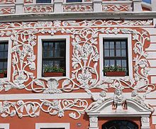
- Princely Drehna , historic town center, moated castle with landscape park to Lenné
- Zinnitz Castle and Park , a rare example of the Schinkel style in the region
- Luckau , the pearl of Lower Lusatia with medieval city wall , Gothic Nikolaikirche; City of the State Garden Show 2000
- Calau Switzerland , a nature reserve with almost alpine terrain by Brandenburg standards
- Crinitz pottery village
- Slavic ramparts near Freesdorf
- Lookout tower at Borcheltsbusch - crane is racing
- Altdöbern Castle , one of the most important castles of the Saxon Rococo
- Höllberghof of the Nature Park Association, a place of rural customs
See also: Tourism in Brandenburg , cycle routes in Brandenburg
Footnotes and individual references

- Berlin-Brandenburger Naturmagazin, Ed .: NABU Berlin, NABU Brandenburg u. a., issue 3/2003
- Nature magazine Berlin, Brandenburg, Mecklenburg-Western Pomerania, publisher: NABU Berlin, NABU Brandenburg u. a., issue 2/2004
Web links
- Niederlausitzer Landrücke Nature Park. (No longer available online.) Ministry for Rural Development, Environment and Consumer Protection of the State of Brandenburg, archived from the original on February 7, 2008 .
- Nature watch large protected areas: Nature watch. (No longer available online.) Formerly in the original
- Niederlausitzer Landrücke Nature Park. (No longer available online.) Regional portal Cottbus and surroundings formerly in the original


