
Aust-Agder
| coat of arms | map |
|---|---|

|
 .svg) |
| Basic data | |
| Country : | Norway |
| Administrative center : | Arendal |
| Area : | 9,158.76 km² |
| Residents : | 117,655 (February 27, 2020) |
| Population density : | 12.4 inhabitants / km² |
| Municipalities : | 15th |
| ISO 3166-2 | NO-09 |
| Fylkesstein : | Grimstad granite |
| politics | |
| Fylkesordfører : | Laila Øygarden |
| Fylkesmann : | Hjalmar Inge Sunde |
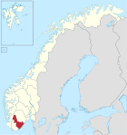
Aust-Agder (German East Agder ) was a province ( Fylke ) in Norway and belonged to the part of Sørlandet . It had a total area of 9,158 km² (of which a land area of 8,314 km²). To the east was Fylke Telemark on Skagerrak near Gjernestangen between Kragerø and Risør. In the west, Vest-Agder was along the Kvåsefjord between Lillesand and Kristiansand . Rogaland was also to the west, north of Vest-Agder . Aust-Agder was the eastern part of the historical Agder Province . The Agder at that time roughly corresponds to the current Fylke Agder.
Before the reform of 1919, the province was called Nedenes amt (also Nedenæs ) and was divided into the two bailiwicks of Nedenes and Robygdelaget (or Råbyggelaget ). Nedenes was the name of a homestead on the Nid River that served as the seat of the bailiff.
On January 1, 2020, Aust-Agder merged with Vest-Agder to form the new Fylke Agder. The basis for the merger was a resolution of the Storting on June 8, 2017, which provided for a reduction to eleven areas as part of a regional reform .
The capital of the province was the city of Arendal ; the most important and longest river was the Otra with a length of 245 km .
coat of arms
Description of the coat of arms : Two gold bars in red .
Municipalities
Aust-Agder divided into 15 municipalities:
|
|

Web links
- Aust-Adger on snl.no in the store norske leksikon
- Political structure on reuber-norwegen.de
- Aust-Agder Fylke kommune on aa-f.kommune.no
- Photo gallery on reuber-norwegen.de
Individual evidence
- ↑ Nye fylker on www.regjeringen.no, accessed on January 3, 2020
- ↑ https://www.ssb.no/statistikkbanken Statistics on ssb.no (Norwegian)
Agder |
Inlandet |
Møre og Romsdal |
Nordland |
Oslo |
Rogaland |
Troms and Finnmark |
Trøndelag |
Vestfold and Telemark |
Vestland |
Viken
former:
Akershus |
Aust-Agder |
Mountains |
Buskerud |
Finnmark |
Hedmark |
Hordaland |
North Trøndelag |
Oppland |
Rogaland |
Sogn og Fjordane |
Sør-Trøndelag |
Telemark |
Troms |
Vest-Agder |
Vestfold |
Østfold
outer areas:
Jan Mayen |
Spitsbergen
Coordinates: 58 ° 46 '12 " N , 8 ° 10' 48" E