
Nonnenbach (Lake Constance)
|
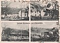
Nonnenbach near Dentenweiler: Butzenbach |
||
 Nonnenbach, below the Nonnenbach School in Kressbronn |
||
| Data | ||
| Water code | DE : 215194 | |
| location | District of Ravensburg , Lindau , Lake District | |
| River system | Rhine | |
| Drain over | Rhine → North Sea | |
| source | at Achberg - Isigatsweiler 47 ° 37 '34 " N , 9 ° 43' 22" O |
|
| Source height | approx. 530 m above sea level NN | |
| muzzle | in Kressbronn in Lake Constance Coordinates: 47 ° 35 ′ 13 ″ N , 9 ° 35 ′ 14 ″ E 47 ° 35 ′ 13 ″ N , 9 ° 35 ′ 14 ″ E |
|
| Mouth height | 395 m above sea level NN | |
| Height difference | approx. 135 m | |
| Bottom slope | approx. 8 ‰ | |
| length | 16.8 km | |
| Catchment area | 26.204 km² | |
| Right tributaries | Fallenbach | |
| Small towns | Lindau | |
| Communities | Achberg , Wasserburg , Kressbronn | |
The Nonnenbach is a nearly 17 km long, a total of about west-southwest of ongoing tributary of Lake Constance in Kressbronn in Baden-Württemberg Bodenseekreis . Its name is derived from the old German word Ungenbach = Unkenbach .
course
The stream rises southwest of the village of Isigatsweiler, which belongs to the municipality of Achberg, and initially flows in a southwestern direction, past Siberatsweiler , Rudenweiler , Saßenweiler , Dentenweiler , Rengersweiler and Hörbolz . From Bechtersweiler and passing under the federal highway 31, it flows - forming the municipalities ( Wasserburg districts Hengnau and Selmnau - Kressbronn ) and the state border (Bavaria – Baden-Württemberg) - in a westerly direction to Kressbronn on Lake Constance. Past the districts of Krummensteg and Arensweiler, the Nonnenbach flows through the center of Kressbronn and finally flows into Lake Constance at the lido.
In old maps, the Nonnenbach in the middle course is also referred to as Gränzbach or Grenzbach .
On the way to the mouth, the stream is consistently accompanied by lush bank vegetation, mainly alder , ash and willow . It largely crosses small forests and agricultural land. The roots of the trees, some of which protrude into the stream, provide a habitat for young fish and small organisms such as river flea shrimp .
Tributaries
From the source to the mouth, the Nonnenbach takes in the following tributaries in addition to many unnamed streams:
- Outflow of the Hermannsberger Weiher (l), near Rudenweiler
- Drainage of the Degersee (r), near Hörbolz
- Ditch from the Burgstallmoos (l), northwest of Hengnau
- Fallenbach (r), center of Kressbronn
use
tannery
A tannery was once operated on what is now the green space on Kressbronner Hauptstrasse . To water the hides and skins, the tanner needed a lot of water that was taken from the Nonnenbach. The wastewater reached Lake Constance unhindered and treated with the Nonnenbach.
Mills
Four mills are or were operated on the course of the Nonnenbach . The Martinsmühle is located just outside of Bechtersweiler ; electrical energy is still generated here with the help of water power. In the municipality of Kressbronn, the water of the Nonnenbach used to drive three mills. The upper , middle and lower mill are still there, the middle mill is still in operation. A street name, a weir system and the former mill pond bear witness to the Untermühle - its history can be traced back to around 1400.
Obermühle
postcard around 1906
Obermühle
millstone
Lower mill
outlet weir
Untermühle
Weiher, today LSG
Under mill

Untermühle
millstone


Protected areas
FFH area
The mouth of the nuns Bach it is part of the reported on 1 January 2005, a total of 1,363.4 hectares large FFH area " Bodenseeufer landscape east Friedrichshafen " (SG no. DE8423341).
Landscape protection areas
In the area northeast of the center of Kressbronn, the valley of the Nonnenbach is part of the landscape protection area " Lake District and Hügelland south of the Argen and Nonnenbachtal " (SG number 4.35.034, total 968 hectares) designated by ordinance of June 19, 1986 of the Tübingen regional council. In the estuary area, the Nonnenbach is part of the 35.3 hectare protected landscape area " Württembergisches Bodenseeufer " (SG-No. 4.35.001) , which was designated on April 13, 1940 .
Biotopes
- Explanation
- SG no. : Protected area number according to the State Institute for the Environment, Measurements and Nature Conservation Baden-Württemberg (LUBW) and Environmental Object Catalog Bavaria (UOK)
- Name : official name of the biotope according to LUBW and UOK
- Location : City, municipality or district that is closest to the respective biotope
- Location : "Gm." = District ; "Gw." = Won ; "Fs." = Parcel
- Ko. : Indication of the geographical coordinates of the respective biotope; linked, opens card
- Natural area : "WA" = West Allgäu hill country ; "BB" = Lake Constance basin
- Size : Area in hectares (1 hectare = 10,000 m²) of the respective biotope
- Recording : Date of the respective recording
- Comments : Descriptions etc. of the respective biotope
- Image : Photo of the respective biotope
Achberg and Tettnang
The following biotopes are identified along the Nonnenbach in the Achberg municipality and Tettnang urban area from the source to the state border to Bavaria :
| SG no. | Surname | place | location | Ko. | Natural space | Size [ha] | Capture | Remarks | image |
|---|---|---|---|---|---|---|---|---|---|
| 183244360356 | Wetland south of Duznau | Duznau | Gm. Achberg |
|
WA | 0.5029 | 05/24/1995 | Wet meadow, pipe grass litter meadow and land reed beds | |
| 183244360440 | Humid bushes northeast of Siggenreute | Siggenreute | Gm. Achberg |
|
WA | 0.0420 | 06/23/1995 | Ash willow and ear willow damp bushes | |
| 183244360423 | Field trees south of Duznau | Duznau | Gm. Achberg |
|
WA | 0.0700 | 05/23/1995 | Field wood with black alder and purple willow | |
| 183244360358 | Wetland at Königsbühl | Siberatsweiler | Gm. Achberg |
|
WA | 0.1495 | 05/15/1995 | Land reed and Steifseggen reed | |
| 183244360425 | Field trees east of Siberatsweiler | Siberatsweiler | Gm. Achberg |
|
WA | 0.2171 | 05/24/1995 | Field wood with silver birch and single hawthorn | |
| 183244360422 | Reeds southwest of Siberatsweiler | Siberatsweiler | Gm. Achberg |
|
WA | 0.2516 | 05/22/1995 | two sub-areas with land reeds and bushes in damp locations | |
| 183244360458 | Reed stocks southwest of Siberatsweiler | Siberatsweiler | Gm. Achberg |
|
WA | 0.0500 | 08/10/1995 | two sub-areas with reed beds and bank reed beds | |
| 183244356595 | Wetland complex 'Graben' northeast of Rudenweiler | Rudenweiler | Gm. Langnau |
|
WA | 1.8439 | 05/24/1995 | Pipe grass litter and wet meadow, land reeds, reeds and bank reeds | |
| 183244356586 | Alluvial forest on the Butzenbach west of Dentenweiler | Dentenweiler | Gm. Langnau |
|
WA | 0.1308 | 05/23/1995 | A riparian forest strip that accompanies the water and is six meters wide on average |
Lindau
The following biotopes are identified along the Nonnenbach in Lindau's urban area in the area of the villages of Rengersweiler , Hörbolz and Bechtersweiler up to the state border to Baden-Württemberg:
| SG no. | Surname | place | location | Ko. | Natural space | Size [ha] | Capture | Remarks | image |
|---|---|---|---|---|---|---|---|---|---|
| 8324-0004-001 | Nonnenbach sections near Rengersweiler | Rengersweiler | Gm. Unterreitnau |
|
WA | 0.5373 | 07/16/1997 | two partial areas; Bank trees and forests on natural and near-natural flowing water | |
| 8324-0003-002 | Larger and smaller residual moisture areas east and north of Rengersweiler | Rengersweiler | Gm. Unterreitnau |
|
WA | 0.7905 | 07/16/1997 | four partial areas; Sedge and rushed meadows, wet meadows, tall herbaceous meadows and Großseggenried | |
| 8324-0124-001 | Straightened section of the “Nonnenbach” south-east of Rengersweiler | Rengersweiler | Gm. Unterreitnau |
|
WA | 0.1497 | 07/16/1997 | Large reed, accompanying wood, tall herbaceous meadow and wet meadow | |
| 8323-0011-002 or 001 | Edges of wood on the Nonnenbach east of Hörbolz |
Drought Hörbolz |
Gm. Unterreitnau |
|
WA | 0.0281 | 07/16/1997 | two partial areas; Shore wood with gray and black alder on natural flowing water | |
| 8323-0010-001 | Straightened Nonnenbach sections southeast and south of Hörbolz | Hörbolz | Gm. Unterreitnau |
|
WA | 0.2653 | 07/16/1997 | two partial areas; Large reed beds and silted up vegetation on a ditch up to two meters wide with rapid water flow averaging 80 centimeters deep |
 |
| 8423-0006-001 | Moist complex on the Nonnenbach east of Bechtersweiler | Bechtersweiler | Gm. Unterreitnau |
|
WA | 0.2542 | 07/18/1997 | Seggenried and Nasswiese on the Nonnenbach, which was laid here because of a Mühlgraben junction on the west side of a narrow passage between two drumlins | |
| 8423-0007-001 | Nonnenbach sections near Martinsmühle southeast of Bechtersweiler | Bechtersweiler | Gm. Unterreitnau |
|
WA | 0.6626 | 07/18/1997 | one of two sub-areas with riparian wood, tall herbaceous vegetation and sedge meadows on near-natural flowing water | |
| 8423-0007-002 | Nonnenbach sections near Martinsmühle southeast of Bechtersweiler | Bechtersweiler | Gm. Unterreitnau |
|
WA | 0.2190 | 07/18/1997 | one of two sub-areas with riparian wood, tall herbaceous vegetation and sedge meadows on near-natural flowing water | |
| 8423-0011-001 | Nonnenbach sections from Bechtersweiler to southwest Rickatshofen |
Bechtersweiler Rickatshofen |
Gm. Unterreitnau |
|
WA | 0.2768 | 07/18/1997 | one of two sub-areas with riparian wood, underwater and floating leaf vegetation on near-natural flowing water |
 |
| 8323-0006-001 | Section of the Nonnenbach west of Bechtersweiler | Bechtersweiler | Gm. Unterreitnau |
|
WA | 0.4517 | 07/22/1997 | Wood on the banks of the near-natural stream | |
| 8423-0011-001 | Nonnenbach sections from Bechtersweiler to southwest Rickatshofen |
Bechtersweiler Rickatshofen |
Gm. Unterreitnau |
|
WA | 1.4995 | 07/18/1997 | one of two sub-areas with riparian wood, underwater and floating leaf vegetation on near-natural flowing water |
Kressbronn
The following biotopes have been identified along the Nonnenbach in the Kressbronn municipality up to the confluence with Lake Constance:
| SG no. | Surname | place | location | Ko. | Natural space | Size [ha] | Capture | Remarks | image |
|---|---|---|---|---|---|---|---|---|---|
| 184234353030 | Wetland 'Ellenhalde' east of Kümmertsweiler | Kümmertsweiler | Gm. Kressbronn Gw. Ellenhalde |
|
WA | 0.3529 | 06/20/1996 | Wetland in the floodplain of the Nonnenbach with wet meadows and reed beds | |
| 184234353023 | Nonnenbach with riparian forest strips southeast of Kümmertsweiler | Kümmertsweiler | Gm. Kressbronn Gw. Wiesenreute |
|
WA | 0.5532 | 06/20/1996 | two partial areas; Near-natural brook over a length of around 1.5 kilometers |
 |
| 184234353029 | Wet meadow 'Ellenhalde' east of Kümmertsweiler | Kümmertsweiler | Gm. Kressbronn Gw. Ellenhalde |
|
WA | 0.4429 | 08/13/1996 | two partial areas; waterlogging wet meadow and bushes in damp locations | |
| 184234353028 | Wetland complex 'Ellenhalde' southwest. Kümmertsweiler | Kümmertsweiler | Gm. Kressbronn Gw. Ellenhalde |
|
WA | 0.9344 | 06/20/1996 | Large wetland in the floodplain of the Nonnenbach with land reeds, reed cane, field trees and wet meadow |
 |
| 184234353027 | Reeds 'Wiesenreute' southeast of Kümmertsweiler | Kümmertsweiler | Gm. Kressbronn Gw. Wiesenreute |
|
WA | 0.1909 | 06/20/1996 | three parts of land with reed stands in the floodplain area of the Nonnenbach | |
| 184234353024 | Wet meadow complex 'Wiesenreute' southeast of Kümmertsweiler | Kümmertsweiler | Gm. Kressbronn Gw.Wiesenreute Fs. 4818-4821 |
|
WA | 1.4078 | 06/20/1996 | three partial areas; Low moor with swamp and bladder sedge, wet meadow, field hedge, land reeds and reeds |
 |
| 284234350233 | Eastern Nonnenbach | Crooked bridge | Gm. Kressbronn Gw. Eggisholz |
|
WA | 2.1000 | 08/02/1989 | Forest biotope; three partial areas with a near-natural section of a lowland brook and black alder - ash forest | |
| 184234353020 | Nonnenbach with riparian forest strips southeast of Krummensteg | Crooked bridge | Gm. Kressbronn Gw.Krummensteg Fs. 6051 |
|
WA | 0.2768 | 06/21/1996 | Close-to-nature stream section, about 750 m long, with riparian forest strips and tall herbaceous meadows accompanying the water | |
| 184234353022 | 'Eggisholz' wetland south-east of Krummensteg | Crooked bridge | Gm. Kressbronn Gw.Krummensteg Fs. 4770 |
|
WA | 0.5429 | 06/21/1996 | Wetland with wet meadow, land reeds and reed beds | |
| 184234353021 | Wet meadow on Nonnenbach southeast of Krummensteg | Crooked bridge | Gm. Kressbronn Gw.Krummensteg Fs. 4770 |
|
WA | 0.2393 | 08/13/1996 | Species-poor wet meadow in the floodplain of the Nonnenbach, which is sometimes used as pasture in some areas |
 |
| 184234353019 | Wetland 'Unter dem Häldele' south of Poppis | Crooked bridge | Gm. Kressbronn Gm. Under the Häldele Fs. 4768 and 4770 |
|
WA | 0.5168 | 06/20/1996 | two partial areas with reed beds, seepage spring, swamp sedge reed and wet meadow |
 |
| 184234353018 | Nonnenbachschleife 'Unter dem Häldele' south of Poppis | Arensweiler , Krummensteg | Gm. Kressbronn Gw. Unter dem Häldele |
|
WA | 0.1962 | 08/13/1996 | Natural creek, cut around a meter deep | |
| 184234353015 | Field trees on the Nonnenbach near Obermühle | Obermühle | Gm. Kressbronn Gw.Butzenegert Fs. 5892/1 |
|
BB | 0.1230 | 08/15/1996 | Linear forest along the left, north-facing embankment of the straightened Nonnenbach | |
| 184234353014 | Alluvial forest on the Nonnenbach west of Obermühle | Obermühle | Gm. Kressbronn Gw. Obermühle Fs. 1140 |
|
BB | 0.0284 | 08/15/1996 | Old woody stock in the riparian forest strip |
 |
| 184234353013 | Near-natural Nonnenbach with wooded border west of Obermühle | Obermühle | Gm. Kressbronn Gm. Obermühle |
|
BB | 0.0200 | 08/15/1996 | Near-natural stream section with riparian forest strip that accompanies the water |
 |
| 284234350232 | Western Nonnenbach | Obermühle | Gm. Kressbronn Gw. Obermühle |
|
BB | 1.7000 | 08/02/1989 | Forest biotope; two partial areas with ravine , blade and near-natural section of a lowland brook | |
| 284234350231 | Bacheschenwald Nonnenbach | Middle mill | Gm. Kressbronn Gw. Mittelmühle and Gw. Mühlhalde |
|
BB | 1.7000 | 08/02/1989 | Forest biotope with a near-natural section of a lowland stream, reed beds and black alder - ash forest | |
| 184234353010 | Wetland 'Mittelmühle' east of Kressbronn | Middle mill | Gm. Kressbronn Gw. Mittelmühle Fs. 1126 |
|
BB | 0.4307 | 08/15/1996 | two partial areas; Wetland with wet meadow, land reed beds, swamp forest and swamp sedge reed | |
| 184234353011 | Alluvial forest strip on Mittelmühlenbach east of Kressbronn | Middle mill | Gm. Kressbronn Gw. Mittelmühle Fs. 1125 and 1126 |
|
BB | 0.0732 | 08/15/1996 | Riparian forest strip with sycamore maple and black alder | |
| 184234352997 | Nonnenbach with riparian forest in Kressbronn Ost | Kressbronn | Gm. Kressbronn Gw. Bochenloch |
|
BB | 0.7713 | 08/16/1996 | Near-natural section of the Nonnenbach with old trees in the riparian forest strip | |
| 184234352998 | Field wood 'Bochenloch' on the Nonnenbach near Kressbronn Ost | Kressbronn | Gm. Kressbronn Gw.Bochenloch Fs. 1114 and 1115 |
|
BB | 0.1473 | 08/15/1996 | Field trees on a steep south-facing slope with old, tall and dense trees | |
| 184234352999 | The 'Bochenloch' pond near Kressbronn | Kressbronn | Gm. Kressbronn Gw. Bochenloch |
|
BB | 0.0837 | 08/16/1996 | Silting area of a pond or the dammed canal to the former 'Untermühle' with diving / floating leaf vegetation and cane grass - reeds |
 |
| 184234352996 | Alluvial forest on the straightened Nonnenbach in Kressbronn | Kressbronn | Gm. Kressbronn Gw. Untermühle Fs. 458/1 and 907 |
|
BB | 0.0846 | 08/16/1996 | two sub-areas; Riparian forest strips shaped by ash along the river on both sides of the Nonnenbach, which has been straightened and fortified on the bank |
|
| 184234352976 | Alluvial forest on the Nonnenbach south of Kressbronn | Kressbronn | Gm. Kressbronn Gw. Brühl and Gw. Reid Fs. 1847 |
|
BB | 0.3390 | 08/28/1996 | ten sub-areas; tall, narrow strip of alluvial forest on both sides of the straightened Nonnenbach stream, which is fortified on the banks |
 |
| 184234352975 | Silver willow border on the Nonnenbach near the Bodan shipyard | Kressbronn | Gm. Kressbronn Fs. 1847 |
|
BB | 0.0213 | 08/29/1996 | Accompanying waters riparian forest strips along the left embankment of the strap on the banks nuns Bach with silver and break pastures | |
| 184234352969 | Wetland complex 'Boschach' west of the Kressbronn bathing area | Kressbronn | Gm. Kressbronn Gw. Boschach |
|
BB | 6.1779 | 06/18/1996 | Large wetland with marsh grass litter, field trees, reed beds, field hedge and wet bushes | |
| 184234352970 | Trees on the Nonnenbach near the Kressbronn lido | Kressbronn | Gm. Kressbronn Fs. 1765/1 and 1847 |
|
BB | 0.0613 | 08/29/1996 | Field hedge along the Nonnenbach with Norway and sycamore maple , silver , broken and purple willow | |
| 184234352966 | Natural shores of Lake Constance west of the Kressbronn lido | Kressbronn | Gm. Kressbronn Gw. Boschach |
|
BB | 1.7958 | 08/29/1996 | Flat shore zone of Lake Constance near the Nonnenbach estuary |
 |
Renaturation
In the winter and spring of 1996, work began in Kressbronn to renature the Nonnenbach, which had been partially built as a canal over thirty years earlier . Between Bodanstrasse and the confluence with Lake Constance, the solid brook bottom and the solid side walls were first removed. The subsequent dredging gave the stream more space and a slightly curved course. Small trees, bushes and reeds were planted. In the second section, the area above Bodanstrasse along Irisstrasse was renatured in 1998 . As a result of the work, the stream now has pools again , small gravel banks at low tide and an increased fish population.
bad luck
On July 21, 2004 a disaster occurred on the upper reaches of the Nonnenbach: When liquid manure was being pumped over, a pipe connection burst and many liters spilled into the creek and ultimately into Lake Constance. Due to the late arrival after 6 p.m. there was no need to issue a bathing ban. Numerous dead fish remained in the Nonnenbach: streams , minnows and brown trout - the former were on the red list of fish species in Baden-Württemberg - were wiped out, grayling , bullheads and other fish species were severely decimated.
The Nonnenbach in literature
The German writer Martin Walser (* 1927 in Wasserburg on Lake Constance) mentions the Nonnenbach both in his 1979 novel Seelenarbeit :
“He saw bends in the Nonnenbach, deep under the corner wood, litter meadows, alder trees. What dark resting places are created by the fact that the brook eats away the bank in places, but then has to leave it behind at the next group of alders. Pure dark mirrors emerge behind the root associations of such alder pulpits. (...) As a child, Xaver was often down by the Nonnenbach for days and preferred to bend over the quiet, dark spots in the bends in the brook. I reached in my arm and let it break from the water level. "
as well as in the 1998 novel Ein springender Brunnen
“... and from Hengnau to Kümmertsweiler it's a maximum of three kilometers. Beeline. In reality it goes uphill behind Hengnau, then through the Atzenbohl forest deep down to the Nonnenbach, over the Krummen Steg and immediately up again very steeply to the hamlet called Kümmertsweiler. "
and in his 1966 novel Das Einhorn :
"... Tough, said Anselm, as you can see, punctuated by too many alders, the Nonnenbach winds its silent tale down through the valley."
Others
- In today's Kressbronn, both the Nonnenbach School and the footpath " Am Nonnenbach " from the train station to Seestrasse are named after the Nonnenbach.
- The municipality of Kressbronn emerged in 1934 from the previously independent offices of Hemigkofen and Nonnenbach .
literature
- Helmuth Voith: In Walser's footsteps - literary walks in the Kressbronn hinterland . Article in the Kressbronner Jahrbuch, p. 49., Kressbronn am Bodensee 2002.
Web links
- Weblink of the State Institute for the Environment, Measurements and Nature Conservation Baden-Württemberg (LUBW)
- Weblink Environmental Object Catalog Bavaria (UOK)
Individual evidence
- ↑ a b State Institute for the Environment Baden-Württemberg (LUBW) ( information )
- ↑ Okularriss the parish Gattnau, 1820
- ↑ Fishing club Kressbronn e. V. in the Kressbronn yearbook 2004.