Lake Constance landscape east of Friedrichshafen
|
FFH area "Bodenseeuferlandschaft east Friedrichshafen"
|
||
|
Iris blossom in the Eriskircher Ried |
||
| location | Bodenseekreis , Baden-Wuerttemberg , Germany | |
| Identifier | DE-8423-341 | |
| WDPA ID | 555522260 | |
| Natura 2000 ID | DE8423341 | |
| FFH area | 13.26 km² | |
| Geographical location | 47 ° 37 ' N , 9 ° 32' E | |
|
|
||
| Setup date | January 1, 2005 | |
| administration | Regional Council Tübingen | |
The Bodenseeuferlandschaft area east of Friedrichshafen is located in the southeast of Baden-Württemberg and is part of the European Natura 2000 network of protected areas . It was designated in 2005 by the Tübingen regional council.
location
The 1363 hectare nature reserve Bodenseeuferlandschaft east of Friedrichshafen belongs to the Bodensee basin . Its three areas are at a height of 391 to 436 m above sea level. NHN and extend into the municipalities of Eriskirch , Kressbronn am Bodensee and Langenargen, which are part of the Lake Constance district , as well as the city of Friedrichshafen .
The sub-areas essentially comprise the area of the shores of Lake Constance between the Rotach estuary in the northwest, the Schussen , the Argen and the Kressbronn Bay in the southeast, as well as the south of the Tettnang Forest between Mariabrunn , Schlatt and Oberdorf .
Protection purpose
The main protection purpose is the preservation of the largest shallow water zone on the north bank of the Obersee and the bank zone with adjacent reed areas and litter meadows as well as larger contiguous forest.
Habitat types
The diversity of habitat types , in large areas still largely natural, with elements of traditional land use and fishing is the link between Lake Constance and the hinterland. The protected area is mainly characterized by the following habitats: inland waterways (40%), mixed (21%) and coniferous forests (15%) as well as moors, swamps and bank vegetation (8%).
The following habitat types according to Annex I of the Habitats Directive occur in the area:
| EU code |
* | Habitat type (official name) | Short name |
|---|---|---|---|
| 3140 | Oligo- to mesotrophic calcareous waters with benthic vegetation of chandelier algae | Lime-rich, nutrient-poor still waters with chandelier algae | |
| 3150 | Natural eutrophic lakes with magnopotamion or hydrocharition vegetation | Natural nutrient-rich lakes | |
| 3270 | Rivers with mud banks with Chenopodion rubri pp and Bidention pp vegetation | Muddy river banks with pioneer vegetation | |
| 6410 | Pipe grass meadows on lime-rich soil, peaty and clayey-silty soils (Molinion caeruleae) | Pipe grass meadows | |
| 6430 | Moist tall herbaceous vegetation of the planar and montane to alpine level | Moist tall herbaceous vegetation | |
| 7210 | * | Calcareous swamps with Cladium mariscus and species of Caricion davallianae | Lime-rich swamps with Schneidried |
| 7230 | Lime-rich fens | Lime-rich fens | |
| 91E0 | * | Alluvial forests with Alnus glutinosa and Fraxinus excelsior (Alno-Padion, Alnion incanae, Salicion albae) | Alluvial forests with alder, ash, willow |
| 91F0 | Hardwood forests with Quercus robur, Ulmus laevis, Ulmus minor, Fraxinus excelsior or Fraxinus angustifolia (Ulmenion minoris) | Hardwood floodplain forests |
Species inventory
The following types of community interest exist in the area:
| image | EU code |
* | Art | scientific name | Species group |
|---|---|---|---|---|---|

|
1016 | Bellied diaper snail | Vertigo moulinisana | Snails | |

|
1059 | Light blue ant bluebird | Maculinea teleius | Butterflies | |

|
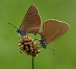
1061 | Dark blue ant bluebird | Maculinea nausithous | Butterflies | |

|
1083 | * | Stag beetle | Lucanus cervus | Beetle |

|
1131 | Strömer | Leuciscus souffia agassizi | Fish and round mouths | |

|
1134 | Bitterling | Rhodeus sericeus | Fish and round mouths | |

|
1163 | Bullhead | Cottus gobio | Fish and round mouths | |

|
1193 | Yellow-bellied toad | Bombina variegata | Amphibians | |

|
1323 | Bechstein's bat | Myotis bechsteinii | Mammals | |

|
1324 | Great mouse ear | Myotis myotis | Mammals | |
| 1387 | Roger's golden hair moss | Orthotrichum rogeri | Mosses | ||

|
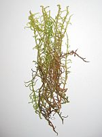
1381 | Glossy sickle moss | Drepanocladus vernicosus | Mosses |
Contiguous protected areas
The following protected areas are part of the FFH area:
| No. | Surname | Places | Area share [%] |
image |
|---|---|---|---|---|
| NSG 4.282 | Bad | Achberg , Kressbronn , Langenargen , Neukirch , Tettnang , Wangen | 1 | |
| LSG 4.35.040 | Ice Age edges of the Argental with Argenaue | Kressbronn , Langenargen , Neukirch , Tettnang | 1 | |
| NSG 4.020 | Eriskircher Ried | Eriskirch , Friedrichshafen | 41 | |
| LSG 4.35.022 | Sand and dredging pits north and west of the beer cellar | Langenargen | 1 | |
| LSG 4.35.021 | Tettnang Forest with Hochwacht, Krüntenbühl, Reichenbühl, Argenhardter Kopf, Schoos and the steep edge of the Argental on the Schwandenbogen | Langenargen , Tettnang | 5 | |
| LSG 4.35.001 | Württemberg shore of Lake Constance | Friedrichshafen , Kressbronn , Langenargen | 4th |
See also
Web links
- Standard data sheet for the FFH area "Bodenseeuferlandschaft east Friedrichshafen"
- Profile of the FFH area Bodenseeuferlandschaft east of Friedrichshafen in the protected area directory of the LUBW
- Regional Council Tübingen (Ed.): Management plan for the FFH area 8423-341 "Bodenseeuferlandschaft east Friedrichshafen" and the bird sanctuary 8323-401 "Eriskircher Ried" . edited by the office community stadt-land-see and environmental office Grabherr. February 26, 2015 (246 pages, baden-wuerttemberg.de [PDF]).
- Climate data and scenarios for the protected area from the Potsdam Institute for Climate Impact Research (PIK)
Individual evidence
- ↑ a b Tübingen regional council (ed.): Management plan for the FFH area 8423-341 "Bodenseeuferlandschaft east Friedrichshafen" and the bird sanctuary 8323-401 "Eriskircher Ried" . edited by the office community stadt-land-see and environmental office Grabherr. February 26, 2015 (246 pages, baden-wuerttemberg.de [PDF]).


